<< Other Photo Pages >> Cat Stane (Kirkliston) - Standing Stone (Menhir) in Scotland in Midlothian
Submitted by feorag on Monday, 22 July 2024 Page Views: 13714
Neolithic and Bronze AgeSite Name: Cat Stane (Kirkliston) Alternative Name: Carlowie Cat StaneCountry: Scotland County: Midlothian Type: Standing Stone (Menhir)
Nearest Town: Kirkliston Nearest Village: Turnhouse
Map Ref: NT1489374373
Latitude: 55.954814N Longitude: 3.364593W
Condition:
| 5 | Perfect |
| 4 | Almost Perfect |
| 3 | Reasonable but with some damage |
| 2 | Ruined but still recognisable as an ancient site |
| 1 | Pretty much destroyed, possibly visible as crop marks |
| 0 | No data. |
| -1 | Completely destroyed |
| 5 | Superb |
| 4 | Good |
| 3 | Ordinary |
| 2 | Not Good |
| 1 | Awful |
| 0 | No data. |
| 5 | Can be driven to, probably with disabled access |
| 4 | Short walk on a footpath |
| 3 | Requiring a bit more of a walk |
| 2 | A long walk |
| 1 | In the middle of nowhere, a nightmare to find |
| 0 | No data. |
| 5 | co-ordinates taken by GPS or official recorded co-ordinates |
| 4 | co-ordinates scaled from a detailed map |
| 3 | co-ordinates scaled from a bad map |
| 2 | co-ordinates of the nearest village |
| 1 | co-ordinates of the nearest town |
| 0 | no data |
Internal Links:
External Links:

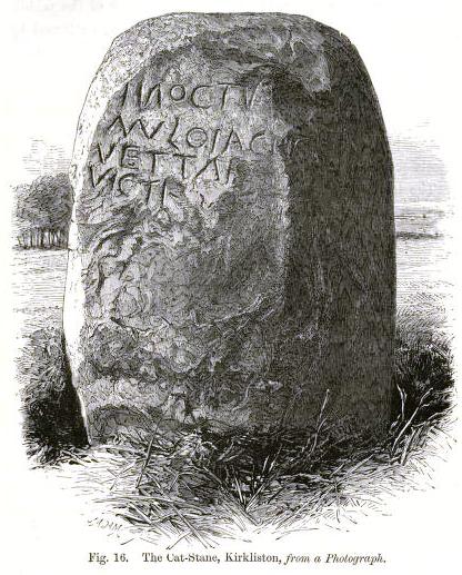
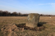
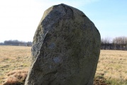
The lettering is badly worn, but is thought to read "In oc tumulo iacit Vetta f. Victi-", suggesting that it marks the burial place of an important female from the Votadini tribe. In 1863, J.Y. Simpson speculated that it marked the grave of none other than the grandfather of Hengist and Horsa!
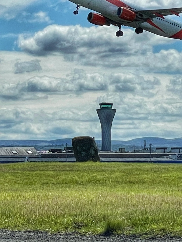
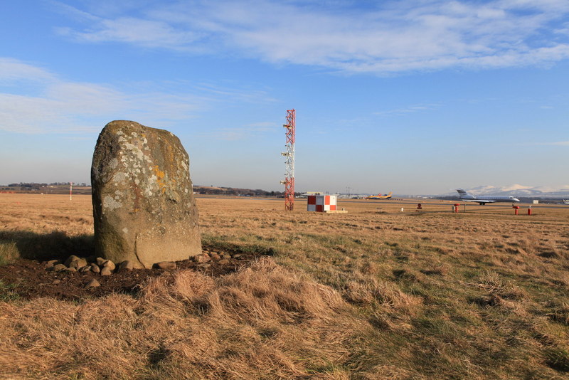
The site has been excavated at least twice, firstly in the 19th century by Simpson, and more recently in the 1960s when the airport was expanded. It's due to be excavated again prior to the construction of a rail link to the airport. Even though it is a scheduled monument, the stone is likely to be removed, possibly to a museum. On the bright side, this does mean that it will be possible to see it close up.
References:
Simpson, J.Y., 1863, "On the Cat-stane, Kirklison: Is it not the tomb of the grandfather of Hengist and Horsa?, Proceedings of the Society of Antiquaries of Scotland, vi, pp. 119-169.
Roden, A., 2006, "Tunnel site between rock and a tarred place", Edinburgh Evening News, 19th January 2006.
Also see Canmore site no. 50719.
You may be viewing yesterday's version of this page. To see the most up to date information please register for a free account.

Do not use the above information on other web sites or publications without permission of the contributor.
Click here to see more info for this site
Nearby sites
Key: Red: member's photo, Blue: 3rd party photo, Yellow: other image, Green: no photo - please go there and take one, Grey: site destroyed
Download sites to:
KML (Google Earth)
GPX (GPS waypoints)
CSV (Garmin/Navman)
CSV (Excel)
To unlock full downloads you need to sign up as a Contributory Member. Otherwise downloads are limited to 50 sites.
Turn off the page maps and other distractions
Nearby sites listing. In the following links * = Image available
1.1km W 281° Carlowrie (Kirkliston) Rock Art (NT138746)
2.5km SSE 165° Gogar Stone* Standing Stone (Menhir) (NT15487199)
2.6km E 82° Cammo Stone* Standing Stone (Menhir) (NT1747774681)
2.8km SW 231° Lochend menhir* Standing Stone (Menhir) (NT12667263)
3.1km SW 234° Huly Hill Cairn* Round Cairn (NT1234272610)
3.1km SW 234° Huly Hill Standing Stones* Standing Stones (NT1234272610)
3.5km N 359° Crossall Hill (South Queensferry)* Ancient Cross (NT14907791)
3.7km SSW 206° Witchis Stane* Standing Stone (Menhir) (NT13177104)
4.5km NNW 332° Bell Stane (Queensferry) Standing Stone (Menhir) (NT12827840)
4.9km NE 55° Cramond Ancient Village or Settlement (NT18957706)
5.0km ESE 110° Lady Well* Holy Well or Sacred Spring (NT196726)
5.0km ESE 110° Physic Well (Corstorphine)* Holy Well or Sacred Spring (NT19597252)
5.1km SSW 202° Tormain Hill* Rock Art (NT12906967)
5.1km SSW 204° Witches' Stone (Ratho)* Rock Art (NT12736973)
6.0km S 175° Newhouse Standing Stone Standing Stone (Menhir) (NT15296838)
7.5km SSE 151° St Mungo's Well (Edinburgh)* Holy Well or Sacred Spring (NT18346773)
7.5km WNW 294° Justice Stone Standing Stone (Menhir) (NT08087759)
7.6km S 189° Dalmahoy Hill Hillfort (NT135669)
8.0km E 94° Succoth Place Double Cist Burial Cist (NT22897362)
8.1km SSW 192° Kaimes Standing Stones (NT130665)
8.2km SSW 204° Kirknewton stone Sculptured Stone (NT11426693)
8.2km NW 304° Abercorn* Sculptured Stone (NT08147910)
9.0km ESE 117° Craiglockart Hill Vitrified Fort Hillfort (NT22827006)
9.1km NNE 25° Inchcolm Sculptured Stone (NT18888260)
9.5km E 91° St George's Well (Edinburgh)* Holy Well or Sacred Spring (NT2440174070)
View more nearby sites and additional images


 We would like to know more about this location. Please feel free to add a brief description and any relevant information in your own language.
 Wir möchten mehr über diese Stätte erfahren. Bitte zögern Sie nicht, eine kurze Beschreibung und relevante Informationen in Deutsch hinzuzufügen.
 Nous aimerions en savoir encore un peu sur les lieux. S'il vous plaît n'hesitez pas à ajouter une courte description et tous les renseignements pertinents dans votre propre langue.
 Quisieramos informarnos un poco más de las lugares. No dude en añadir una breve descripción y otros datos relevantes en su propio idioma.