 with our Megalithic Portal iPhone app")


<< Our Photo Pages >> Herriot's Dyke - Misc. Earthwork in Scotland in Scottish Borders
Submitted by mafenty on Tuesday, 19 September 2006 Page Views: 6121
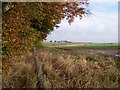
Multi-periodSite Name: Herriot's DykeCountry: Scotland
NOTE: This site is 0.929 km away from the location you searched for.
County: Scottish Borders Type: Misc. Earthwork
Nearest Town: Greenlaw
Map Ref: NT722485
Latitude: 55.729101N Longitude: 2.444206W
Condition:
| 5 | Perfect |
| 4 | Almost Perfect |
| 3 | Reasonable but with some damage |
| 2 | Ruined but still recognisable as an ancient site |
| 1 | Pretty much destroyed, possibly visible as crop marks |
| 0 | No data. |
| -1 | Completely destroyed |
| 5 | Superb |
| 4 | Good |
| 3 | Ordinary |
| 2 | Not Good |
| 1 | Awful |
| 0 | No data. |
| 5 | Can be driven to, probably with disabled access |
| 4 | Short walk on a footpath |
| 3 | Requiring a bit more of a walk |
| 2 | A long walk |
| 1 | In the middle of nowhere, a nightmare to find |
| 0 | No data. |
| 5 | co-ordinates taken by GPS or official recorded co-ordinates |
| 4 | co-ordinates scaled from a detailed map |
| 3 | co-ordinates scaled from a bad map |
| 2 | co-ordinates of the nearest village |
| 1 | co-ordinates of the nearest town |
| 0 | no data |
Internal Links:
External Links:
")
Previously recorded "up to 14miles" ( Transactions of Berwickshire Naturalists) Once thought to extend across Berwickshire to Hutton
"Herrisdige" is a Scandinavian word for district boundary
You may be viewing yesterday's version of this page. To see the most up to date information please register for a free account.
")
")
Do not use the above information on other web sites or publications without permission of the contributor.
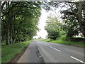
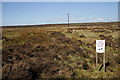
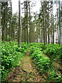
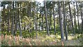
Nearby Images from Geograph Britain and Ireland:
©2020(licence)
©2009(licence)
©2006(licence)
©2018(licence)
©2009(licence)
The above images may not be of the site on this page, they are loaded from Geograph.
Please Submit an Image of this site or go out and take one for us!
Click here to see more info for this site
Nearby sites
Key: Red: member's photo, Blue: 3rd party photo, Yellow: other image, Green: no photo - please go there and take one, Grey: site destroyed
Download sites to:
KML (Google Earth)
GPX (GPS waypoints)
CSV (Garmin/Navman)
CSV (Excel)
To unlock full downloads you need to sign up as a Contributory Member. Otherwise downloads are limited to 50 sites.
Turn off the page maps and other distractions
Nearby sites listing. In the following links * = Image available
1.2km S 181° Piersknowe Plantation* Cairn (NT72174726)
5.4km NNE 23° Raecleughhead* Hillfort (NT74355351)
5.7km W 268° Harelaw* Misc. Earthwork (NT66444834)
7.4km SSE 148° Crosshall Cross* Ancient Cross (NT76064223)
8.3km NE 49° Duns Mercat Cross* Ancient Cross (NT7855253883)
8.8km NE 45° Duns Law Hillfort* Hillfort (NT78505468)
10.1km NE 36° Cumledge Cist* Cist (NT782566)
10.9km NE 40° Primrose Hill Fort* Hillfort (NT79285682)
11.0km WNW 300° Kingside Hill (Cranshaws) Stone Circle (NT62635403)
11.1km S 176° Piper's Grave Cists Cist (NT72923739)
11.3km NE 51° Manderston cist* Cist (NT81125555)
11.5km NE 47° Broomhouse Souterrain* Souterrain (Fogou, Earth House) (NT80675629)
11.6km WNW 302° Twin Law Cairns* Cairn (NT624547)
12.1km NNE 21° Cockburn Law Hillfort* Hillfort (NT76565975)
12.1km NNE 22° Cockburn Law Settlement* Ancient Village or Settlement (NT76915969)
12.4km W 276° Bruntaburn Mill* Standing Stone (Menhir) (NT59814979)
12.8km SSE 163° Sprouston Cropmark Complex* Ancient Village or Settlement (NT7581036220)
12.8km NNE 23° Edin's Hall* Broch or Nuraghe (NT7724060310)
12.8km NE 55° Edrom Sculptured Stone (NT828558)
13.1km NNE 34° Preston Cleugh Fort* Hillfort (NT79555941)
13.6km NNE 28° Elba copper mines* Ancient Mine, Quarry or other Industry (NT787605)
13.7km W 269° Cambridge Standing Stone* Standing Stone (Menhir) (NT58434826)
13.9km W 273° Blythe Fort Hillfort (NT58244941)
14.1km W 261° Dods Corse Stone (Boon)* Ancient Cross (NT58214633)
14.5km NW 316° Mutiny Stones* Cairn (NT62255902)
View more nearby sites and additional images


 We would like to know more about this location. Please feel free to add a brief description and any relevant information in your own language.
 Wir möchten mehr über diese Stätte erfahren. Bitte zögern Sie nicht, eine kurze Beschreibung und relevante Informationen in Deutsch hinzuzufügen.
 Nous aimerions en savoir encore un peu sur les lieux. S'il vous plaît n'hesitez pas à ajouter une courte description et tous les renseignements pertinents dans votre propre langue.
 Quisieramos informarnos un poco más de las lugares. No dude en añadir una breve descripción y otros datos relevantes en su propio idioma.