


<< Text Pages >> West Revoch - Stone Row / Alignment in Scotland in East Renfrewshire
Submitted by Anne T on Sunday, 01 May 2016 Page Views: 2799
Neolithic and Bronze AgeSite Name: West Revoch Alternative Name: West Revoch FarmCountry: Scotland
NOTE: This site is 3.0 km away from the location you searched for.
County: East Renfrewshire Type: Stone Row / Alignment
Nearest Town: East Kilbridge Nearest Village: Eaglesham
Map Ref: NS55104995
Latitude: 55.721237N Longitude: 4.308463W
Condition:
| 5 | Perfect |
| 4 | Almost Perfect |
| 3 | Reasonable but with some damage |
| 2 | Ruined but still recognisable as an ancient site |
| 1 | Pretty much destroyed, possibly visible as crop marks |
| 0 | No data. |
| -1 | Completely destroyed |
| 5 | Superb |
| 4 | Good |
| 3 | Ordinary |
| 2 | Not Good |
| 1 | Awful |
| 0 | No data. |
| 5 | Can be driven to, probably with disabled access |
| 4 | Short walk on a footpath |
| 3 | Requiring a bit more of a walk |
| 2 | A long walk |
| 1 | In the middle of nowhere, a nightmare to find |
| 0 | No data. |
| 5 | co-ordinates taken by GPS or official recorded co-ordinates |
| 4 | co-ordinates scaled from a detailed map |
| 3 | co-ordinates scaled from a bad map |
| 2 | co-ordinates of the nearest village |
| 1 | co-ordinates of the nearest town |
| 0 | no data |
Be the first person to rate this site - see the 'Contribute!' box in the right hand menu.
Internal Links:
External Links:
Stone Row / Alignment in East Renfrewshire
Situated close to West Revoch Farm, just north of the Dunwan Dam and close to the B764, little is known about this stone row other than that it is a single row comprising 4 stones (size of stones and length of row currently unknown).
There is public access to this site, which sits at an altitude of 255 metres.
Note: Have you visited this site? Are you able to provide a better description and a photograph?
You may be viewing yesterday's version of this page. To see the most up to date information please register for a free account.
Do not use the above information on other web sites or publications without permission of the contributor.
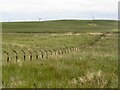
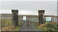
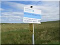
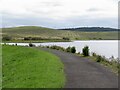
Nearby Images from Geograph Britain and Ireland:
©2022(licence)
©2022(licence)
©2022(licence)
©2022(licence)
©2022(licence)
The above images may not be of the site on this page, they are loaded from Geograph.
Please Submit an Image of this site or go out and take one for us!
Click here to see more info for this site
Nearby sites
Key: Red: member's photo, Blue: 3rd party photo, Yellow: other image, Green: no photo - please go there and take one, Grey: site destroyed
Download sites to:
KML (Google Earth)
GPX (GPS waypoints)
CSV (Garmin/Navman)
CSV (Excel)
To unlock full downloads you need to sign up as a Contributory Member. Otherwise downloads are limited to 50 sites.
![]()
Turn off the page maps and other distractions
Nearby sites listing. In the following links * = Image available
1.4km W 272° Ballageich Hill* Cairn (NS53745005)
7.8km NW 318° Duncarnock Hillfort Hillfort (NS50105590)
7.8km N 356° Rouken Glen Park* Rock Art (NS54795771)
8.1km WNW 293° Covenanter's Stone* Stone Circle (NS47735333)
8.5km WNW 288° Moyne Moor* Cairn (NS471529)
10.1km NE 51° Law Knowe* Cairn (NS63175613)
10.9km N 353° Boydstone Road (Eastwood) Standing Stone (Menhir) (NS541608)
11.7km N 356° Pollok House Barrow* Round Barrow(s) (NS54606164)
12.4km N 10° Queen's Park Earthworks* Hillfort (NS5776062110)
12.5km S 172° The Dagon Stone* Standing Stone (Menhir) (NS56333746)
13.0km NNW 347° Crookston Castle* Ancient Village or Settlement (NS5255962715)
13.0km E 92° Shawton (Chapeltown) Standing Stone (Menhir) (NS68124906)
13.4km SSW 194° Molmont Stone Circle (NS514371)
13.7km NNE 30° Gallowflat Round Barrow* Round Barrow(s) (NS6230061580)
14.2km NW 315° Gleniffer Braes Menhirs* Standing Stones (NS45356026)
14.2km NNE 33° Hamilton Farm (Cambuslang) Cairn (NS633616)
14.5km W 269° Thougritstane* Natural Stone / Erratic / Other Natural Feature (NS40575024)
14.5km SSE 162° Loanfoot* Chambered Cairn (NS592360)
14.7km S 186° Gallow Law (Hillend) Cairn (NS5313535382)
14.9km NNE 17° Arns Well (Glasgow) Holy Well or Sacred Spring (NS59966406)
15.0km WSW 243° Buiston Crannog* Crannog (NS41554352)
15.2km ESE 106° Three Stanes (Strathaven) Standing Stones (NS69574524)
15.3km NNE 12° St Thenew's Well (Glasgow) Holy Well or Sacred Spring (NS589648)
15.4km NNW 333° Barochan Cross* Ancient Cross (NS48556395)
15.5km NNE 14° Stock Well (Glasgow) Holy Well or Sacred Spring (NS594649)
View more nearby sites and additional images


 We would like to know more about this location. Please feel free to add a brief description and any relevant information in your own language.
 Wir möchten mehr über diese Stätte erfahren. Bitte zögern Sie nicht, eine kurze Beschreibung und relevante Informationen in Deutsch hinzuzufügen.
 Nous aimerions en savoir encore un peu sur les lieux. S'il vous plaît n'hesitez pas à ajouter une courte description et tous les renseignements pertinents dans votre propre langue.
 Quisieramos informarnos un poco más de las lugares. No dude en añadir una breve descripción y otros datos relevantes en su propio idioma.