


<< Other Photo Pages >> Sprouston Cropmark Complex - Ancient Village or Settlement in Scotland in Scottish Borders
Submitted by Anne T on Friday, 08 May 2026 Page Views: 1040
Multi-periodSite Name: Sprouston Cropmark Complex Alternative Name: Whitmuirhaugh, SproustonCountry: Scotland County: Scottish Borders Type: Ancient Village or Settlement
Nearest Town: Kelso Nearest Village: Sprouston
Map Ref: NT7581036220
Latitude: 55.618961N Longitude: 2.385641W
Condition:
| 5 | Perfect |
| 4 | Almost Perfect |
| 3 | Reasonable but with some damage |
| 2 | Ruined but still recognisable as an ancient site |
| 1 | Pretty much destroyed, possibly visible as crop marks |
| 0 | No data. |
| -1 | Completely destroyed |
| 5 | Superb |
| 4 | Good |
| 3 | Ordinary |
| 2 | Not Good |
| 1 | Awful |
| 0 | No data. |
| 5 | Can be driven to, probably with disabled access |
| 4 | Short walk on a footpath |
| 3 | Requiring a bit more of a walk |
| 2 | A long walk |
| 1 | In the middle of nowhere, a nightmare to find |
| 0 | No data. |
| 5 | co-ordinates taken by GPS or official recorded co-ordinates |
| 4 | co-ordinates scaled from a detailed map |
| 3 | co-ordinates scaled from a bad map |
| 2 | co-ordinates of the nearest village |
| 1 | co-ordinates of the nearest town |
| 0 | no data |
Internal Links:
External Links:
")
The prehistoric component includes what appears to be a large timber hall comparable in size and shape to the excavated Neolithic halls at Balbridie (Aberdeenshire) and Doon Hill A (East Lothian), with distinctive V-shaped gable ends. A D-shaped enclosure approximately 180m by 80m with a segmented ditch and at least five causeways has been interpreted as a possible Neolithic causewayed enclosure — if confirmed, an exceptionally rare example in Scotland. A double row of pits forming a timber avenue is also likely Neolithic.
The Anglian component is nationally important. Several substantial rectangular timber halls with annexes, closely comparable to the excavated royal halls at Yeavering (Ad Gefrin) in Northumberland, sit within a sub-rectangular palisaded enclosure. Smaller sunken-featured buildings and an ordered cemetery of at least 380 east-west graves with a possible associated church complete the picture of what is interpreted as an urbs regis — a royal centre of the Anglian kingdom of Northumbria, probably founded in the late 6th or early 7th century. Sprouston, Yeavering and Milfield form a trio of sites at the top of the early medieval settlement hierarchy in the Tweed-Till basin.
Roman finds from the area include a 2nd-century brooch, denarii and Samian pottery. An oval fort with double palisade represents Iron Age or Romano-British activity.
No excavation has taken place — the entire interpretation rests on aerial photography by RCAHMS and Cambridge University, and field-walking that recovered flint, pottery and iron objects. The site was designated a Scheduled Monument in 1971.
References:
Trove Scotland, "Whitmuirhaugh, Sprouston, Site ID 58328";
Historic Environment Scotland, "Whitmuirhaugh,settlement & cemetery"l
Archaeology Data Service, "Sprouston, Roxburghshire: an early Anglian centre
of the eastern Tweed Basin, E.M. Smith, 1991); and
Cambridge University Press, "St Joseph, J.K. "Sprouston, Roxburghshire: an Anglo-Saxon settlement discovered by air reconnaissance, Anglo-Saxon England".
Condition: all features survive as subsurface cropmarks in arable land; no earthworks above ground; ploughsoil finds confirm integrity of deposits)
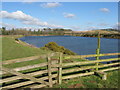
Ambience: attractive Tweed valley farmland setting between village and river, but nothing visible on the ground
Access: private arable farmland; Scheduled Monument SM3023; no public access to the cropmark fields)
You may be viewing yesterday's version of this page. To see the most up to date information please register for a free account.
Do not use the above information on other web sites or publications without permission of the contributor.
Nearby Images from Geograph Britain and Ireland:

©2013(licence)

©2020(licence)

©2013(licence)
©2013(licence)

©2020(licence)
The above images may not be of the site on this page, they are loaded from Geograph.
Please Submit an Image of this site or go out and take one for us!
Click here to see more info for this site
Nearby sites
Key: Red: member's photo, Blue: 3rd party photo, Yellow: other image, Green: no photo - please go there and take one, Grey: site destroyed
Download sites to:
KML (Google Earth)
GPX (GPS waypoints)
CSV (Garmin/Navman)
CSV (Excel)
To unlock full downloads you need to sign up as a Contributory Member. Otherwise downloads are limited to 50 sites.
Turn off the page maps and other distractions
Nearby sites listing. In the following links * = Image available
3.1km WNW 292° Piper's Grave Cists Cist (NT72923739)
4.6km SE 139° Lempitlaw Sculptured Stone (NT78813278)
6.0km N 2° Crosshall Cross* Ancient Cross (NT76064223)
7.2km SSE 167° Frogden Stone Circle (NT77372922)
9.1km SE 136° Virtue Well (Yetholm)* Holy Well or Sacred Spring (NT8211129650)
9.2km SE 125° Bowmont Hill Hillfort (NT834309)
9.7km WSW 240° The Law (Scottish Borders) Artificial Mound (NT6735831447)
10.0km SE 132° Venchen Farm Cottages (Town Yetholm)* Standing Stone (Menhir) (NT8319929486)
10.0km SSW 201° Haughhead Kip (Eckford)* Sculptured Stone (NT72212683)
10.2km ESE 115° Pawston Hill Camp Hillfort (NT8505031847)
11.5km E 97° Moneylaws Castle Hill Ancient Village or Settlement (NT87213474)
11.6km NNW 341° Piersknowe Plantation* Cairn (NT72174726)
11.9km SW 229° Fairnington Stone Circle (NT667285)
12.2km SE 134° Green Humbleton Hillfort* Hillfort (NT846277)
12.3km ESE 121° Elsdonburn Shank Shielings (Kilham)* Ancient Village or Settlement (NT8641429858)
12.4km SE 136° Sheilknowe Burn Enclosure* Ancient Village or Settlement (NT84462728)
12.4km SE 134° Kirk Yetholm* Ancient Village or Settlement (NT848276)
12.5km ESE 114° Longknowe (Kilham)* Ancient Village or Settlement (NT8716831040)
12.5km SE 134° Green Humbleton Settlement* Ancient Village or Settlement (NT84832758)
12.5km SE 135° Shielknowe Burn Scooped Settlement* Ancient Village or Settlement (NT8457727300)
12.8km E 80° The King's Stone (Coldstream)* Standing Stone (Menhir) (NT88423845)
12.8km SE 128° Coldsmouth Hill Ring Cairns* Cist (NT858282)
12.8km NNW 343° Herriot's Dyke* Misc. Earthwork (NT722485)
12.9km ESE 123° Elsdonburn Shank (Kilham)* Ancient Village or Settlement (NT86572912)
13.0km SE 134° Stob Stones* Standing Stones (NT85142710)
View more nearby sites and additional images


 We would like to know more about this location. Please feel free to add a brief description and any relevant information in your own language.
 Wir möchten mehr über diese Stätte erfahren. Bitte zögern Sie nicht, eine kurze Beschreibung und relevante Informationen in Deutsch hinzuzufügen.
 Nous aimerions en savoir encore un peu sur les lieux. S'il vous plaît n'hesitez pas à ajouter une courte description et tous les renseignements pertinents dans votre propre langue.
 Quisieramos informarnos un poco más de las lugares. No dude en añadir una breve descripción y otros datos relevantes en su propio idioma.