


<< Text Pages >> Yetlington Lane - Rock Art in England in Northumberland
Submitted by Anne T on Sunday, 08 July 2018 Page Views: 981
Rock ArtSite Name: Yetlington Lane Alternative Name: ERA-680; Beckensall 352Country: England County: Northumberland Type: Rock Art
Nearest Town: Alnwick Nearest Village: Yetlington
Map Ref: NU0311010600
Latitude: 55.389352N Longitude: 1.952458W
Condition:
| 5 | Perfect |
| 4 | Almost Perfect |
| 3 | Reasonable but with some damage |
| 2 | Ruined but still recognisable as an ancient site |
| 1 | Pretty much destroyed, possibly visible as crop marks |
| 0 | No data. |
| -1 | Completely destroyed |
| 5 | Superb |
| 4 | Good |
| 3 | Ordinary |
| 2 | Not Good |
| 1 | Awful |
| 0 | No data. |
| 5 | Can be driven to, probably with disabled access |
| 4 | Short walk on a footpath |
| 3 | Requiring a bit more of a walk |
| 2 | A long walk |
| 1 | In the middle of nowhere, a nightmare to find |
| 0 | No data. |
| 5 | co-ordinates taken by GPS or official recorded co-ordinates |
| 4 | co-ordinates scaled from a detailed map |
| 3 | co-ordinates scaled from a bad map |
| 2 | co-ordinates of the nearest village |
| 1 | co-ordinates of the nearest town |
| 0 | no data |
Be the first person to rate this site - see the 'Contribute!' box in the right hand menu.
Internal Links:
External Links:
Rock Art in Northumberland
This rock art panel is recorded by Beckensall as "the stone has a motif that fits exactly on the surface of the cobble: a cup and groove at the centre of two fine penannulars."
For basic information, including Beckensall's drawing from c1970, see England's Rock Art entry for ERA-680 Yetlington Lane.
The original Beckensall record can be found at Internet Archive: Beckensall 352 Yetlington Lane.
This rock art panel is recorded as now being in a private collection.
Note: Have you seen this rock art panel? Do you know where it is currently located? Do you have any photographs or information to add?
You may be viewing yesterday's version of this page. To see the most up to date information please register for a free account.
Do not use the above information on other web sites or publications without permission of the contributor.
Nearby Images from Geograph Britain and Ireland:
©2007(licence)

©2025(licence)
©2013(licence)
©2013(licence)
©2013(licence)
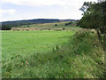
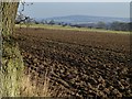
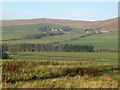
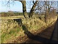
The above images may not be of the site on this page, they are loaded from Geograph.
Please Submit an Image of this site or go out and take one for us!
Click here to see more info for this site
Nearby sites
Key: Red: member's photo, Blue: 3rd party photo, Yellow: other image, Green: no photo - please go there and take one, Grey: site destroyed
Download sites to:
KML (Google Earth)
GPX (GPS waypoints)
CSV (Garmin/Navman)
CSV (Excel)
To unlock full downloads you need to sign up as a Contributory Member. Otherwise downloads are limited to 50 sites.
Turn off the page maps and other distractions
Nearby sites listing. In the following links * = Image available
2.5km SE 135° Tinkler's Dene Hillfort (NU04890881)
3.0km NNW 347° Chubden Camp* Ancient Village or Settlement (NU02431353)
3.1km WSW 245° Scrainwood 7 Rock Art (NU0031409310)
3.1km ESE 107° Callaly Castle Hillfort* Hillfort (NU06080971)
3.1km NE 45° Mountain Farm Rock Art Rock Art (NU053128)
3.1km WSW 254° Scrainwood 6 Rock Art (NU0009109725)
3.1km SE 131° Hard Nab Round Cairn Cairn (NU05480852)
3.3km WSW 258° Scrainwood Quarry 0 & N01 Rock Art (NT9989809945)
3.3km ESE 117° Hob's Nick Round Cairns Cairn (NU06060911)
3.3km WSW 257° Scrainwood 1. Rock Art (NT9984609856)
3.5km WSW 255° Scrainwood 3 Rock Art (NT9967809669)
3.5km WSW 255° Scrainwood 4 Rock Art (NT9967609667)
3.6km WSW 255° Scrainwood 5 Rock Art (NT9967309664)
3.6km N 1° Gibbs Hill* Hillfort (NU032142)
3.6km NNW 345° Old Fawdon Hill* Hillfort (NU022141)
3.7km WSW 252° Scrainwood 2 Rock Art (NT9963209442)
3.7km WSW 256° Scrainwood 8 & 9 Rock Art (NT9946009720)
3.8km ENE 69° St Bartholomew's Church (Whittingham)* Ancient Cross (NU0666411937)
4.0km W 275° Alnham* Ancient Cross (NT99081098)
4.1km ENE 66° Hawklemass Well (Whittingham)* Holy Well or Sacred Spring (NU06831228)
4.1km N 0° Castle Knowe (Wooler)* Hillfort (NU03131468)
4.2km NNW 335° Wether Hill* Hillfort (NU013144)
4.7km WNW 283° Alnham Northfield Rock Art (NT9847911668)
4.8km NW 326° Little Cleugh Hillfort (NU004146)
5.1km W 274° Castle Hill (Northumberland)* Hillfort (NT98001094)
View more nearby sites and additional images


 We would like to know more about this location. Please feel free to add a brief description and any relevant information in your own language.
 Wir möchten mehr über diese Stätte erfahren. Bitte zögern Sie nicht, eine kurze Beschreibung und relevante Informationen in Deutsch hinzuzufügen.
 Nous aimerions en savoir encore un peu sur les lieux. S'il vous plaît n'hesitez pas à ajouter une courte description et tous les renseignements pertinents dans votre propre langue.
 Quisieramos informarnos un poco más de las lugares. No dude en añadir una breve descripción y otros datos relevantes en su propio idioma.