<< Text Pages >> Nelly's Moss Barrow - Round Barrow(s) in England in Northumberland
Submitted by Modern-neolithic on Tuesday, 21 May 2019 Page Views: 598
Neolithic and Bronze AgeSite Name: Nelly''s Moss BarrowCountry: England
NOTE: This site is 0.607 km away from the location you searched for.
County: Northumberland Type: Round Barrow(s)
Nearest Town: Rothbury
Map Ref: NU07480158
Latitude: 55.308256N Longitude: 1.883713W
Condition:
| 5 | Perfect |
| 4 | Almost Perfect |
| 3 | Reasonable but with some damage |
| 2 | Ruined but still recognisable as an ancient site |
| 1 | Pretty much destroyed, possibly visible as crop marks |
| 0 | No data. |
| -1 | Completely destroyed |
| 5 | Superb |
| 4 | Good |
| 3 | Ordinary |
| 2 | Not Good |
| 1 | Awful |
| 0 | No data. |
| 5 | Can be driven to, probably with disabled access |
| 4 | Short walk on a footpath |
| 3 | Requiring a bit more of a walk |
| 2 | A long walk |
| 1 | In the middle of nowhere, a nightmare to find |
| 0 | No data. |
| 5 | co-ordinates taken by GPS or official recorded co-ordinates |
| 4 | co-ordinates scaled from a detailed map |
| 3 | co-ordinates scaled from a bad map |
| 2 | co-ordinates of the nearest village |
| 1 | co-ordinates of the nearest town |
| 0 | no data |
Internal Links:
External Links:
Round Barrow in Northumberland
Described as a round barrow situated in a prominent position on a gentle southwest slope on the top of a ridge, which falls away very steeply to the south and west.
Field Investigations carried out in 1957 and 1971 failed to locate the barrow due to dense forest and undergrowth.
The forest planted by Lord Armstrong now covers the entire area around the Cragside estate.
The land is now owned by the National Trust.
Source:Pastscape
You may be viewing yesterday's version of this page. To see the most up to date information please register for a free account.
Do not use the above information on other web sites or publications without permission of the contributor.
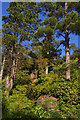
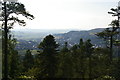
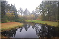
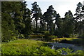
Nearby Images from Geograph Britain and Ireland:
©2016(licence)
©2016(licence)

©2017(licence)
©2011(licence)
©2016(licence)
The above images may not be of the site on this page, they are loaded from Geograph.
Please Submit an Image of this site or go out and take one for us!
Click here to see more info for this site
Nearby sites
Key: Red: member's photo, Blue: 3rd party photo, Yellow: other image, Green: no photo - please go there and take one, Grey: site destroyed
Download sites to:
KML (Google Earth)
GPX (GPS waypoints)
CSV (Garmin/Navman)
CSV (Excel)
To unlock full downloads you need to sign up as a Contributory Member. Otherwise downloads are limited to 50 sites.
Turn off the page maps and other distractions
Nearby sites listing. In the following links * = Image available
1.2km SSE 154° Craghead Camp* Hillfort (NU08010049)
1.4km SW 219° Whitton Burn N03* Rock Art (NU0660700483)
1.4km SW 217° Whitton Burn 1b* Rock Art (NU0662700450)
1.4km SW 217° Whitton Burn 1a* Rock Art (NU0661700452)
1.4km SW 218° Stone 'From Near Rothbury' Rock Art (NU0661000450)
1.6km SW 224° Whitton Burn 3* Rock Art (NU0638100437)
1.7km SSW 213° Whitton Burn 2a* Rock Art (NU0656100146)
1.7km W 273° The Rothbury Cross* Ancient Cross (NU0577201657)
1.7km SSW 213° Whitton Burn 2c Rock Art (NU0655400134)
1.7km SSW 212° Whitton Burn 2b* Rock Art (NU0656100129)
1.7km SSW 212° Whitton Burn N04 Rock Art (NU0656200128)
1.7km SW 221° North Lordenshaw 6n Rock Art (NU0633800268)
1.7km SW 221° North Lordenshaw 6p Rock Art (NU0632400265)
1.7km SW 221° North Lordenshaw 6o Rock Art (NU0632600262)
1.8km SW 222° North Lordenshaw 6x Rock Art (NU0630900268)
1.8km SW 221° North Lordenshaw 6aa Rock Art (NU0631400252)
1.8km SW 222° North Lordenshaw 6q Rock Art (NU0629800254)
1.8km SW 222° North Lordenshaw 6r Rock Art (NU0627700260)
1.8km SW 221° North Lordenshaw 6v Rock Art (NU0630600220)
1.8km SW 221° North Lordenshaw 6m Rock Art (NU0629400214)
1.8km SW 222° North Lordenshaw 6t Rock Art (NU0626800222)
1.8km SW 220° North Lordenshaw 6w Rock Art (NU0629900194)
1.8km SW 220° North Lordenshaw 6z. Rock Art (NU0631100172)
1.8km SW 220° North Lordenshaw 6z(i) Rock Art (NU0631100171)
1.8km SW 216° Whitton Burn N01 Rock Art (NU0641200091)
View more nearby sites and additional images


 We would like to know more about this location. Please feel free to add a brief description and any relevant information in your own language.
 Wir möchten mehr über diese Stätte erfahren. Bitte zögern Sie nicht, eine kurze Beschreibung und relevante Informationen in Deutsch hinzuzufügen.
 Nous aimerions en savoir encore un peu sur les lieux. S'il vous plaît n'hesitez pas à ajouter une courte description et tous les renseignements pertinents dans votre propre langue.
 Quisieramos informarnos un poco más de las lugares. No dude en añadir una breve descripción y otros datos relevantes en su propio idioma.