


<< Text Pages >> Simonside Moor - Rock Art in England in Northumberland
Submitted by Anne T on Monday, 23 April 2018 Page Views: 1038
Rock ArtSite Name: Simonside Moor Alternative Name: ERA-1256; Beckensall 874Country: England County: Northumberland Type: Rock Art
Nearest Town: Rothbury Nearest Village: Simonside
Map Ref: NU0120000100
Latitude: 55.295011N Longitude: 1.982649W
Condition:
| 5 | Perfect |
| 4 | Almost Perfect |
| 3 | Reasonable but with some damage |
| 2 | Ruined but still recognisable as an ancient site |
| 1 | Pretty much destroyed, possibly visible as crop marks |
| 0 | No data. |
| -1 | Completely destroyed |
| 5 | Superb |
| 4 | Good |
| 3 | Ordinary |
| 2 | Not Good |
| 1 | Awful |
| 0 | No data. |
| 5 | Can be driven to, probably with disabled access |
| 4 | Short walk on a footpath |
| 3 | Requiring a bit more of a walk |
| 2 | A long walk |
| 1 | In the middle of nowhere, a nightmare to find |
| 0 | No data. |
| 5 | co-ordinates taken by GPS or official recorded co-ordinates |
| 4 | co-ordinates scaled from a detailed map |
| 3 | co-ordinates scaled from a bad map |
| 2 | co-ordinates of the nearest village |
| 1 | co-ordinates of the nearest town |
| 0 | no data |
Be the first person to rate this site - see the 'Contribute!' box in the right hand menu.
Internal Links:
External Links:
Rock Art in Northumberland
The exact location of this rock art panel has been withheld at the request of the landowner, although it is recorded as being on Open Access land. It is described by NADRAP as being on a large boulder relocated in a depression formed by past quarrying of bell pit extraction. The motif is complex combining groups of cups, large shallow cups, linear and linking grooves, a large oculus - groove and penannular. Peck marks were observed in different areas some indicating incompleteness in the motif design.
For more information see England's Rock Art entry for ERA-1256 Simonside Moor, which includes NADRAP's notes, Beckensall's description, photographs, a panoramic photograph, a sketch of the rock and its motifs, plus photogrammetry, a VRML model, a QTVR model and media from the Beckensall Archive.
The original Beckensall record can be found at Internet Archive: Beckensall 874 Simonside Moor.
This rock art panel is located on Open Access land [note: Beckensall records this panel as being on private land - seek landowner permission].
Note: Have you seen this rock art panel? Do you have any photographs or information to add?
You may be viewing yesterday's version of this page. To see the most up to date information please register for a free account.
Do not use the above information on other web sites or publications without permission of the contributor.
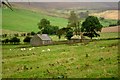
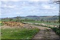
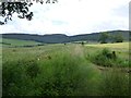
Nearby Images from Geograph Britain and Ireland:
©2008(licence)
©2017(licence)

©2017(licence)
©2014(licence)

©2006(licence)
The above images may not be of the site on this page, they are loaded from Geograph.
Please Submit an Image of this site or go out and take one for us!
Click here to see more info for this site
Nearby sites
Key: Red: member's photo, Blue: 3rd party photo, Yellow: other image, Green: no photo - please go there and take one, Grey: site destroyed
Download sites to:
KML (Google Earth)
GPX (GPS waypoints)
CSV (Garmin/Navman)
CSV (Excel)
To unlock full downloads you need to sign up as a Contributory Member. Otherwise downloads are limited to 50 sites.
Turn off the page maps and other distractions
Nearby sites listing. In the following links * = Image available
1.1km SSE 153° Ravensheugh Cairn* Cairn (NZ0169099150)
1.2km ENE 71° Tosson Burgh* Hillfort (NU02340049)
1.3km S 169° Ravenshaugh Main Stone* Natural Stone / Erratic / Other Natural Feature (NZ0144598783)
1.4km E 98° Great Tosson Cairn* Cairn (NZ026999)
1.5km SE 129° Cambo Bridle road* Ancient Trackway (NZ02349918)
1.8km SE 139° Simonside Cairn 2* Cairn (NZ02409871)
1.9km E 92° Great Tosson Enclosure* Ancient Village or Settlement (NU03130003)
2.2km SE 136° Simonside Cairn 1* Cairn (NZ0271098520)
2.5km SE 134° Old Stell Crag* Rock Outcrop (NZ0297498372)
2.9km ESE 122° Dove Crag* Rock Outcrop (NZ0367898540)
3.0km ESE 122° Dove Crag Cairn* Cairn (NZ0372898523)
3.1km WSW 256° Witchy Neuk* Hillfort (NY9817399358)
3.2km NE 51° West Hills 2 Rock Art (NU0367702093)
3.3km NE 53° West Hills Camp* Hillfort (NU0380102085)
3.3km NE 52° Westhills Camp (Rock Art) Rock Art (NU038021)
3.4km NE 53° West Hill 1e Rock Art (NU0389302113)
3.4km NE 52° West Hills (Bracken Wood) 3 & 4 Rock Art (NU0385002190)
3.4km NE 54° West Hills 1a* Rock Art (NU0394602067)
3.4km NE 54° West Hills 1d* Rock Art (NU0395002062)
3.4km NE 54° West Hills 1f Rock Art (NU0394302072)
3.4km NE 54° West Hills 1c Rock Art (NU0395102064)
3.4km NE 54° West Hills 1b* Rock Art (NU0394502077)
3.4km NE 54° Westhills Farm Cairn* Cairn (NU0393802095)
3.4km ENE 62° Westcliffe Modern Circle* Modern Stone Circle etc (NU0422301673)
3.4km ENE 61° Westcliffe House N02 Rock Art (NU0419801743)
View more nearby sites and additional images


 We would like to know more about this location. Please feel free to add a brief description and any relevant information in your own language.
 Wir möchten mehr über diese Stätte erfahren. Bitte zögern Sie nicht, eine kurze Beschreibung und relevante Informationen in Deutsch hinzuzufügen.
 Nous aimerions en savoir encore un peu sur les lieux. S'il vous plaît n'hesitez pas à ajouter une courte description et tous les renseignements pertinents dans votre propre langue.
 Quisieramos informarnos un poco más de las lugares. No dude en añadir una breve descripción y otros datos relevantes en su propio idioma.