<< Our Photo Pages >> The Gloonan Stone (Craigagh) - Natural Stone / Erratic / Other Natural Feature in Ireland (Northern) in Co. Antrim
Submitted by Sunny100 on Monday, 10 June 2013 Page Views: 4334
Natural PlacesSite Name: The Gloonan Stone (Craigagh) Alternative Name: St Patrick's Knee-StoneCountry: Ireland (Northern)
NOTE: This site is 2.545 km away from the location you searched for.
County: Co. Antrim Type: Natural Stone / Erratic / Other Natural Feature
Nearest Town: Cushendall Nearest Village: Cushendun
Map Ref: D23363218
Latitude: 55.121495N Longitude: 6.067171W
Condition:
| 5 | Perfect |
| 4 | Almost Perfect |
| 3 | Reasonable but with some damage |
| 2 | Ruined but still recognisable as an ancient site |
| 1 | Pretty much destroyed, possibly visible as crop marks |
| 0 | No data. |
| -1 | Completely destroyed |
| 5 | Superb |
| 4 | Good |
| 3 | Ordinary |
| 2 | Not Good |
| 1 | Awful |
| 0 | No data. |
| 5 | Can be driven to, probably with disabled access |
| 4 | Short walk on a footpath |
| 3 | Requiring a bit more of a walk |
| 2 | A long walk |
| 1 | In the middle of nowhere, a nightmare to find |
| 0 | No data. |
| 5 | co-ordinates taken by GPS or official recorded co-ordinates |
| 4 | co-ordinates scaled from a detailed map |
| 3 | co-ordinates scaled from a bad map |
| 2 | co-ordinates of the nearest village |
| 1 | co-ordinates of the nearest town |
| 0 | no data |
Internal Links:
External Links:
 (PID:163849)")
At the entrance to the farm on Glendun Road some 2 miles west of Cushendun opposite St Patrick and St Brigid's church, Craigagh, there is ballaun stone. The stone has a circular hole that is often filled with water and also a circular depression said to have been made by St Patrick's knee when he knelt on the stone to drink the water.
Since the time of St Patrick in the 5th century AD the stone has been regarded as sacred; the water in the larger hole has had the ability to cure warts and other skin problems - so much so that it is "perhaps" mistakenly called St Patrick's Well. However the stone pre-dates the saint. One possibility is that it was used as a sort of baptismal font by Celtic missionaries, or that it was used for grinding corn?
The Journal of Antiquities also includes an entry for The Gloonan Stone, Cushendun, Co. Antrim, Northern Ireland, which includes a description and drawing of the stone, information about St Patrick and St Brigid's church across the road from the stone and a list of reference sources for more information.
You may be viewing yesterday's version of this page. To see the most up to date information please register for a free account.
 (PID:163850)")
 (PID:163848)")
Do not use the above information on other web sites or publications without permission of the contributor.
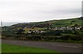
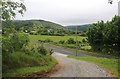
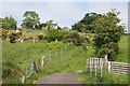
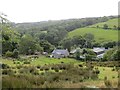
Nearby Images from Geograph Britain and Ireland:
©2013(licence)
©2016(licence)
©2007(licence)

©2016(licence)
©2014(licence)
The above images may not be of the site on this page, they are loaded from Geograph.
Please Submit an Image of this site or go out and take one for us!
Click here to see more info for this site
Nearby sites
Click here to view sites on an interactive map of the areaKey: Red: member's photo, Blue: 3rd party photo, Yellow: other image, Green: no photo - please go there and take one, Grey: site destroyed
Download sites to:
KML (Google Earth)
GPX (GPS waypoints)
CSV (Garmin/Navman)
CSV (Excel)
To unlock full downloads you need to sign up as a Contributory Member. Otherwise downloads are limited to 50 sites.
Turn off the page maps and other distractions
Nearby sites listing. In the following links * = Image available
2.1km ENE 59° Ballycleagh* Stone Row / Alignment (D251333)
2.5km NNW 337° Cushleake Mountain Stone Circle (D223345)
3.1km NNE 32° Altagore* Stone Fort or Dun (D2494734883)
3.7km NNE 34° Chambered Grave (Tornamoney)* Chambered Tomb (NW430913)
4.2km SSW 211° Ossian's Grave* Court Tomb
4.8km SSW 212° Cloghs* Passage Grave
5.7km WNW 302° Ballyvennaght Court Tomb * Court Tomb (D1844035020)
5.7km NW 325° Ballyvennaght Portal Tomb* Portal Tomb (D1998036750)
5.8km NNW 335° Cloughananca 2* Portal Tomb (D2074037330)
5.8km NNW 327° Stone of Sorrows (Cloch na h-Uaighe)* Standing Stone (Menhir) (NW379934)
6.7km SW 219° Tievebulliagh Ancient Mine, Quarry or other Industry (D193268)
6.8km NNW 348° Carnanmore* Passage Grave (D218388)
8.0km S 174° Cross-Carved Stone and Children's Burial Ground* Early Christian Sculptured Stone (NW411803)
8.7km NNW 348° Torr Head Passage Tomb* Passage Grave
9.0km WNW 289° Duncarbit Standing Stones* Standing Stones (D1473434814)
9.4km SE 143° Galboly Lower* Passage Grave
9.5km SE 145° Galboly Upper* Passage Grave (D2900724454)
9.9km W 271° McQuillan's Grave* Chambered Tomb (D1339032140)
10.3km WNW 286° Corvally Standing Stone* Standing Stone (Menhir) (NW3104391773)
11.3km W 281° Breen Standing Stone* Standing Stone (Menhir) (NW2982791165)
11.8km NNW 334° Lough Na Cranagh* Crannog (NW362993)
12.1km NW 317° Culfeightrin Stones* Standing Stones (D1477040765)
12.1km NW 323° Ballyvoy Court Tomb* Court Tomb
12.2km NW 323° Ballyvoy Passage Tomb* Passage Grave
12.5km WNW 291° Knocklayd Cairn* Cairn
View more nearby sites and additional images


 We would like to know more about this location. Please feel free to add a brief description and any relevant information in your own language.
 Wir möchten mehr über diese Stätte erfahren. Bitte zögern Sie nicht, eine kurze Beschreibung und relevante Informationen in Deutsch hinzuzufügen.
 Nous aimerions en savoir encore un peu sur les lieux. S'il vous plaît n'hesitez pas à ajouter une courte description et tous les renseignements pertinents dans votre propre langue.
 Quisieramos informarnos un poco más de las lugares. No dude en añadir una breve descripción y otros datos relevantes en su propio idioma.