<< Text Pages >> Lac La Ronge Rock Art - Rock Art in Canada
Submitted by bat400 on Friday, 16 March 2007 Page Views: 12163
Rock ArtSite Name: Lac La Ronge Rock ArtCountry: Canada
NOTE: This site is 203.676 km away from the location you searched for.
Type: Rock Art
Nearest Town: La Ronge
Latitude: 55.122000N Longitude: 105.238W
Condition:
| 5 | Perfect |
| 4 | Almost Perfect |
| 3 | Reasonable but with some damage |
| 2 | Ruined but still recognisable as an ancient site |
| 1 | Pretty much destroyed, possibly visible as crop marks |
| 0 | No data. |
| -1 | Completely destroyed |
| 5 | Superb |
| 4 | Good |
| 3 | Ordinary |
| 2 | Not Good |
| 1 | Awful |
| 0 | No data. |
| 5 | Can be driven to, probably with disabled access |
| 4 | Short walk on a footpath |
| 3 | Requiring a bit more of a walk |
| 2 | A long walk |
| 1 | In the middle of nowhere, a nightmare to find |
| 0 | No data. |
| 5 | co-ordinates taken by GPS or official recorded co-ordinates |
| 4 | co-ordinates scaled from a detailed map |
| 3 | co-ordinates scaled from a bad map |
| 2 | co-ordinates of the nearest village |
| 1 | co-ordinates of the nearest town |
| 0 | no data |
Be the first person to rate this site - see the 'Contribute!' box in the right hand menu.
Internal Links:
External Links:
Rock Art at Lac La Ronge, Saskatchewan.
This is one of the many areas in the Canadian Shield where rock art may be found. Some of the pictogram figures have been dated to 2000 years ago based on analysis of the paint used. Others showing figures with rifles date into the modern era.
The location is given for the town closest to the Lac La Ronge Provicial Park . The lake and the connected Churchill River System give access to many rock art sites. Many are accessible only by boat.
You may be viewing yesterday's version of this page. To see the most up to date information please register for a free account.
Do not use the above information on other web sites or publications without permission of the contributor.
Nearby Images from Flickr
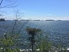
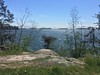
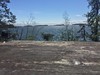
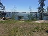
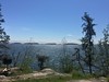
The above images may not be of the site on this page, but were taken nearby. They are loaded from Flickr so please click on them for image credits.
Click here to see more info for this site
Nearby sites
Click here to view sites on an interactive map of the areaKey: Red: member's photo, Blue: 3rd party photo, Yellow: other image, Green: no photo - please go there and take one, Grey: site destroyed
Download sites to:
KML (Google Earth)
GPX (GPS waypoints)
CSV (Garmin/Navman)
CSV (Excel)
To unlock full downloads you need to sign up as a Contributory Member. Otherwise downloads are limited to 50 sites.
Turn off the page maps and other distractions
Nearby sites listing. In the following links * = Image available
195.7km SSW 210° Park Valley Megalithic Stone Circle* Modern Stone Circle etc
214.6km SSE 158° Nipawin Medicine Wheel Reconciliation Park* Ancient Village or Settlement
220.4km SSW 194° Âsowanânihk Ancient Indigenous Site* Ancient Village or Settlement
320.2km ESE 119° Kapakoskasewakak Lake stones Stone Row / Alignment
334.4km SSW 196° Wanuskewin Heritage Park* Museum
456.3km NW 304° Quarry of the Ancestors Ancient Mine, Quarry or other Industry
456.5km SSW 192° Mistaseni Cairn* Marker Stone
460.3km SSW 191° Mistasiniy* Natural Stone / Erratic / Other Natural Feature
636.4km S 184° St.Victor Petroglyphs* Rock Art
661.1km S 177° Minton Turtle Effigy* Rock Art
662.9km S 177° Minton Deer Effigy* Rock Art
676.2km SW 215° Saami Giant Teepee* Ancient Village or Settlement
678.7km S 180° Blackfoot Buffalo Effigy* Rock Art
693.9km SSW 211° Stampede Site* Ancient Mine, Quarry or other Industry
696.8km SW 227° Majorville Medicine Wheel* Round Cairn
732.8km SW 221° Fincastle Grazing Reserve Bison Kill* Ancient Mine, Quarry or other Industry
740.5km WSW 237° Ootssip'tomowa Look Out Hill* Hill Figure or Geoglyph
752.7km SW 225° Sundial Medicine Wheel* Ring Cairn
768.6km SW 234° Big Rock (Alberta)* Rock Art
783.0km NE 54° Inuksuk Churchill Modern Stone Circle etc
799.9km SW 216° Writing-on-Stone Provincial Park* Rock Art
828.6km SW 227° Head-Smashed-In Buffalo Jump* Ancient Mine, Quarry or other Industry
833.2km WSW 251° Cataract Creek Petroglyphs* Rock Art
854.3km SE 127° Bannock Point Petroforms* Stone Row / Alignment
954.8km SSW 210° First Peoples Buffalo Jump* Natural Stone / Erratic / Other Natural Feature
View more nearby sites and additional images


 We would like to know more about this location. Please feel free to add a brief description and any relevant information in your own language.
 Wir möchten mehr über diese Stätte erfahren. Bitte zögern Sie nicht, eine kurze Beschreibung und relevante Informationen in Deutsch hinzuzufügen.
 Nous aimerions en savoir encore un peu sur les lieux. S'il vous plaît n'hesitez pas à ajouter une courte description et tous les renseignements pertinents dans votre propre langue.
 Quisieramos informarnos un poco más de las lugares. No dude en añadir una breve descripción y otros datos relevantes en su propio idioma.