<< Our Photo Pages >> Guestwick Hills 1 - Rock Art in England in County Durham
Submitted by Anne T on Wednesday, 09 May 2018 Page Views: 1596
Rock ArtSite Name: Guestwick Hills 1 Alternative Name: Gueswick Hills 1; ERA-1749; SMR/HER D5421Country: England
NOTE: This site is 1.31 km away from the location you searched for.
County: County Durham Type: Rock Art
Nearest Town: Middleton-in-Teesdale Nearest Village: Cotherstone / Hunderthwaite
Map Ref: NZ0025521039
Latitude: 54.584551N Longitude: 1.997569W
Condition:
| 5 | Perfect |
| 4 | Almost Perfect |
| 3 | Reasonable but with some damage |
| 2 | Ruined but still recognisable as an ancient site |
| 1 | Pretty much destroyed, possibly visible as crop marks |
| 0 | No data. |
| -1 | Completely destroyed |
| 5 | Superb |
| 4 | Good |
| 3 | Ordinary |
| 2 | Not Good |
| 1 | Awful |
| 0 | No data. |
| 5 | Can be driven to, probably with disabled access |
| 4 | Short walk on a footpath |
| 3 | Requiring a bit more of a walk |
| 2 | A long walk |
| 1 | In the middle of nowhere, a nightmare to find |
| 0 | No data. |
| 5 | co-ordinates taken by GPS or official recorded co-ordinates |
| 4 | co-ordinates scaled from a detailed map |
| 3 | co-ordinates scaled from a bad map |
| 2 | co-ordinates of the nearest village |
| 1 | co-ordinates of the nearest town |
| 0 | no data |
Be the first person to rate this site - see the 'Contribute!' box in the right hand menu.
Internal Links:
External Links:
")
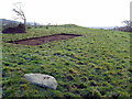
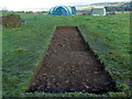
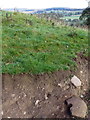
This rock art panel is recorded by NADRAP as having two depressions, both set within a small patch of reddening which has become ingrained within the stone. NADRAP notes the shape of the cup and the presence of a cairn 30m southeast dictate "its 'prehistoric' nature remains compelling'. They add that a single, more definite pitting mark can be seen between the depressions.
For more information see England's Rock Art entry for ERA-1749 Guestwick Hills 1, which includes NADRAP's notes, photographs, a sketch of the rock and its motifs, plus photogrammetry.
This panel is located on private land. Please seek permission before visiting.
You may be viewing yesterday's version of this page. To see the most up to date information please register for a free account.
")
Do not use the above information on other web sites or publications without permission of the contributor.
Nearby Images from Geograph Britain and Ireland:
©2019(licence)
©2019(licence)
©2019(licence)
©2019(licence)
©2011(licence)
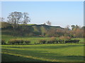
The above images may not be of the site on this page, they are loaded from Geograph.
Please Submit an Image of this site or go out and take one for us!
Click here to see more info for this site
Nearby sites
Key: Red: member's photo, Blue: 3rd party photo, Yellow: other image, Green: no photo - please go there and take one, Grey: site destroyed
Download sites to:
KML (Google Earth)
GPX (GPS waypoints)
CSV (Garmin/Navman)
CSV (Excel)
To unlock full downloads you need to sign up as a Contributory Member. Otherwise downloads are limited to 50 sites.
Turn off the page maps and other distractions
Nearby sites listing. In the following links * = Image available
64m SSE 157° Guestwick Hills 2 Rock Art (NZ0028020980)
908m SSE 148° Christening Stone (Cotherstone)* Ancient Cross (NZ0074420272)
1.3km SE 130° Thwaite Hall (Cotherstone) Rock Art (NZ0123420213)
2.3km NNE 17° Stobgreen Plantation 3 Rock Art (NZ0093623252)
2.5km NNE 26° Brackenheads 7* Rock Art (NZ0134023255)
2.5km NNE 29° Brackenheads N03* Rock Art (NZ0145423225)
2.5km NNE 28° Brackenheads N01* Rock Art (NZ0142323244)
2.5km NNE 28° Brackenheads N02 Rock Art (NZ0144923234)
2.5km NNE 26° Brackenheads 8* Rock Art (NZ0136123281)
2.6km NNE 29° Brackenheads 5 Rock Art (NZ0150023290)
2.6km NNE 29° Brackenheads 6* Rock Art (NZ0150123299)
2.6km NNE 29° Brackenheads 2* Rock Art (NZ0150523298)
2.6km NNE 29° Brackenheads 1* Rock Art (NZ0150823298)
2.6km NNE 30° Brackenheads 3* Rock Art (NZ0153523286)
2.6km NNE 29° Brackenheads 4 Rock Art (NZ0150423321)
2.7km NNE 18° Stobgreen Plantation N01 Rock Art (NZ0107323567)
2.7km NNE 23° Stobgreen Plantation - The Grayson Stone* Rock Art (NZ0128723489)
2.7km S 186° The Butter Stone* Standing Stone (Menhir) (NY9997318384)
2.8km W 272° Bracken Rigg 2* Rock Art (NY9745321132)
2.8km W 268° Bracken Rigg 1* Rock Art (NY9740920922)
3.0km N 9° Stobgreen Plantation 1* Rock Art (NZ0071423974)
3.0km N 9° Stobgreen Plantation 2* Rock Art (NZ0072824000)
3.5km NE 37° Barnard Castle Allotment 1 & Langleydale Common 10 Rock Art (NZ0237923805)
3.6km E 96° Hawkesley Hill 2 Rock Art (NZ0382020672)
3.6km E 96° Hawkesley Hill 1 Rock Art (NZ0382120675)
View more nearby sites and additional images


 We would like to know more about this location. Please feel free to add a brief description and any relevant information in your own language.
 Wir möchten mehr über diese Stätte erfahren. Bitte zögern Sie nicht, eine kurze Beschreibung und relevante Informationen in Deutsch hinzuzufügen.
 Nous aimerions en savoir encore un peu sur les lieux. S'il vous plaît n'hesitez pas à ajouter une courte description et tous les renseignements pertinents dans votre propre langue.
 Quisieramos informarnos un poco más de las lugares. No dude en añadir una breve descripción y otros datos relevantes en su propio idioma.