


<< Text Pages >> Brignall, Moor House Farm - Rock Art in England in County Durham
Submitted by Anne T on Wednesday, 04 April 2018 Page Views: 1411
Rock ArtSite Name: Brignall, Moor House Farm Alternative Name: ERA-975; SMR/HER D3516Country: England County: County Durham Type: Rock Art
Nearest Town: Barnard Castle Nearest Village: Scargill
Map Ref: NZ0563011637
Latitude: 54.500026N Longitude: 1.914579W
Condition:
| 5 | Perfect |
| 4 | Almost Perfect |
| 3 | Reasonable but with some damage |
| 2 | Ruined but still recognisable as an ancient site |
| 1 | Pretty much destroyed, possibly visible as crop marks |
| 0 | No data. |
| -1 | Completely destroyed |
| 5 | Superb |
| 4 | Good |
| 3 | Ordinary |
| 2 | Not Good |
| 1 | Awful |
| 0 | No data. |
| 5 | Can be driven to, probably with disabled access |
| 4 | Short walk on a footpath |
| 3 | Requiring a bit more of a walk |
| 2 | A long walk |
| 1 | In the middle of nowhere, a nightmare to find |
| 0 | No data. |
| 5 | co-ordinates taken by GPS or official recorded co-ordinates |
| 4 | co-ordinates scaled from a detailed map |
| 3 | co-ordinates scaled from a bad map |
| 2 | co-ordinates of the nearest village |
| 1 | co-ordinates of the nearest town |
| 0 | no data |
Be the first person to rate this site - see the 'Contribute!' box in the right hand menu.
Internal Links:
External Links:
Rock Art in County Durham
This rock art panel is located on a triangular shaped block of stone, recently set in a recently planted hedgerow between two fields which are also separated by a wire fence. The motifs are recorded as a number of cup-like depressions along with eroded ridges which give the impression of groove. The stone also has some solution holes, so the nature of markings on this stone is likely to be natural rather than man-made.
For more information and a more detailed description see England's Rock Art entry for ERA-975 Brignall, Moor House Farm, which includes NADRAP's notes, photographs, a sketch of the rock and its motifs, plus photogrammetry.
It is not recorded if this rock art panel is located on Open Access or private land; land usage given is 'other: hedgerow'.
Note: Have you seen this rock art panel? Do you have any photographs, information or comments to add?
You may be viewing yesterday's version of this page. To see the most up to date information please register for a free account.
Do not use the above information on other web sites or publications without permission of the contributor.
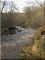
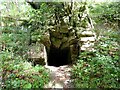
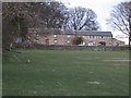
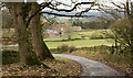
Nearby Images from Geograph Britain and Ireland:
©2022(licence)
©2021(licence)
©2007(licence)
©2016(licence)

©2023(licence)
The above images may not be of the site on this page, they are loaded from Geograph.
Please Submit an Image of this site or go out and take one for us!
Click here to see more info for this site
Nearby sites
Key: Red: member's photo, Blue: 3rd party photo, Yellow: other image, Green: no photo - please go there and take one, Grey: site destroyed
Download sites to:
KML (Google Earth)
GPX (GPS waypoints)
CSV (Garmin/Navman)
CSV (Excel)
To unlock full downloads you need to sign up as a Contributory Member. Otherwise downloads are limited to 50 sites.
Turn off the page maps and other distractions
Nearby sites listing. In the following links * = Image available
1.8km ENE 67° St. Mary's Church (Brignall)* Ancient Cross (NZ0725712313)
2.2km ENE 75° St Mary's Old Church (Brignall)* Ancient Cross (NZ0772412196)
2.4km SSE 156° Cowclose House (Barningham Moor)* Ancient Village or Settlement (NZ0659309445)
2.4km SSE 151° Grey Stones (Barningham Moor)* Ancient Village or Settlement (NZ0679209519)
2.4km SSE 151° Barningham Moor 97* Rock Art (NZ0680509501)
2.5km SE 134° Barningham Moor 1. Rock Art (NZ0742809924)
2.5km S 188° Barningham Moor 23* Rock Art (NZ0527609168)
2.5km SE 133° Barningham Moor 96* Rock Art (NZ0749909926)
2.5km SSE 156° Barningham Moor 98* Rock Art (NZ0668509331)
2.7km SE 136° Brown Hill (Barningham) Ancient Village or Settlement (NZ0749809706)
2.7km SSW 196° Barningham Moor 17 Rock Art (NZ0487009001)
2.8km S 188° Barningham Moor 21 Rock Art (NZ0526708866)
2.8km S 187° Barningham Moor 19 Rock Art (NZ0529608846)
2.8km S 191° Barningham Moor 16 Rock Art (NZ0509508874)
2.8km S 190° Barningham Moor 18 Rock Art (NZ0514508859)
2.8km S 187° Barningham Moor 22 Rock Art (NZ0528208835)
2.8km S 183° Barningham Moor 20* Rock Art (NZ0546708808)
2.8km SSW 197° Barningham Moor 12.* Rock Art (NZ0481608917)
2.9km SSW 193° Barningham Moor 13.* Rock Art (NZ0498908851)
2.9km SSW 193° Barningham Moor 14* Rock Art (NZ0500108818)
2.9km SSW 197° Barningham Moor 11. Rock Art (NZ0477108819)
3.0km SSW 193° Barningham Moor 15 Rock Art (NZ0493708735)
3.1km SSW 198° Barningham Moor 8* Rock Art (NZ0467408731)
3.1km S 176° Barningham Moor 114* Rock Art (NZ0585808580)
3.1km ESE 118° Barningham Modern Stone Circle* Modern Stone Circle etc (NZ084102)
View more nearby sites and additional images


 We would like to know more about this location. Please feel free to add a brief description and any relevant information in your own language.
 Wir möchten mehr über diese Stätte erfahren. Bitte zögern Sie nicht, eine kurze Beschreibung und relevante Informationen in Deutsch hinzuzufügen.
 Nous aimerions en savoir encore un peu sur les lieux. S'il vous plaît n'hesitez pas à ajouter une courte description et tous les renseignements pertinents dans votre propre langue.
 Quisieramos informarnos un poco más de las lugares. No dude en añadir una breve descripción y otros datos relevantes en su propio idioma.