<< Our Photo Pages >> Nipawin Medicine Wheel Reconciliation Park - Ancient Village or Settlement in Canada
Submitted by TheDruid-3X3 on Wednesday, 21 May 2025 Page Views: 2248
Multi-periodSite Name: Nipawin Medicine Wheel Reconciliation Park Alternative Name: Nipawin Hydro Electric Station, Nipawin Reconciliation Medicine WheelCountry: Canada
NOTE: This site is 90.38 km away from the location you searched for.
Type: Ancient Village or Settlement
Nearest Town: Nipawin, Saskatechewan Nearest Village: White Fox, Saskatchewan
Latitude: 53.323611N Longitude: 104.041667W
Condition:
| 5 | Perfect |
| 4 | Almost Perfect |
| 3 | Reasonable but with some damage |
| 2 | Ruined but still recognisable as an ancient site |
| 1 | Pretty much destroyed, possibly visible as crop marks |
| 0 | No data. |
| -1 | Completely destroyed |
| 5 | Superb |
| 4 | Good |
| 3 | Ordinary |
| 2 | Not Good |
| 1 | Awful |
| 0 | No data. |
| 5 | Can be driven to, probably with disabled access |
| 4 | Short walk on a footpath |
| 3 | Requiring a bit more of a walk |
| 2 | A long walk |
| 1 | In the middle of nowhere, a nightmare to find |
| 0 | No data. |
| 5 | co-ordinates taken by GPS or official recorded co-ordinates |
| 4 | co-ordinates scaled from a detailed map |
| 3 | co-ordinates scaled from a bad map |
| 2 | co-ordinates of the nearest village |
| 1 | co-ordinates of the nearest town |
| 0 | no data |
Internal Links:
External Links:
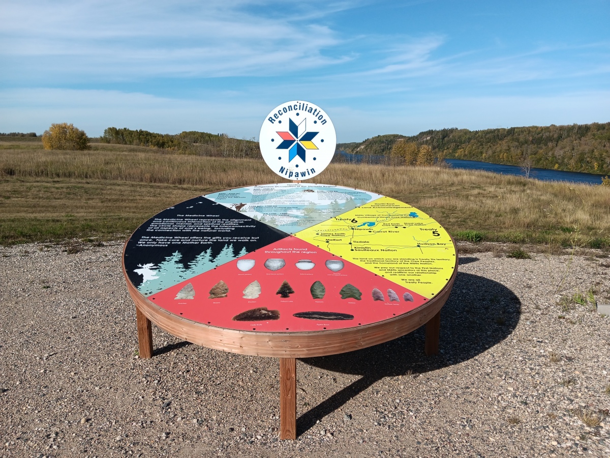
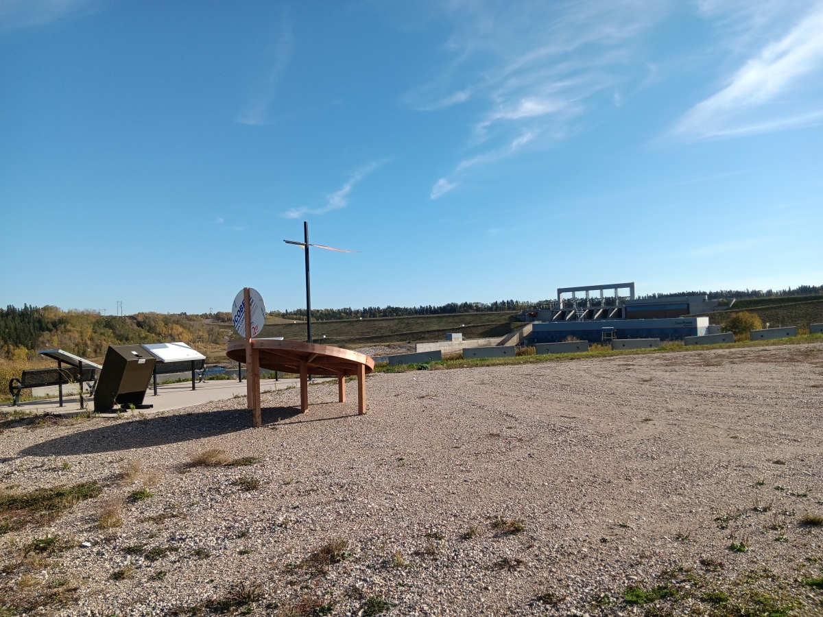
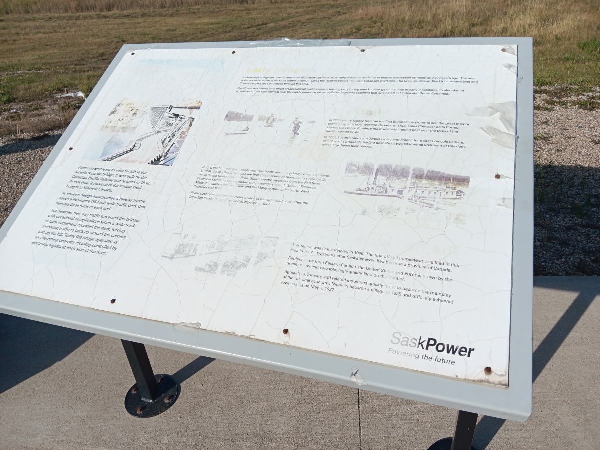
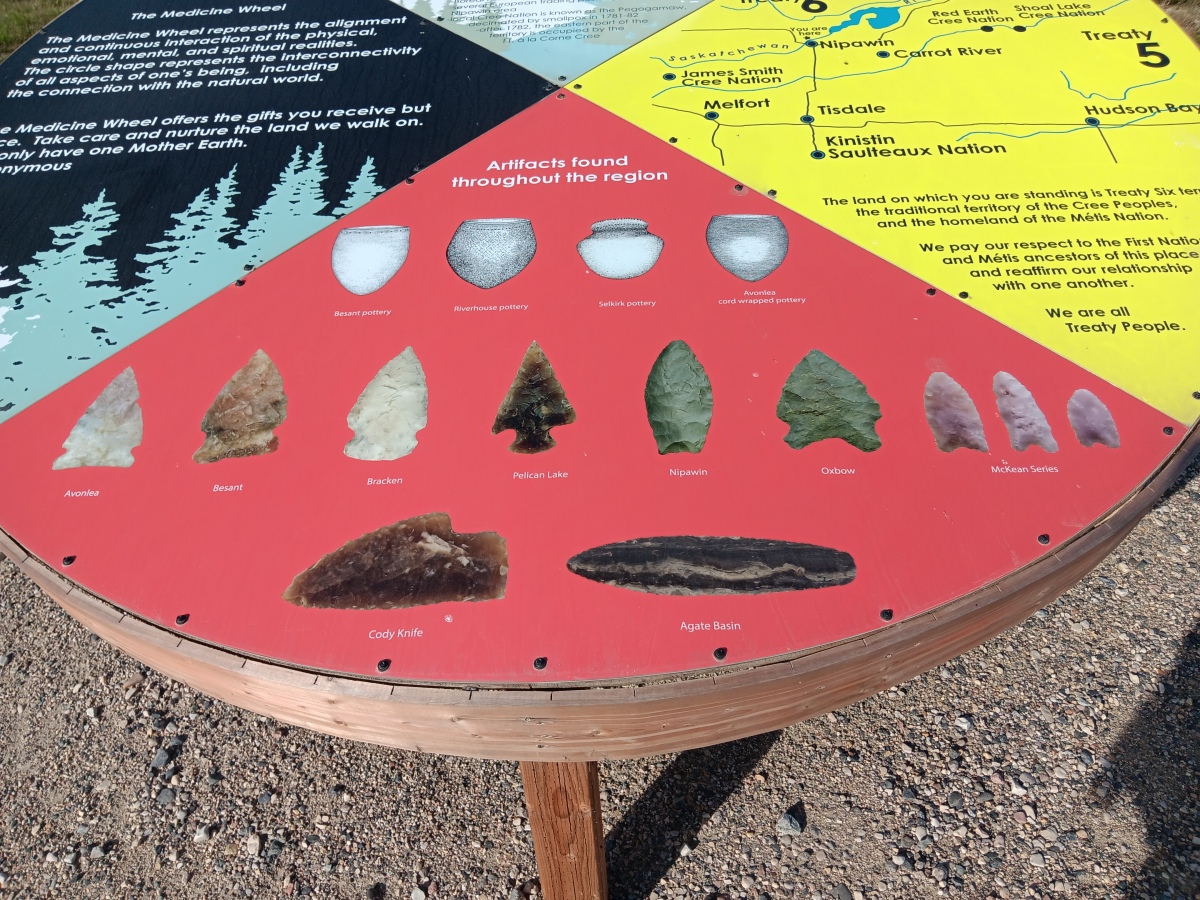
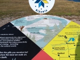
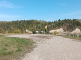
This honours 7,500 years of history at the site, the treaty land in the northeast and the teaching of the medicine wheel - a permanent reminder of the path towards truth and reconciliation.
The four aspects of the display are an area describing the significance of the wheel, an acknowledgement of Treaty 6 lands, the artifacts found at the site by archaeologists and a timeline of events.
An event unveiling the medicine wheel featured an honour song sung by Trevor Cheekinew and Hume Mirasty. Sharon Meyere joined the event to teach about the medicine wheel. Students at Wagner School did a hoop dance.
Reconciliation Nipawin’s Denise Blomquist told northeastNOW that the planning process for this started in 2018.
“We started with history. We started talking to archeologists who did the digs at the Nipawin Hydroelectric Station before the dam was built.”
By contacting the University of Saskatchewan who carried out the dig, they discovered the articles and a timeline of the area.
With 5,000 years of Indigenous history now at the group’s fingertips, Blomquist explained they began figuring out how they wanted to share this history.
“We wanted to somehow make that into something that we could display. We had the idea to contact SaskPower and see if they wanted to partner with us.”
SaskPower not only partnered with the group but paid for the sign.
Blomquist said that this project is another step toward the continuous work that the group has planned and will continue to do in the future.
“We just wanted to bring attention to the ongoing legacy and make sure people have access to participate in reconciliation.”
You may be viewing yesterday's version of this page. To see the most up to date information please register for a free account.
Do not use the above information on other web sites or publications without permission of the contributor.
Click here to see more info for this site
Nearby sites
Click here to view sites on an interactive map of the areaKey: Red: member's photo, Blue: 3rd party photo, Yellow: other image, Green: no photo - please go there and take one, Grey: site destroyed
Download sites to:
KML (Google Earth)
GPX (GPS waypoints)
CSV (Garmin/Navman)
CSV (Excel)
To unlock full downloads you need to sign up as a Contributory Member. Otherwise downloads are limited to 50 sites.
Turn off the page maps and other distractions
Nearby sites listing. In the following links * = Image available
132.3km W 265° Âsowanânihk Ancient Indigenous Site* Ancient Village or Settlement
179.8km W 281° Park Valley Megalithic Stone Circle* Modern Stone Circle etc
206.1km ENE 78° Kapakoskasewakak Lake stones Stone Row / Alignment
210.9km SW 236° Wanuskewin Heritage Park* Museum
214.6km NNW 339° Lac La Ronge Rock Art Rock Art
302.6km SW 216° Mistaseni Cairn* Marker Stone
304.2km SW 215° Mistasiniy* Natural Stone / Erratic / Other Natural Feature
453.1km SSW 197° St.Victor Petroglyphs* Rock Art
462.8km S 186° Minton Turtle Effigy* Rock Art
464.7km S 186° Minton Deer Effigy* Rock Art
485.4km S 190° Blackfoot Buffalo Effigy* Rock Art
587.3km SW 234° Saami Giant Teepee* Ancient Village or Settlement
589.2km SW 229° Stampede Site* Ancient Mine, Quarry or other Industry
645.0km NW 316° Quarry of the Ancestors Ancient Mine, Quarry or other Industry
648.8km WSW 245° Majorville Medicine Wheel* Round Cairn
660.8km WSW 238° Fincastle Grazing Reserve Bison Kill* Ancient Mine, Quarry or other Industry
680.8km ESE 118° Bannock Point Petroforms* Stone Row / Alignment
697.5km WSW 243° Sundial Medicine Wheel* Ring Cairn
707.2km SW 231° Writing-on-Stone Provincial Park* Rock Art
727.7km WSW 254° Ootssip'tomowa Look Out Hill* Hill Figure or Geoglyph
744.5km SSE 161° Double Ditch State Historic Site* Ancient Village or Settlement
745.0km WSW 251° Big Rock (Alberta)* Rock Art
776.3km WSW 243° Head-Smashed-In Buffalo Jump* Ancient Mine, Quarry or other Industry
831.0km SE 146° Standing Rock State Historic Site* Artificial Mound
838.0km SW 222° First Peoples Buffalo Jump* Natural Stone / Erratic / Other Natural Feature
View more nearby sites and additional images


 We would like to know more about this location. Please feel free to add a brief description and any relevant information in your own language.
 Wir möchten mehr über diese Stätte erfahren. Bitte zögern Sie nicht, eine kurze Beschreibung und relevante Informationen in Deutsch hinzuzufügen.
 Nous aimerions en savoir encore un peu sur les lieux. S'il vous plaît n'hesitez pas à ajouter une courte description et tous les renseignements pertinents dans votre propre langue.
 Quisieramos informarnos un poco más de las lugares. No dude en añadir una breve descripción y otros datos relevantes en su propio idioma.