


<< Text Pages >> Gipton Wood - Ancient Village or Settlement in England in Yorkshire (West)
Submitted by Andy B on Tuesday, 06 September 2011 Page Views: 11174
Multi-periodSite Name: Gipton WoodCountry: England
NOTE: This site is 1.956 km away from the location you searched for.
County: Yorkshire (West) Type: Ancient Village or Settlement
Nearest Town: Leeds Nearest Village: Potter Newton
Map Ref: SE32653664
Latitude: 53.825010N Longitude: 1.505477W
Condition:
| 5 | Perfect |
| 4 | Almost Perfect |
| 3 | Reasonable but with some damage |
| 2 | Ruined but still recognisable as an ancient site |
| 1 | Pretty much destroyed, possibly visible as crop marks |
| 0 | No data. |
| -1 | Completely destroyed |
| 5 | Superb |
| 4 | Good |
| 3 | Ordinary |
| 2 | Not Good |
| 1 | Awful |
| 0 | No data. |
| 5 | Can be driven to, probably with disabled access |
| 4 | Short walk on a footpath |
| 3 | Requiring a bit more of a walk |
| 2 | A long walk |
| 1 | In the middle of nowhere, a nightmare to find |
| 0 | No data. |
| 5 | co-ordinates taken by GPS or official recorded co-ordinates |
| 4 | co-ordinates scaled from a detailed map |
| 3 | co-ordinates scaled from a bad map |
| 2 | co-ordinates of the nearest village |
| 1 | co-ordinates of the nearest town |
| 0 | no data |
Internal Links:
External Links:
A late prehistoric enclosed settlement and the surviving part of a second, situated in Potter Newton at the north end of Gipton Wood. The main, southern, enclosure has a substantial ditch with a well-defined outer bank. The ditch is about 5 metres wide and 0.6 metres deep. The bank is 5-6 metres wide and is up to 0.5 metres high.
Immediately to the north is part of a second enclosure which has been partly destroyed by a modern road and housing estate. This enclosure is bounded by a bank approximately 4 metres wide and 0.3 metres high. An additional ditch 4 metres wide with an outer bank about 4 metres wide and 0.2-0.3 metres high is present on the west side of the enclosure.
Source: Pastscape
Note: Gipton Wood Archaeological Walk, Thursday 8th September
You may be viewing yesterday's version of this page. To see the most up to date information please register for a free account.
Do not use the above information on other web sites or publications without permission of the contributor.
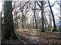
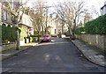
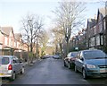
Nearby Images from Geograph Britain and Ireland:
©2009(licence)

©2023(licence)
©2009(licence)

©2009(licence)
©2009(licence)
The above images may not be of the site on this page, they are loaded from Geograph.
Please Submit an Image of this site or go out and take one for us!
Click here to see more info for this site
Nearby sites
Key: Red: member's photo, Blue: 3rd party photo, Yellow: other image, Green: no photo - please go there and take one, Grey: site destroyed
Download sites to:
KML (Google Earth)
GPX (GPS waypoints)
CSV (Garmin/Navman)
CSV (Excel)
To unlock full downloads you need to sign up as a Contributory Member. Otherwise downloads are limited to 50 sites.
Turn off the page maps and other distractions
Nearby sites listing. In the following links * = Image available
3.4km ENE 67° Grim's Dyke* Misc. Earthwork (SE358380)
3.5km SSW 210° Quarry Hill (Leeds) Ancient Village or Settlement (SE309336)
3.6km SW 215° Lady Well (Leeds) Holy Well or Sacred Spring (SE30603373)
3.8km SW 227° Leeds City Museum* Museum (SE2993634036)
3.9km SSW 211° St Peter's Minster Church (Kirkgate)* Ancient Cross (SE30653330)
4.7km WSW 239° Gray Stone (Burley) Natural Stone / Erratic / Other Natural Feature (SE2865934229)
4.9km SW 220° St Helen's Well (Holbeck) Holy Well or Sacred Spring (SE295329)
6.3km NW 305° Adel Cupstone* Rock Art (SE274402)
6.5km N 350° Grey Stone (Harewood)* Rock Art (SE31474308)
7.2km E 84° Barwick in Elmet Hillfort* Hillfort (SE398375)
7.6km NNE 31° All Hallows (Bardsey)* Ancient Cross (SE3656143122)
8.9km WNW 301° Long Stone (Adel) Standing Stone (Menhir) (SE25014119)
9.0km WNW 297° Gab Wood (2)* Carving (SE2460640625)
9.3km W 276° Horsforth Milestone* Rock Art (SE23323748)
10.6km E 88° St Ricarius (Aberford) Ancient Cross (SE4331037170)
11.4km NE 34° Collingham Crosses* Ancient Cross (SE3901546096)
11.8km W 273° St Wilfrid (Calverley) Sculptured Stone (SE208372)
12.3km W 276° Calverley Woods 2 (Leeds) Rock Art (SE2037737939)
12.3km W 276° Calverley Woods 3 (Leeds)* Rock Art (SE2036937923)
12.6km N 359° St Helen's Well (Kirkby Overblow)* Holy Well or Sacred Spring (SE32354920)
12.6km W 276° Calverley Woods 1 (Leeds) Rock Art (SE20083791)
12.6km W 272° Calverley Woods Stone Circle (Leeds) Stone Circle (SE200370)
12.9km NW 311° Cayley Hall Well* Holy Well or Sacred Spring (SE229451)
12.9km W 273° West Woods 1 (Calverley) Rock Art (SE19703731)
13.1km W 273° West Woods 2 (Calverley) Rock Art (SE195373)
View more nearby sites and additional images


 We would like to know more about this location. Please feel free to add a brief description and any relevant information in your own language.
 Wir möchten mehr über diese Stätte erfahren. Bitte zögern Sie nicht, eine kurze Beschreibung und relevante Informationen in Deutsch hinzuzufügen.
 Nous aimerions en savoir encore un peu sur les lieux. S'il vous plaît n'hesitez pas à ajouter une courte description et tous les renseignements pertinents dans votre propre langue.
 Quisieramos informarnos un poco más de las lugares. No dude en añadir una breve descripción y otros datos relevantes en su propio idioma.