 with our Megalithic Portal iPhone app")


<< Text Pages >> Stannary (Halifax) - Stone Circle in England in Yorkshire (South)
Submitted by Anne T on Tuesday, 09 January 2018 Page Views: 3730
Neolithic and Bronze AgeSite Name: Stannary (Halifax)Country: England
NOTE: This site is 0.395 km away from the location you searched for.
County: Yorkshire (South) Type: Stone Circle
Nearest Town: Halifax
Map Ref: SE088256
Latitude: 53.726728N Longitude: 1.868105W
Condition:
| 5 | Perfect |
| 4 | Almost Perfect |
| 3 | Reasonable but with some damage |
| 2 | Ruined but still recognisable as an ancient site |
| 1 | Pretty much destroyed, possibly visible as crop marks |
| 0 | No data. |
| -1 | Completely destroyed |
| 5 | Superb |
| 4 | Good |
| 3 | Ordinary |
| 2 | Not Good |
| 1 | Awful |
| 0 | No data. |
| 5 | Can be driven to, probably with disabled access |
| 4 | Short walk on a footpath |
| 3 | Requiring a bit more of a walk |
| 2 | A long walk |
| 1 | In the middle of nowhere, a nightmare to find |
| 0 | No data. |
| 5 | co-ordinates taken by GPS or official recorded co-ordinates |
| 4 | co-ordinates scaled from a detailed map |
| 3 | co-ordinates scaled from a bad map |
| 2 | co-ordinates of the nearest village |
| 1 | co-ordinates of the nearest town |
| 0 | no data |
Be the first person to rate this site - see the 'Contribute!' box in the right hand menu.
Internal Links:
External Links:
Stone Circle in Yorkshire (South)
The site is now a built up area in Halifax, but The Northern Antiquarian (TNA) has come across a reference to a 'stannary' just west of the town centre. In 1961, place name expert A.H.Smith took this to be "probably just a stone circle" from the archaic verbs stan (stone) and hring (ring). For more information see TNA's page for Stannary, Halifax, West Yorkshire.
TNA requests: "If we could locate additional folklore or other historical data that might throw further light on this, it would be an important find. The finding of prehistoric burial remains less than a mile south of Stannary on the other side of town shows that ancient man was in Halifax, but it would be good if we could find more…"
Note: Do you have any information which might lead to the true origin and nature of this site? If so, please post a comment below. Thank you.
You may be viewing yesterday's version of this page. To see the most up to date information please register for a free account.
Do not use the above information on other web sites or publications without permission of the contributor.
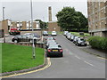
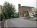
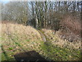
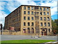
Nearby Images from Geograph Britain and Ireland:
©2013(licence)
©2013(licence)
©2019(licence)

©2024(licence)
©2016(licence)
The above images may not be of the site on this page, they are loaded from Geograph.
Please Submit an Image of this site or go out and take one for us!
Click here to see more info for this site
Nearby sites
Key: Red: member's photo, Blue: 3rd party photo, Yellow: other image, Green: no photo - please go there and take one, Grey: site destroyed
Download sites to:
KML (Google Earth)
GPX (GPS waypoints)
CSV (Garmin/Navman)
CSV (Excel)
To unlock full downloads you need to sign up as a Contributory Member. Otherwise downloads are limited to 50 sites.
Turn off the page maps and other distractions
Nearby sites listing. In the following links * = Image available
1.7km SSE 160° Shaw Hill (Skircoat) Cairn (SE09372401)
2.7km W 262° Warley Edge (Halifax)* Rock Art (SE061252)
3.3km W 278° Tower Hill (Warley) Cairn (SE05472604)
3.8km WNW 290° Tower Hill Enclosure Misc. Earthwork (SE05192689)
4.4km E 81° Priestly Green Holy Well Holy Well or Sacred Spring (SE13202632)
4.6km NNW 334° Mount Zion (Illingworth) Cist (SE068297)
5.2km NW 307° Robin Hood's Penny Stone (Wainstalls) Standing Stone (Menhir) (SE04632870)
5.4km NW 323° The Carrs (Ovenden) Ancient Village or Settlement (SE0554729937)
5.5km WNW 301° The White Stones Natural Stone / Erratic / Other Natural Feature (SE041284)
6.2km WNW 286° Midgley Moor Ring Cairn (SE0284227259)
6.4km WNW 284° Crow Hill Cairn Circle* Stone Circle (SE026271)
6.4km NW 306° Sleepy Lowe Cairn (SE03612936)
6.4km SE 129° St Matthew (Rastrick)* Ancient Cross (SE1383121596)
6.4km W 260° Sowerby Lad (Mytholmroyd) Standing Stone (Menhir) (SE02442443)
6.6km NNW 334° The Giants Tooth Modern Stone Circle etc (SE059315)
6.6km WNW 283° Foster Clough* Misc. Earthwork (SE02352708)
6.6km NNW 333° The Boggarts Grave Holy Well or Sacred Spring (SE058315)
6.8km S 180° St Helen's Well (Stainland) Holy Well or Sacred Spring (SE088188)
7.0km NNW 332° The Nab Round Cairn (SE0549831755)
7.1km NW 311° Rocking Stone (Warley Moor) Natural Stone / Erratic / Other Natural Feature (SE0339930199)
7.1km WNW 287° Churn Milk Joan (Midgley Moor)* Standing Stone (Menhir) (SE0197327691)
7.4km WNW 292° Miller's Grave* Cairn (SE0191328369)
7.7km WNW 284° Wicken Hill* Misc. Earthwork (SE0133527390)
7.7km WNW 292° Greenwood Stone (Midgley Moor)* Marker Stone (SE0165228514)
8.0km NW 311° Dean Head Stony Edge* Rock Art (SE0267730808)
View more nearby sites and additional images


 We would like to know more about this location. Please feel free to add a brief description and any relevant information in your own language.
 Wir möchten mehr über diese Stätte erfahren. Bitte zögern Sie nicht, eine kurze Beschreibung und relevante Informationen in Deutsch hinzuzufügen.
 Nous aimerions en savoir encore un peu sur les lieux. S'il vous plaît n'hesitez pas à ajouter une courte description et tous les renseignements pertinents dans votre propre langue.
 Quisieramos informarnos un poco más de las lugares. No dude en añadir una breve descripción y otros datos relevantes en su propio idioma.