<< Text Pages >> Oldbridge Logboat, River Boyne - Not Known (by us) in Ireland (Republic of) in Co. Meath
Submitted by GaelicLaird on Friday, 02 April 2021 Page Views: 437
Neolithic and Bronze AgeSite Name: Oldbridge Logboat, River BoyneCountry: Ireland (Republic of)
NOTE: This site is 1.913 km away from the location you searched for.
County: Co. Meath Type: Not Known (by us)
Nearest Village: Drybridge
Latitude: 53.718560N Longitude: 6.40177W
Condition:
| 5 | Perfect |
| 4 | Almost Perfect |
| 3 | Reasonable but with some damage |
| 2 | Ruined but still recognisable as an ancient site |
| 1 | Pretty much destroyed, possibly visible as crop marks |
| 0 | No data. |
| -1 | Completely destroyed |
| 5 | Superb |
| 4 | Good |
| 3 | Ordinary |
| 2 | Not Good |
| 1 | Awful |
| 0 | No data. |
| 5 | Can be driven to, probably with disabled access |
| 4 | Short walk on a footpath |
| 3 | Requiring a bit more of a walk |
| 2 | A long walk |
| 1 | In the middle of nowhere, a nightmare to find |
| 0 | No data. |
| 5 | co-ordinates taken by GPS or official recorded co-ordinates |
| 4 | co-ordinates scaled from a detailed map |
| 3 | co-ordinates scaled from a bad map |
| 2 | co-ordinates of the nearest village |
| 1 | co-ordinates of the nearest town |
| 0 | no data |
Internal Links:
External Links:
Co. Meath. In June 2016 four anglers (Stephen Murphy, accompanied by Kieran Mahar, William Gregory and David Johnston) discovered the remains of a logboat while fishing a tidal stretch of the River Boyne at Oldbridge, Co. Meath.
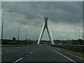
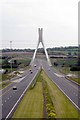
The logboat was found lying up-side-down mid-channel in the river approximately 300m upstream of the Drogheda M1 suspension bridge. Only the floor of the boat survives; it has an overall length of 3.12m, is parallel-sided in plan and has a maximum surviving width of 75cm. The boat has a flat longitudinal floor and slightly rounded transverse cross section and it is likely to be the case that the boat originally had a rounded bow and stern. The overall length of the boat appears to have been at least 4m and very probably longer. There is no evidence for tool marks or other features on the boat. Both bark and sapwood are absent.
Neither end of the boat survives intact but the bow is normally the narrower end of the vessel with logboats in Ireland. The floor is slightly rounded in transverse section and measures 12cm in thickness near the stern and is 9.5cm thick in the middle of the boat. The underside of the stern end of the boat is badly eroded and uneven as this side lay exposed on the riverbed and is marked with a number of circular hollows and depressions. These were probably caused by the scouring of riverine stones or pebbles on its surface whereas the opposite end or bow is smooth and rounded and appears to be the original under surface of the boat.
Due to the fragility of the boat it was decided in collaboration with the National Museum of Ireland to recover the boat from the river for safe keeping. The boat is currently undergoing treatment by the NMI's Conservation Unit.
Recently a sample was sent to the 14Chrono Centre in Queen's University Belfast which provided a date of circa 3300BC-2900BC. This logboat is one of only 11 logboats known to have been found in the Boyne but more importantly it is one of only 8 boats known from Ireland to date to the Neolithic period (c.4000 -2500 BC).
Record Source Brady 2016; Underwater Archaeology Unit Wreck Files
A good write up and more photos of the find can be found here: Oldbridge Logboat
You may be viewing yesterday's version of this page. To see the most up to date information please register for a free account.
Do not use the above information on other web sites or publications without permission of the contributor.
Nearby Images from Geograph Britain and Ireland:
©2013(licence)
©2007(licence)
©2013(licence)

©2009(licence)
©2007(licence)
The above images may not be of the site on this page, they are loaded from Geograph.
Please Submit an Image of this site or go out and take one for us!
Click here to see more info for this site
Nearby sites
Click here to view sites on an interactive map of the areaKey: Red: member's photo, Blue: 3rd party photo, Yellow: other image, Green: no photo - please go there and take one, Grey: site destroyed
Download sites to:
KML (Google Earth)
GPX (GPS waypoints)
CSV (Garmin/Navman)
CSV (Excel)
To unlock full downloads you need to sign up as a Contributory Member. Otherwise downloads are limited to 50 sites.
Turn off the page maps and other distractions
Nearby sites listing. In the following links * = Image available
2.5km WSW 240° Dowth Henge* Henge (O034742)
2.9km WSW 239° Dowth Hall* Passage Grave
2.9km SW 230° Donore Mystery Mound Artificial Mound (O0334573550)
3.3km W 275° Townleyhall Passage Tomb* Passage Grave (O0222075723)
3.5km ESE 103° Millmount* Artificial Mound
3.6km WSW 243° Dowth Passage Grave* Passage Grave (O02377377)
4.9km SW 234° Newgrange Standing Stones* Standing Stones
5.4km SW 236° Newgrange Barrow ME019-049001* Chambered Tomb (SB0500930882)
5.5km WSW 241° Newgrange* Passage Grave (O00747272)
5.6km WSW 241° Newgrange Stone Circle* Stone Circle (O007727)
6.1km WSW 237° Recently Discovered Prehistoric Cropmark near Newgrange* Misc. Earthwork
6.2km WSW 252° Knowth Timber Circle* Timber Circle (N997734)
6.2km WSW 252° Knowth* Passage Grave (N99697342)
6.6km N 351° Muiredach's Cross (Monasterboice)* Ancient Cross (O044820)
9.3km ENE 75° Baltray* Standing Stones
9.5km NNW 329° Tinure* Rock Art (O005835)
9.5km W 269° Hill of Slane* Artificial Mound
11.8km WNW 295° Grangegeeth Sculptured Stone
13.0km SSE 157° Greenanstown Stone Circle (O110637)
13.3km SSE 160° Micknanstown* Passage Grave
14.5km SSE 160° Fourknocks* Passage Grave (O10856202)
15.3km SE 127° Knocknagin* Passage Grave
16.5km NW 318° Hurlstone* Holed Stone (N9426987509)
17.0km SE 125° Bremore Port* Passage Grave
18.3km SSW 193° Kilbrew Henge
View more nearby sites and additional images


 We would like to know more about this location. Please feel free to add a brief description and any relevant information in your own language.
 Wir möchten mehr über diese Stätte erfahren. Bitte zögern Sie nicht, eine kurze Beschreibung und relevante Informationen in Deutsch hinzuzufügen.
 Nous aimerions en savoir encore un peu sur les lieux. S'il vous plaît n'hesitez pas à ajouter une courte description et tous les renseignements pertinents dans votre propre langue.
 Quisieramos informarnos un poco más de las lugares. No dude en añadir una breve descripción y otros datos relevantes en su propio idioma.