


<< Text Pages >> Featherstone Cursus - Cursus in England in Yorkshire (West)
Submitted by EssexMan on Wednesday, 07 April 2010 Page Views: 6598
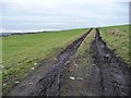
Neolithic and Bronze AgeSite Name: Featherstone CursusCountry: England County: Yorkshire (West) Type: Cursus
Nearest Town: Wakefield Nearest Village: Featherstone
Map Ref: SE418232 Landranger Map Number: 105
Latitude: 53.703565N Longitude: 1.368297W
Condition:
| 5 | Perfect |
| 4 | Almost Perfect |
| 3 | Reasonable but with some damage |
| 2 | Ruined but still recognisable as an ancient site |
| 1 | Pretty much destroyed, possibly visible as crop marks |
| 0 | No data. |
| -1 | Completely destroyed |
| 5 | Superb |
| 4 | Good |
| 3 | Ordinary |
| 2 | Not Good |
| 1 | Awful |
| 0 | No data. |
| 5 | Can be driven to, probably with disabled access |
| 4 | Short walk on a footpath |
| 3 | Requiring a bit more of a walk |
| 2 | A long walk |
| 1 | In the middle of nowhere, a nightmare to find |
| 0 | No data. |
| 5 | co-ordinates taken by GPS or official recorded co-ordinates |
| 4 | co-ordinates scaled from a detailed map |
| 3 | co-ordinates scaled from a bad map |
| 2 | co-ordinates of the nearest village |
| 1 | co-ordinates of the nearest town |
| 0 | no data |
Internal Links:
External Links:
Long Enclosure in West Yorkshire
Status: Possible
NMR No. SE 42 SW 65
Extent: 162mx35m
You may be viewing yesterday's version of this page. To see the most up to date information please register for a free account.
Do not use the above information on other web sites or publications without permission of the contributor.
Nearby Images from Geograph Britain and Ireland:
©2013(licence)
©2011(licence)
©2011(licence)
©2013(licence)
©2011(licence)
The above images may not be of the site on this page, they are loaded from Geograph.
Please Submit an Image of this site or go out and take one for us!
Click here to see more info for this site
Nearby sites
Key: Red: member's photo, Blue: 3rd party photo, Yellow: other image, Green: no photo - please go there and take one, Grey: site destroyed
Download sites to:
KML (Google Earth)
GPX (GPS waypoints)
CSV (Garmin/Navman)
CSV (Excel)
To unlock full downloads you need to sign up as a Contributory Member. Otherwise downloads are limited to 50 sites.
Turn off the page maps and other distractions
Nearby sites listing. In the following links * = Image available
2.8km NNE 24° Castleford Museum* Museum (SE4293625772)
5.7km ENE 78° Round Hill Field (Ferrybridge) Cairn (SE47332444)
5.7km ENE 77° Angel Moon Field Cairn (SE47342449)
5.7km E 80° Ferrybridge Henge* Henge (SE4746024240)
5.8km E 83° Ferrybridge N Timber Circle (SE476240)
5.9km E 82° Ferrybridge N Timber Circle (SE476241)
6.1km NE 55° Ferry Fryston Bronze Age Burial* Barrow Cemetery (SE4680026700)
6.5km SW 219° All Saints (Crofton) Ancient Cross (SE37781812)
12.4km NE 35° Sherburn Cross* Ancient Cross (SE488335)
12.8km S 173° South Kirby Camp* Hillfort (SE435105)
13.2km S 177° Ringstone Hill (Brierley) Stone Circle (SE42571005)
14.0km N 7° St Ricarius (Aberford) Ancient Cross (SE4331037170)
14.4km N 353° Barwick in Elmet Hillfort* Hillfort (SE398375)
14.7km SSE 147° Little John's Well (Hampole)* Holy Well or Sacred Spring (SE4988810873)
14.8km NNE 23° Saxton Church* Ancient Cross (SE47583689)
15.0km NW 313° St Peter's Minster Church (Kirkgate)* Ancient Cross (SE30653330)
15.0km NW 314° Quarry Hill (Leeds) Ancient Village or Settlement (SE309336)
15.2km SE 139° Robin Hood's Well (Burghwallis)* Holy Well or Sacred Spring (SE51901175)
15.3km NW 314° Lady Well (Leeds) Holy Well or Sacred Spring (SE30603373)
15.6km NW 309° St Helen's Well (Holbeck) Holy Well or Sacred Spring (SE295329)
16.0km NNW 338° Grim's Dyke* Misc. Earthwork (SE358380)
16.0km NW 313° Leeds City Museum* Museum (SE2993634036)
16.2km NNW 326° Gipton Wood Ancient Village or Settlement (SE32653664)
17.0km WSW 256° St Michael and All Angels (Thornhill)* Ancient Cross (SE25341885)
17.1km NW 311° Gray Stone (Burley) Natural Stone / Erratic / Other Natural Feature (SE2865934229)
View more nearby sites and additional images


 We would like to know more about this location. Please feel free to add a brief description and any relevant information in your own language.
 Wir möchten mehr über diese Stätte erfahren. Bitte zögern Sie nicht, eine kurze Beschreibung und relevante Informationen in Deutsch hinzuzufügen.
 Nous aimerions en savoir encore un peu sur les lieux. S'il vous plaît n'hesitez pas à ajouter une courte description et tous les renseignements pertinents dans votre propre langue.
 Quisieramos informarnos un poco más de las lugares. No dude en añadir una breve descripción y otros datos relevantes en su propio idioma.