<< Our Photo Pages >> Gornaya Shoria 'Megaliths' - Natural Stone / Erratic / Other Natural Feature in Russia
Submitted by AKFisher on Thursday, 27 June 2024 Page Views: 3153
Natural PlacesSite Name: Gornaya Shoria 'Megaliths' Alternative Name: Горная Шория, Surak-Kuilum Megalithic ComplexCountry: Russia
NOTE: This site is 169.119 km away from the location you searched for.
Type: Natural Stone / Erratic / Other Natural Feature
Nearest Town: Orton
Latitude: 53.255900N Longitude: 88.542640E
Condition:
| 5 | Perfect |
| 4 | Almost Perfect |
| 3 | Reasonable but with some damage |
| 2 | Ruined but still recognisable as an ancient site |
| 1 | Pretty much destroyed, possibly visible as crop marks |
| 0 | No data. |
| -1 | Completely destroyed |
| 5 | Superb |
| 4 | Good |
| 3 | Ordinary |
| 2 | Not Good |
| 1 | Awful |
| 0 | No data. |
| 5 | Can be driven to, probably with disabled access |
| 4 | Short walk on a footpath |
| 3 | Requiring a bit more of a walk |
| 2 | A long walk |
| 1 | In the middle of nowhere, a nightmare to find |
| 0 | No data. |
| 5 | co-ordinates taken by GPS or official recorded co-ordinates |
| 4 | co-ordinates scaled from a detailed map |
| 3 | co-ordinates scaled from a bad map |
| 2 | co-ordinates of the nearest village |
| 1 | co-ordinates of the nearest town |
| 0 | no data |
Internal Links:
External Links:

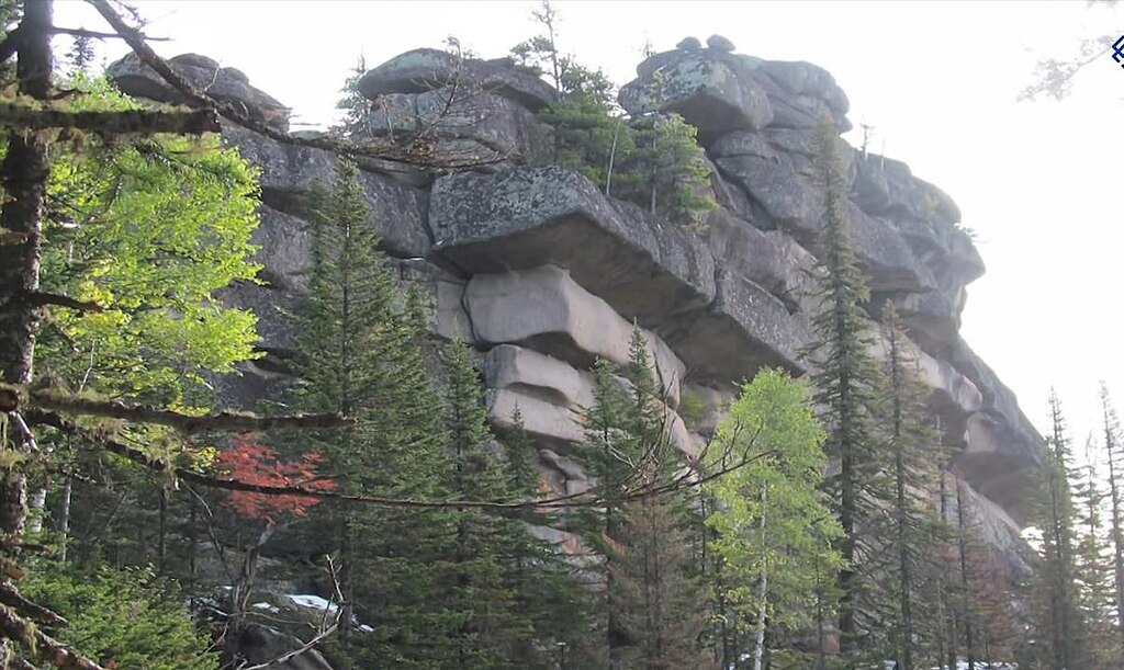
The Gornaya Shoria megaliths, also known as the Surak-Kuilum megalithic complex and by other names, form the ridgecrests and summit of Mount Kuylyum (Kuilum, Kulyum)(Russian: Горна Куйлюм), 1,203 m (3,947 ft) in elevation. The base of this mountain is located 8 km away from the village of Orton (Russian: Ортон). Mount Kuylyum is part of the Kulyum-Surak granite massif in the Shoria Mountains. The ridgecrests and summits of this massif ranges in elevation between 700 and 1,203 m (2,297 and 3,947 ft).
Fringe articles have claimed these rock formations are gigantic prehistoric man-made blocks, or megaliths. Geologic mapping of ridgecrests and summit of Mount Kuylyum by geologists, which was conducted in the late 1990s, identified these rock formations as denudated prepared ridges (Russian: Денудационные отпрепарированные гребни и гряды), which are ridges created by the natural and differential erosion of local bedrock.
Theories on formation
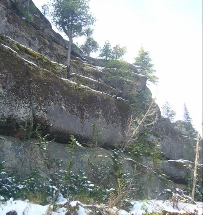
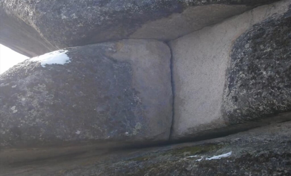
Russian popular articles have reported that scientists have proposed the rock formation to be the result of geological processes associated with the intense weathering of the rock composing Mount Shoriya. Both tectonic forces acting on deeply buried bedrock and pressure release that occurs within near surface bedrock as it is uplifted and eroded commonly form rectangular, block-like, rock formations that consist of jointed rock. Tectonic forces acting on deeply buried massive bedrock, such as granite, and pressure release as this bedrock is uncovered by erosion, can create sets of joints which are known as orthogonal joint sets, that intersect at nearly 90 degrees. Orthogonal joint sets quite often result in the formation of rock formations that are comparable in size and shape to the blocks shown in pictures of the alleged megaliths.
It is quite common for spheroidal weathering, a form of chemical weathering, to occur as groundwater circulates through orthogonal joint sets in the near-surface. This process results in the alteration and disintegration of bedrock adjacent to the joints. The preferential removal of weathered bedrock by erosion often creates bedrock blocks, which are called corestones. These bedrock blocks commonly have rounded corners and are separated from each other by cracks of variable size. Such corestones form both hills and mountains composed of exposed and rectangular blocks of jointed bedrock that are comparable to the rock formations found in the Mountain Shoriya. These hills and mountains are known as either tors or koppies. From Wikipedia.
Further information and references:
Wikipedia: en.wikipedia.org/wiki/Gornaya_Shoria_megaliths
Directions:
Gornaya Shoria is located in the Kemerovo Oblast, Russia in a remote area. The closest town is Orton. A local guide is recommended as well as consultation with your host country's consulate or embassy concerning any travel to Russia at this time.
You may be viewing yesterday's version of this page. To see the most up to date information please register for a free account.


Do not use the above information on other web sites or publications without permission of the contributor.
Click here to see more info for this site
Nearby sites
Click here to view sites on an interactive map of the areaKey: Red: member's photo, Blue: 3rd party photo, Yellow: other image, Green: no photo - please go there and take one, Grey: site destroyed
Download sites to:
KML (Google Earth)
GPX (GPS waypoints)
CSV (Garmin/Navman)
CSV (Excel)
To unlock full downloads you need to sign up as a Contributory Member. Otherwise downloads are limited to 50 sites.
Turn off the page maps and other distractions
Nearby sites listing. In the following links * = Image available
140.5km NNE 24° Paleolithic settlement Small Syya* Ancient Village or Settlement
157.2km NE 35° Tuim Cromlech* Stone Circle
163.5km ENE 63° Great Salbyk Kurgan* Pyramid / Mastaba
178.8km NNE 26° Complex Sunduki* Natural Stone / Erratic / Other Natural Feature
198.3km ENE 74° Museum Kyzlasov L.R.* Museum
224.0km SW 233° Mayma VI Barrow Cemetery
227.1km SW 232° Anokhin Museum* Museum
229.1km SW 230° Oldest settlement Ulalinka* Ancient Village or Settlement
298.6km SW 224° Tavdinsky Caves Cave or Rock Shelter
320.3km ESE 123° Ancient sanctuary Chaa-Holl* Rock Cut Tomb
324.5km SW 215° Tuekta kurgan* Artificial Mound
334.2km SW 233° Denisova* Cave or Rock Shelter
335.3km SW 235° Karama - Paleolithic settlement* Ancient Village or Settlement
336.7km SSW 201° Chuya Deer Stone* Standing Stone (Menhir)
338.8km SSW 201° Kalbak-Tash* Rock Art
340.4km SSW 204° Inya Deer Stones* Standing Stone (Menhir)
371.5km ESE 108° Arzhan Scythian royal necropolis* Barrow Cemetery
384.5km S 180° Tarhatinsky megalithic site* Standing Stones
409.9km NE 40° Settlement Afontova Mountain* Ancient Village or Settlement
413.7km NE 41° Krasnoyarsk Regional Museum of Local Lore* Museum
433.5km ESE 111° Republican Museum of Kyzyl* Museum
460.6km SSW 200° Berel Burial Mounds* Barrow Cemetery
461.4km S 183° Shiveet Mountain Petroglyphs* Rock Art
462.8km S 182° Mt. Shiveet altar stone with petroglyphs* Rock Art
512.6km S 182° Lake Hoton Petroglyphs* Rock Art
View more nearby sites and additional images


 We would like to know more about this location. Please feel free to add a brief description and any relevant information in your own language.
 Wir möchten mehr über diese Stätte erfahren. Bitte zögern Sie nicht, eine kurze Beschreibung und relevante Informationen in Deutsch hinzuzufügen.
 Nous aimerions en savoir encore un peu sur les lieux. S'il vous plaît n'hesitez pas à ajouter une courte description et tous les renseignements pertinents dans votre propre langue.
 Quisieramos informarnos un poco más de las lugares. No dude en añadir una breve descripción y otros datos relevantes en su propio idioma.