


<< Our Photo Pages >> Bully Hill (Tealby) - Round Barrow(s) in England in Lincolnshire
Submitted by Catrinm on Monday, 09 October 2017 Page Views: 2642
Neolithic and Bronze AgeSite Name: Bully Hill (Tealby) Alternative Name: Tealby round barrowCountry: England
NOTE: This site is 4.023 km away from the location you searched for.
County: Lincolnshire Type: Round Barrow(s)
Nearest Village: Tealby
Map Ref: TF17279227
Latitude: 53.414213N Longitude: 0.237086W
Condition:
| 5 | Perfect |
| 4 | Almost Perfect |
| 3 | Reasonable but with some damage |
| 2 | Ruined but still recognisable as an ancient site |
| 1 | Pretty much destroyed, possibly visible as crop marks |
| 0 | No data. |
| -1 | Completely destroyed |
| 5 | Superb |
| 4 | Good |
| 3 | Ordinary |
| 2 | Not Good |
| 1 | Awful |
| 0 | No data. |
| 5 | Can be driven to, probably with disabled access |
| 4 | Short walk on a footpath |
| 3 | Requiring a bit more of a walk |
| 2 | A long walk |
| 1 | In the middle of nowhere, a nightmare to find |
| 0 | No data. |
| 5 | co-ordinates taken by GPS or official recorded co-ordinates |
| 4 | co-ordinates scaled from a detailed map |
| 3 | co-ordinates scaled from a bad map |
| 2 | co-ordinates of the nearest village |
| 1 | co-ordinates of the nearest town |
| 0 | no data |
Internal Links:
External Links:
I have visited· I would like to visit
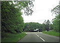
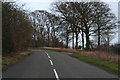
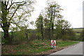
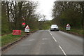
oldman visited on 25th Oct 2018 Easily seen from the road
 (PID:172247)")
This is a Bronze Age round barrow marked as Tumulus on OS map, on B1225 North East of Tealby, along which there are several barrows but this one not previously indexed on MP. Near farm labelled as Bully Hill, and site known as Bully Hill * Not to be confused with Bully Hills the seven-long row of barrows at Tathwell.
Covered by vegetation so hard to photograph well, but a good recognisable round shape (person shows height in uploaded photo) and immediately visible from road.
For more information see Pastscape Monument No. 351854 which adds that the barrow is approximately 20 metres across, is described as a 'fine round barrow, and "yielded a skeleton, 4 skulls and other human, and animal bones, charcoal and ashes, and unbaked "British" and Roman pottery fragments, when opened by Trollope."
You may be viewing yesterday's version of this page. To see the most up to date information please register for a free account.
 (PID:187537)")
Do not use the above information on other web sites or publications without permission of the contributor.
Nearby Images from Geograph Britain and Ireland:
©2012(licence)
©2014(licence)
©2013(licence)
©2013(licence)

©2006(licence)
The above images may not be of the site on this page, they are loaded from Geograph.
Please Submit an Image of this site or go out and take one for us!
Click here to see more info for this site
Nearby sites
Key: Red: member's photo, Blue: 3rd party photo, Yellow: other image, Green: no photo - please go there and take one, Grey: site destroyed
Download sites to:
KML (Google Earth)
GPX (GPS waypoints)
CSV (Garmin/Navman)
CSV (Excel)
To unlock full downloads you need to sign up as a Contributory Member. Otherwise downloads are limited to 50 sites.
Turn off the page maps and other distractions
Nearby sites listing. In the following links * = Image available
1.5km NNE 15° Lud well (Stainton-Le-Vale)* Holy Well or Sacred Spring (TF17629376)
3.4km W 273° Walesby All Saints church carvings* Sculptured Stone (TF1382892388)
5.2km NE 56° Hoe Hill Long Barrow* Long Barrow (TF215953)
5.3km NE 45° Ash Hill Long Barrow* Long Barrow (TF20889612)
5.7km NW 318° Hills Brough* Long Barrow (TF1337396415)
8.0km SE 133° Grims Mound* Round Barrow(s) (TF23258693)
8.3km SSE 153° Burgh on Bain* Long Barrow (TF21298497)
9.0km NNE 12° Ash Holt Long Barrow* Long Barrow (TA1898001112)
9.2km SSE 154° Burgh Top* Round Barrow(s) (TF21458406)
10.5km NNW 330° Syfer Spring Holy Well or Sacred Spring (TA117012)
10.5km NNW 330° Holy Well (Caistor) Holy Well or Sacred Spring (TA1172501229)
11.9km SW 223° Wickenby Ancient Village or Settlement (TF0928883432)
12.1km NNW 337° Fonaby Stone* Standing Stones (TA123033)
15.6km NW 308° Maiden Well (Maidenwell) Holy Well or Sacred Spring (TA047015)
15.7km NW 307° The Maiden-Well Holy Well or Sacred Spring (TA045015)
15.7km ENE 59° Tetney Log Coffin Burial* Round Barrow(s) (TA3064300616)
15.7km SE 131° Tathwell Long Barrow* Long Barrow (TF29458225)
16.0km NNW 331° Holy Wells (Barnetby le Wold) Holy Well or Sacred Spring (TA091061)
16.6km ESE 111° Julian Bower Turf Maze (Louth) Maze or Labyrinth (TF32938677)
17.1km NNW 348° Brocklesby Park (Great Limber) Cairn (TA1332708902)
17.5km N 10° Ragged Spring (Healing) Holy Well or Sacred Spring (TA199096)
18.2km NNE 26° Toot Hill Round Barrow* Round Barrow(s) (TA24800888)
18.3km NNE 15° Toot Hill Bowl Barrow Round Barrow(s) (TA21601011)
18.5km ESE 123° Bully Hills* Barrow Cemetery (TF33128272)
19.3km W 264° Newell's Well (Glentham) Holy Well or Sacred Spring (SK981897)
View more nearby sites and additional images


 We would like to know more about this location. Please feel free to add a brief description and any relevant information in your own language.
 Wir möchten mehr über diese Stätte erfahren. Bitte zögern Sie nicht, eine kurze Beschreibung und relevante Informationen in Deutsch hinzuzufügen.
 Nous aimerions en savoir encore un peu sur les lieux. S'il vous plaît n'hesitez pas à ajouter une courte description et tous les renseignements pertinents dans votre propre langue.
 Quisieramos informarnos un poco más de las lugares. No dude en añadir una breve descripción y otros datos relevantes en su propio idioma.