 with our Megalithic Portal iPhone app")


<< Text Pages >> Castle Hill (Nottinghamshire) - Hillfort in England in Nottinghamshire
Submitted by vicky on Thursday, 25 March 2004 Page Views: 9187
Iron Age and Later PrehistorySite Name: Castle Hill (Nottinghamshire)Country: England
NOTE: This site is 3.2 km away from the location you searched for.
County: Nottinghamshire Type: Hillfort
Nearest Town: Retford Nearest Village: Welham
Map Ref: SK741806 Landranger Map Number: 120
Latitude: 53.317155N Longitude: 0.889155W
Condition:
| 5 | Perfect |
| 4 | Almost Perfect |
| 3 | Reasonable but with some damage |
| 2 | Ruined but still recognisable as an ancient site |
| 1 | Pretty much destroyed, possibly visible as crop marks |
| 0 | No data. |
| -1 | Completely destroyed |
| 5 | Superb |
| 4 | Good |
| 3 | Ordinary |
| 2 | Not Good |
| 1 | Awful |
| 0 | No data. |
| 5 | Can be driven to, probably with disabled access |
| 4 | Short walk on a footpath |
| 3 | Requiring a bit more of a walk |
| 2 | A long walk |
| 1 | In the middle of nowhere, a nightmare to find |
| 0 | No data. |
| 5 | co-ordinates taken by GPS or official recorded co-ordinates |
| 4 | co-ordinates scaled from a detailed map |
| 3 | co-ordinates scaled from a bad map |
| 2 | co-ordinates of the nearest village |
| 1 | co-ordinates of the nearest town |
| 0 | no data |
Internal Links:
External Links:
Hillfort in Nottinghamshire
Have you visited this site? Please add a comment below.
You may be viewing yesterday's version of this page. To see the most up to date information please register for a free account.
 (PID:289313)")
Do not use the above information on other web sites or publications without permission of the contributor.
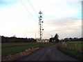
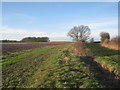
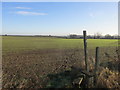
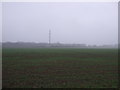
Nearby Images from Geograph Britain and Ireland:
©2005(licence)
©2013(licence)
©2016(licence)

©2010(licence)
©2011(licence)
The above images may not be of the site on this page, they are loaded from Geograph.
Please Submit an Image of this site or go out and take one for us!
Click here to see more info for this site
Nearby sites
Key: Red: member's photo, Blue: 3rd party photo, Yellow: other image, Green: no photo - please go there and take one, Grey: site destroyed
Download sites to:
KML (Google Earth)
GPX (GPS waypoints)
CSV (Garmin/Navman)
CSV (Excel)
To unlock full downloads you need to sign up as a Contributory Member. Otherwise downloads are limited to 50 sites.
Turn off the page maps and other distractions
Nearby sites listing. In the following links * = Image available
2.7km NW 326° St John's Well (Welham) Holy Well or Sacred Spring (SK72558280)
2.7km SSE 165° Lady well (Headon)* Holy Well or Sacred Spring (SK7483877954)
7.5km SSE 162° Kingshaugh* Hillfort (SK765735)
9.2km S 178° Holy well (Tuxford) Holy Well or Sacred Spring (SK745714)
10.7km S 187° Holy well ( Tuxford ) Holy Well or Sacred Spring (SK7370)
14.0km S 188° The Duck's Mouth* Holy Well or Sacred Spring (SK724667)
15.4km SW 232° Budby Barrow* Round Barrow(s) (SK62187087)
15.8km ESE 105° South Ingleby Tumulus Misc. Earthwork (SK8946576860)
17.2km WNW 282° St Mary's Well (Wallingwells) Holy Well or Sacred Spring (SK572840)
18.5km SSE 154° Besthorpe Ancient Village or Settlement (SK825641)
18.7km SW 230° Thynghowe* Artificial Mound (SK59936834)
21.2km W 268° Thorpe Common Shelter Cave or Rock Shelter (SK529794)
21.3km E 97° St Pancras Well* Holy Well or Sacred Spring (SK954785)
21.4km WSW 254° Mother Grundy’s Parlour Cave or Rock Shelter (SK536743)
21.5km W 279° Dead Man's Cave/Anston Stones Wood* Cave or Rock Shelter (SK5276283530)
21.5km WSW 254° Creswell Crags* Cave or Rock Shelter (SK535743)
21.6km WSW 254° Robin Hood’s Cave* Cave or Rock Shelter (SK534742)
21.7km WSW 253° Ossiferous Fissure Cave or Rock Shelter (SK533741)
21.7km WSW 253° Pin Hole Cave Cave or Rock Shelter (SK533741)
21.7km ENE 62° St. Helen's Well (Hemswell)* Holy Well or Sacred Spring (SK932911)
21.8km WSW 254° Church Hole* Cave or Rock Shelter (SK532741)
21.9km NNE 13° Holy Well (Lower Burnham)* Holy Well or Sacred Spring (SE78520205)
23.0km W 260° Ash Tree Cave* Cave or Rock Shelter (SK5148576144)
23.4km ENE 67° Aisthorpe springs Holy Well or Sacred Spring (SK956899)
23.6km WSW 258° Markland Grips Hillfort* Hillfort (SK511752)
View more nearby sites and additional images


 We would like to know more about this location. Please feel free to add a brief description and any relevant information in your own language.
 Wir möchten mehr über diese Stätte erfahren. Bitte zögern Sie nicht, eine kurze Beschreibung und relevante Informationen in Deutsch hinzuzufügen.
 Nous aimerions en savoir encore un peu sur les lieux. S'il vous plaît n'hesitez pas à ajouter une courte description et tous les renseignements pertinents dans votre propre langue.
 Quisieramos informarnos un poco más de las lugares. No dude en añadir una breve descripción y otros datos relevantes en su propio idioma.