


<< Our Photo Pages >> St Agnes Well, Longham - Holy Well or Sacred Spring in England in Norfolk
Submitted by hamstermoon on Sunday, 13 February 2011 Page Views: 7944
Springs and Holy WellsSite Name: St Agnes Well, LonghamCountry: England
NOTE: This site is 2.892 km away from the location you searched for.
County: Norfolk Type: Holy Well or Sacred Spring
Nearest Town: Gressenhall Nearest Village: East Dereham
Map Ref: TF94831586
Latitude: 52.705333N Longitude: 0.882335E
Condition:
| 5 | Perfect |
| 4 | Almost Perfect |
| 3 | Reasonable but with some damage |
| 2 | Ruined but still recognisable as an ancient site |
| 1 | Pretty much destroyed, possibly visible as crop marks |
| 0 | No data. |
| -1 | Completely destroyed |
| 5 | Superb |
| 4 | Good |
| 3 | Ordinary |
| 2 | Not Good |
| 1 | Awful |
| 0 | No data. |
| 5 | Can be driven to, probably with disabled access |
| 4 | Short walk on a footpath |
| 3 | Requiring a bit more of a walk |
| 2 | A long walk |
| 1 | In the middle of nowhere, a nightmare to find |
| 0 | No data. |
| 5 | co-ordinates taken by GPS or official recorded co-ordinates |
| 4 | co-ordinates scaled from a detailed map |
| 3 | co-ordinates scaled from a bad map |
| 2 | co-ordinates of the nearest village |
| 1 | co-ordinates of the nearest town |
| 0 | no data |
Internal Links:
External Links:
I have visited· I would like to visit
rocket couldn't find on 11th May 2021 This site is no longer accessible to the public
")
The Norfolk Heritage Explorer says that it "formerly had [a] brick well head, now replaced by clay bank and pond".
When we visited we found the remains of an iron gate covering a concrete well head. This did have bricks so it could have been the original one reused. Some of the water from this was being piped off in a rather Heath Robinson manner but another spring-point, directly below the concrete construction, was also pouring clear water directly out of the chalky ground. This created a pool which ran off into a streamlet, which then fed into the small brook, flowing past which is the parish boundary between Gressenhall and Longham.
Behind the well head is a body of water which although has been artificially expanded is in fact is a 'blow well'. This has lots of small springs coming up into its base and each lets off some big bubbles of carbon dioxide every so often. From reading around on the subject this pool, which seems to be part of a fairly large spring field including the spring with the well head and the one below it, could actually be the real St Agnes Well.
You may be viewing yesterday's version of this page. To see the most up to date information please register for a free account.
")
")
")
")
Do not use the above information on other web sites or publications without permission of the contributor.
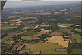
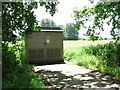
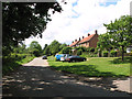
Nearby Images from Geograph Britain and Ireland:
©2018(licence)
©2014(licence)
©2014(licence)
©2014(licence)
©2017(licence)
The above images may not be of the site on this page, they are loaded from Geograph.
Please Submit an Image of this site or go out and take one for us!
Click here to see more info for this site
Nearby sites
Key: Red: member's photo, Blue: 3rd party photo, Yellow: other image, Green: no photo - please go there and take one, Grey: site destroyed
Download sites to:
KML (Google Earth)
GPX (GPS waypoints)
CSV (Garmin/Navman)
CSV (Excel)
To unlock full downloads you need to sign up as a Contributory Member. Otherwise downloads are limited to 50 sites.
Turn off the page maps and other distractions
Nearby sites listing. In the following links * = Image available
4.6km SE 126° St Withburga's Well* Holy Well or Sacred Spring (TF9865213305)
7.0km NE 37° North Elmham Chapel* Ancient Temple (TF9888121640)
8.0km NNW 341° Whissonsett wheel-head cross* Ancient Cross (TF91922334)
8.4km WNW 284° Great Wood Round Barrow(s) (TF8659017560)
9.5km WNW 299° Litcham Heath* Round Barrow(s) (TF863202)
10.3km WNW 295° Weasenham Plantation* Barrow Cemetery (TF853198)
12.0km SSW 209° Devil's Dyke (Norfolk)* Misc. Earthwork (TF8934705200)
14.7km WSW 245° Swaffham Settlement Stone* Natural Stone / Erratic / Other Natural Feature (TF8181009038)
15.1km NW 313° Fox Covert Bowl Barrows (West Rudham)* Round Barrow(s) (TF8339525782)
15.5km ENE 65° Pettywell* Holy Well or Sacred Spring (TG086230)
16.0km NW 307° West Rudham* Round Barrow(s) (TF81652495)
16.6km E 85° The Warren Barrow Round Barrow(s) (TG11371798)
16.7km NW 306° West Rudham South* Long Barrow (TF8094125116)
16.7km NW 307° West Rudham North* Long Barrow (TF8104325337)
16.8km NW 307° West Rudham Cursus Cursus (TF810254)
17.6km SSW 200° Merton Stone* Natural Stone / Erratic / Other Natural Feature (TL895991)
18.0km E 85° Alderford Common Barrow Round Barrow(s) (TG12751828)
18.4km NNW 326° Wicken Covert Barrow Round Barrow(s) (TF83973081)
18.6km SW 234° Cockley Cley Iceni Village* Museum (TF802043)
18.6km NW 325° Coxford Heath Barrow Round Barrow(s) (TF83493070)
19.1km WSW 253° The Cowell Stone Natural Stone / Erratic / Other Natural Feature (TF7673509558)
19.2km SW 235° St Mary’s Chapel, Cockley Cley* Ancient Temple (TF79550411)
19.3km SSW 209° Little Cressingham Barrow Cemetery* Barrow Cemetery (TL861986)
19.8km W 264° Narborough Camp Hillfort Hillfort (TF75141308)
20.8km WSW 252° Hangour Hill Round Barrow(s) (TF7520008700)
View more nearby sites and additional images


 We would like to know more about this location. Please feel free to add a brief description and any relevant information in your own language.
 Wir möchten mehr über diese Stätte erfahren. Bitte zögern Sie nicht, eine kurze Beschreibung und relevante Informationen in Deutsch hinzuzufügen.
 Nous aimerions en savoir encore un peu sur les lieux. S'il vous plaît n'hesitez pas à ajouter une courte description et tous les renseignements pertinents dans votre propre langue.
 Quisieramos informarnos un poco más de las lugares. No dude en añadir una breve descripción y otros datos relevantes en su propio idioma.