<< Our Photo Pages >> Castle Farm Hillfort - Hillfort in England in Shropshire
Submitted by TheWhiteRider on Monday, 10 July 2006 Page Views: 7046
Iron Age and Later PrehistorySite Name: Castle Farm HillfortCountry: England
NOTE: This site is 3.037 km away from the location you searched for.
County: Shropshire Type: Hillfort
Nearest Town: Telford Nearest Village: Priorslee
Map Ref: SJ724095
Latitude: 52.682486N Longitude: 2.409699W
Condition:
| 5 | Perfect |
| 4 | Almost Perfect |
| 3 | Reasonable but with some damage |
| 2 | Ruined but still recognisable as an ancient site |
| 1 | Pretty much destroyed, possibly visible as crop marks |
| 0 | No data. |
| -1 | Completely destroyed |
| 5 | Superb |
| 4 | Good |
| 3 | Ordinary |
| 2 | Not Good |
| 1 | Awful |
| 0 | No data. |
| 5 | Can be driven to, probably with disabled access |
| 4 | Short walk on a footpath |
| 3 | Requiring a bit more of a walk |
| 2 | A long walk |
| 1 | In the middle of nowhere, a nightmare to find |
| 0 | No data. |
| 5 | co-ordinates taken by GPS or official recorded co-ordinates |
| 4 | co-ordinates scaled from a detailed map |
| 3 | co-ordinates scaled from a bad map |
| 2 | co-ordinates of the nearest village |
| 1 | co-ordinates of the nearest town |
| 0 | no data |
Internal Links:
External Links:
I have visited· I would like to visit
TheWhiteRider has visited here
")
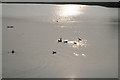
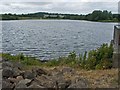
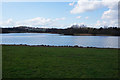
An Iron Age, double-ditched enclosure or fort of 2.5 acres visible as a crop mark until 1980 when the site was inundated during the construction of a reservoir.
Excavations of the site were carried out prior to its destruction and suggested that initially the site was abandoned before completion only to be re-fortified with a second ditch during the Roman period. A very limited amount of dating evidence was found during the excavation suggesting that the site was only occupied briefly, if at all. Watling Street and the Roman fort of Uxacona, on Red Hill, are nearby.
The site can be viewed from a layby just off the Castle Farm roundabout, but nothing remains to be seen.
You may be viewing yesterday's version of this page. To see the most up to date information please register for a free account.
Do not use the above information on other web sites or publications without permission of the contributor.
Nearby Images from Geograph Britain and Ireland:
©2007(licence)
©2008(licence)
©2016(licence)

©2020(licence)
©2010(licence)
The above images may not be of the site on this page, they are loaded from Geograph.
Please Submit an Image of this site or go out and take one for us!
Click here to see more info for this site
Nearby sites
Key: Red: member's photo, Blue: 3rd party photo, Yellow: other image, Green: no photo - please go there and take one, Grey: site destroyed
Download sites to:
KML (Google Earth)
GPX (GPS waypoints)
CSV (Garmin/Navman)
CSV (Excel)
To unlock full downloads you need to sign up as a Contributory Member. Otherwise downloads are limited to 50 sites.
Turn off the page maps and other distractions
Nearby sites listing. In the following links * = Image available
7.3km WNW 292° St Margarets Well (Telford) Holy Well or Sacred Spring (SJ656123)
7.6km NNE 25° Pave Lane Hillfort* Misc. Earthwork (SJ756164)
8.5km W 262° Willow Moor Barrow Cemetary* Barrow Cemetery (SJ640083)
8.8km ENE 67° Blymhill Marsh Holy Well or Sacred Spring (SJ80511290)
9.3km NNW 332° Wall Camp* Hillfort (SJ681178)
9.4km W 262° The Wrekin* Hillfort (SJ630083)
9.8km ESE 120° St Cuthbert's Well (Shropshire)* Holy Well or Sacred Spring (SJ8084404565)
10.1km NW 318° Kynnersley Burnt Mounds Artificial Mound (SJ657171)
13.1km ENE 57° St Edith's Well (Church Eaton)* Holy Well or Sacred Spring (SJ83521653)
13.9km SW 226° Holy Trinity (Much Wenlock)* Ancient Cross (SO623999)
14.0km SW 226° St Owens Well* Holy Well or Sacred Spring (SO622999)
14.1km SSE 166° St Peter's Well (Worfield)* Holy Well or Sacred Spring (SO758958)
14.3km SSE 154° Chesterton Walls* Hillfort (SO78679668)
14.6km SW 222° St Milburgas Well (Much Wenlock)* Holy Well or Sacred Spring (SO625988)
15.3km ESE 108° The Leper Well* Holy Well or Sacred Spring (SJ87030478)
15.7km NW 318° Ellerdine Heath* Standing Stone (Menhir) (SJ6191821168)
16.5km SSW 199° Morville Cross* Ancient Cross (SO6695893875)
17.5km WNW 286° Upton Magna* Timber Circle (SJ555144)
17.5km WSW 253° Cove Coppice* Barrow Cemetery (SJ555046)
17.7km ENE 62° Webb Stone* Standing Stone (Menhir) (SJ881177)
17.8km WSW 250° Stevenshill* Hillfort (SJ556036)
19.0km SSE 168° Burf Castle Hillfort (SO76279085)
19.0km WNW 291° Ebury Hillfort* Hillfort (SJ546164)
19.1km WNW 283° Haughmond Hill Camp* Hillfort (SJ537138)
19.5km NE 37° St Anne's Well (nr Lawnhead) Holy Well or Sacred Spring (SJ84262498)
View more nearby sites and additional images


 We would like to know more about this location. Please feel free to add a brief description and any relevant information in your own language.
 Wir möchten mehr über diese Stätte erfahren. Bitte zögern Sie nicht, eine kurze Beschreibung und relevante Informationen in Deutsch hinzuzufügen.
 Nous aimerions en savoir encore un peu sur les lieux. S'il vous plaît n'hesitez pas à ajouter une courte description et tous les renseignements pertinents dans votre propre langue.
 Quisieramos informarnos un poco más de las lugares. No dude en añadir una breve descripción y otros datos relevantes en su propio idioma.