 with our Megalithic Portal iPhone app")

, Aubrey Burl")
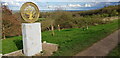
<< Image Pages >> Oldbury Camp (Warwickshire) - Hillfort in England in Warwickshire
Submitted by vicky on Monday, 26 August 2002 Page Views: 13798
Iron Age and Later PrehistorySite Name: Oldbury Camp (Warwickshire)Country: England
NOTE: This site is 2.08 km away from the location you searched for.
County: Warwickshire Type: Hillfort
Map Ref: SP3140094700 Landranger Map Number: 140
Latitude: 52.549247N Longitude: 1.538366W
Condition:
| 5 | Perfect |
| 4 | Almost Perfect |
| 3 | Reasonable but with some damage |
| 2 | Ruined but still recognisable as an ancient site |
| 1 | Pretty much destroyed, possibly visible as crop marks |
| 0 | No data. |
| -1 | Completely destroyed |
| 5 | Superb |
| 4 | Good |
| 3 | Ordinary |
| 2 | Not Good |
| 1 | Awful |
| 0 | No data. |
| 5 | Can be driven to, probably with disabled access |
| 4 | Short walk on a footpath |
| 3 | Requiring a bit more of a walk |
| 2 | A long walk |
| 1 | In the middle of nowhere, a nightmare to find |
| 0 | No data. |
| 5 | co-ordinates taken by GPS or official recorded co-ordinates |
| 4 | co-ordinates scaled from a detailed map |
| 3 | co-ordinates scaled from a bad map |
| 2 | co-ordinates of the nearest village |
| 1 | co-ordinates of the nearest town |
| 0 | no data |
Be the first person to rate this site - see the 'Contribute!' box in the right hand menu.
Internal Links:
External Links:
I have visited· I would like to visit
Hodur saw from a distance on 18th Jun 2018 - their rating: Cond: 2 Amb: 2 Can't reach. It is fenced off on private land. It's also been built on.
 (PID:303856)")
Have you visited this site? Please add a comment below.
You may be viewing yesterday's version of this page. To see the most up to date information please register for a free account.
Do not use the above information on other web sites or publications without permission of the contributor.
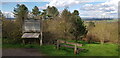
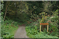
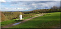
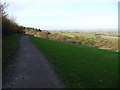
Nearby Images from Geograph Britain and Ireland:
©2024(licence)
©2014(licence)
©2024(licence)
©2009(licence)
©2024(licence)
The above images may not be of the site on this page, they are loaded from Geograph.
Please Submit an Image of this site or go out and take one for us!
Click here to see more info for this site
Nearby sites
Key: Red: member's photo, Blue: 3rd party photo, Yellow: other image, Green: no photo - please go there and take one, Grey: site destroyed
Download sites to:
KML (Google Earth)
GPX (GPS waypoints)
CSV (Garmin/Navman)
CSV (Excel)
To unlock full downloads you need to sign up as a Contributory Member. Otherwise downloads are limited to 50 sites.
Turn off the page maps and other distractions
Nearby sites listing. In the following links * = Image available
1.4km SSW 211° Ansley Common Round Barrow(s) (SP307935)
4.9km ENE 59° Fenny Drayton Barrow* Round Barrow(s) (SP356973)
9.7km S 186° Burrow Hill Camp (Warwickshire)* Hillfort (SP304850)
10.3km ENE 59° King Richard's Well* Holy Well or Sacred Spring (SK402000)
12.7km WSW 248° Beggars Well* Holy Well or Sacred Spring (SP1962989822)
13.0km E 82° Barwell Stone* Standing Stone (Menhir) (SP4429096665)
13.8km WSW 243° Coleshill Bridge* Ancient Village or Settlement (SP191884)
14.0km NW 311° St Ruffin's Well (Tamworth)* Holy Well or Sacred Spring (SK207038)
15.1km S 177° St. Catherine's Well (Coventry) Holy Well or Sacred Spring (SP323796)
16.2km ESE 110° Wigston Parva Henge (SP467893)
17.1km SSW 204° Berkswell* Holy Well or Sacred Spring (SP244791)
17.1km E 80° Earl Shilton Bypass Round Barrow(s) (SP483978)
17.2km E 90° Stoney Stanton Stone Standing Stone (Menhir) (SP486949)
17.5km WNW 290° St Modwen's Well (Canwell) Holy Well or Sacred Spring (SK14890058)
18.5km ENE 62° Desford Stone Standing Stone (Menhir) (SK478034)
18.9km ESE 110° Claybrooke Magna Standing Stone (Menhir) (SP493885)
19.6km SE 141° Brinklow Tumulus* Artificial Mound (SP43877957)
20.1km NNW 331° Stone in Croxall Churchyard* Marker Stone (SK2140512127)
20.9km W 276° Keeper's Well* Holy Well or Sacred Spring (SP1049296613)
21.2km E 83° Huncote Stone* Standing Stone (Menhir) (SP5246497256)
21.4km ENE 59° Bury Camp (Leicestershire)* Hillfort (SK4980005700)
21.4km W 279° Druid's Well (Sutton Park) Holy Well or Sacred Spring (SP1016297991)
21.7km ENE 74° Wishing Stone* Standing Stone (Menhir) (SK523009)
22.1km W 275° Rowton Well* Holy Well or Sacred Spring (SP0927496487)
22.2km SSE 157° Ryton on Dunsmore Cursus Cursus (SP404744)
View more nearby sites and additional images


 We would like to know more about this location. Please feel free to add a brief description and any relevant information in your own language.
 Wir möchten mehr über diese Stätte erfahren. Bitte zögern Sie nicht, eine kurze Beschreibung und relevante Informationen in Deutsch hinzuzufügen.
 Nous aimerions en savoir encore un peu sur les lieux. S'il vous plaît n'hesitez pas à ajouter une courte description et tous les renseignements pertinents dans votre propre langue.
 Quisieramos informarnos un poco más de las lugares. No dude en añadir una breve descripción y otros datos relevantes en su propio idioma.