

, Aubrey Burl")
<< Text Pages >> Wimblington Cursus - Cursus in England in Cambridgeshire
Submitted by EssexMan on Wednesday, 07 April 2010 Page Views: 6132
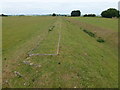
Neolithic and Bronze AgeSite Name: Wimblington CursusCountry: England
NOTE: This site is 4.572 km away from the location you searched for.
County: Cambridgeshire Type: Cursus
Nearest Town: Cambridge Nearest Village: Wimblington
Map Ref: TL44979351 Landranger Map Number: 142
Latitude: 52.520191N Longitude: 0.135198E
Condition:
| 5 | Perfect |
| 4 | Almost Perfect |
| 3 | Reasonable but with some damage |
| 2 | Ruined but still recognisable as an ancient site |
| 1 | Pretty much destroyed, possibly visible as crop marks |
| 0 | No data. |
| -1 | Completely destroyed |
| 5 | Superb |
| 4 | Good |
| 3 | Ordinary |
| 2 | Not Good |
| 1 | Awful |
| 0 | No data. |
| 5 | Can be driven to, probably with disabled access |
| 4 | Short walk on a footpath |
| 3 | Requiring a bit more of a walk |
| 2 | A long walk |
| 1 | In the middle of nowhere, a nightmare to find |
| 0 | No data. |
| 5 | co-ordinates taken by GPS or official recorded co-ordinates |
| 4 | co-ordinates scaled from a detailed map |
| 3 | co-ordinates scaled from a bad map |
| 2 | co-ordinates of the nearest village |
| 1 | co-ordinates of the nearest town |
| 0 | no data |
Internal Links:
External Links:
Cruciform Long Enclosure in Cambridgeshire
Status: Doubtful
NMR No. TL 49 SW 39
Extent: 500mx19m
Terminal type: Square
Associated with Roman site at Stonea Grange
You may be viewing yesterday's version of this page. To see the most up to date information please register for a free account.
Do not use the above information on other web sites or publications without permission of the contributor.
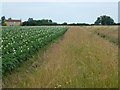
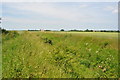
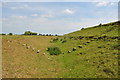
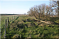
Nearby Images from Geograph Britain and Ireland:
©2013(licence)
©2010(licence)
©2010(licence)
©2008(licence)
©2013(licence)
The above images may not be of the site on this page, they are loaded from Geograph.
Please Submit an Image of this site or go out and take one for us!
Click here to see more info for this site
Nearby sites
Key: Red: member's photo, Blue: 3rd party photo, Yellow: other image, Green: no photo - please go there and take one, Grey: site destroyed
Download sites to:
KML (Google Earth)
GPX (GPS waypoints)
CSV (Garmin/Navman)
CSV (Excel)
To unlock full downloads you need to sign up as a Contributory Member. Otherwise downloads are limited to 50 sites.
Turn off the page maps and other distractions
Nearby sites listing. In the following links * = Image available
537m SSW 200° Stonea Camp* Hillfort (TL448930)
2.9km ESE 106° Manea Cursus Cursus (TL478928)
11.8km SSE 168° Wardy Hill* Hillfort (TL478820)
14.5km S 184° Sutton in the Isle Round Barrow Round Barrow(s) (TL443790)
15.9km SSE 147° Ely Museum* Museum (TL5405980463)
17.1km SSW 192° Haddenham Long Barrow (TL420767)
17.9km NNE 26° Giant's Grave (Marshland) Round Barrow(s) (TF5237009830)
17.9km NNE 26° Tom Hickathrift's Washbowl Round Barrow(s) (TF5237009830)
20.2km SSW 192° Haddenham Enclosure Causewayed Enclosure (TL412736)
21.3km WNW 300° Pode Hole Farm Round Barrow(s) (TF262037)
21.6km WNW 283° Must Farm* Ancient Village or Settlement (TL2370097600)
22.8km WNW 285° Flag Fen Visitors Centre* Museum (TL227989)
23.2km WNW 293° Oliver Cromwell's Hill (Eye) Cairn (TF232018)
23.3km S 188° Belsar's Hill* Hillfort (TL424703)
24.1km ENE 74° St. Margaret's Well (Wereham)* Holy Well or Sacred Spring (TF6801)
25.3km W 280° Fletton Cross* Ancient Cross (TL198971)
25.5km SSW 208° Holywell (Cambridgeshire)* Holy Well or Sacred Spring (TL336707)
25.6km SSE 156° Wicken Fen* Natural Stone / Erratic / Other Natural Feature (TL563705)
26.0km WNW 283° Hedda Stone* Early Christian Sculptured Stone (TL194987)
26.4km NW 313° Crowland Henge* Henge (TF25061086)
26.4km WNW 283° Peterborough Stone* Standing Stone (Menhir) (TL190985)
26.5km WNW 283° Peterborough Museum* Museum (TL189985)
26.6km SSW 208° Low Hill Bowl Barrow, Fen Drayton RSPB Reserve* Round Barrow(s) (TL33336960)
27.3km ESE 117° Undley Ringwork Misc. Earthwork (TL6979081860)
27.5km SSW 208° Fenstanton Cursus Cursus (TL326689)
View more nearby sites and additional images


 We would like to know more about this location. Please feel free to add a brief description and any relevant information in your own language.
 Wir möchten mehr über diese Stätte erfahren. Bitte zögern Sie nicht, eine kurze Beschreibung und relevante Informationen in Deutsch hinzuzufügen.
 Nous aimerions en savoir encore un peu sur les lieux. S'il vous plaît n'hesitez pas à ajouter une courte description et tous les renseignements pertinents dans votre propre langue.
 Quisieramos informarnos un poco más de las lugares. No dude en añadir una breve descripción y otros datos relevantes en su propio idioma.