


<< Other Photo Pages >> Tasburgh Fort - Hillfort in England in Norfolk
Submitted by enkidu41 on Sunday, 14 January 2024 Page Views: 14047
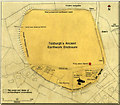
Iron Age and Later PrehistorySite Name: Tasburgh FortCountry: England
NOTE: This site is 7.1 km away from the location you searched for.
County: Norfolk Type: Hillfort
Nearest Town: Long Stratton Nearest Village: Tasburgh
Map Ref: TM201960 Landranger Map Number: 134
Latitude: 52.517409N Longitude: 1.242544E
Condition:
| 5 | Perfect |
| 4 | Almost Perfect |
| 3 | Reasonable but with some damage |
| 2 | Ruined but still recognisable as an ancient site |
| 1 | Pretty much destroyed, possibly visible as crop marks |
| 0 | No data. |
| -1 | Completely destroyed |
| 5 | Superb |
| 4 | Good |
| 3 | Ordinary |
| 2 | Not Good |
| 1 | Awful |
| 0 | No data. |
| 5 | Can be driven to, probably with disabled access |
| 4 | Short walk on a footpath |
| 3 | Requiring a bit more of a walk |
| 2 | A long walk |
| 1 | In the middle of nowhere, a nightmare to find |
| 0 | No data. |
| 5 | co-ordinates taken by GPS or official recorded co-ordinates |
| 4 | co-ordinates scaled from a detailed map |
| 3 | co-ordinates scaled from a bad map |
| 2 | co-ordinates of the nearest village |
| 1 | co-ordinates of the nearest town |
| 0 | no data |
Internal Links:
External Links:
")
Note: Illegal nighthawkers' treasure hunting at Tasburgh earthworks leaves it full of holes. More in the comments
You may be viewing yesterday's version of this page. To see the most up to date information please register for a free account.
")
Do not use the above information on other web sites or publications without permission of the contributor.
coldrum has found this location on Google Street View:
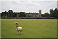
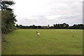
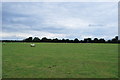
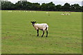
Nearby Images from Geograph Britain and Ireland:
©2010(licence)
©2010(licence)
©2010(licence)
©2010(licence)
©2009(licence)
The above images may not be of the site on this page, they are loaded from Geograph.
Please Submit an Image of this site or go out and take one for us!
Click here to see more info for this site
Nearby sites
Key: Red: member's photo, Blue: 3rd party photo, Yellow: other image, Green: no photo - please go there and take one, Grey: site destroyed
Download sites to:
KML (Google Earth)
GPX (GPS waypoints)
CSV (Garmin/Navman)
CSV (Excel)
To unlock full downloads you need to sign up as a Contributory Member. Otherwise downloads are limited to 50 sites.
Turn off the page maps and other distractions
Nearby sites listing. In the following links * = Image available
7.9km NNE 24° Venta Icenorum* Ancient Village or Settlement (TG230034)
10.1km N 9° Eaton Heath* Barrow Cemetery (TG2128006050)
10.7km NNE 24° Arminghall Henge* Henge (TG240060)
11.0km WNW 302° St Thomas's Well (Wymondham)* Holy Well or Sacred Spring (TG10550146)
12.8km NNE 16° Norwich Castle Museum and Art Gallery* Museum (TG231085)
13.1km ENE 70° The White Heath Mounds Round Barrow(s) (TG3225000920)
13.3km W 265° Bunn's Bank Misc. Earthwork (TM0690094200)
13.6km NNW 342° St Walstan's Well* Holy Well or Sacred Spring (TG15350878)
14.0km SE 136° Flixton Park Quarry Timber Circle (TM303863)
14.8km N 350° Roundwell* Holy Well or Sacred Spring (TG168104)
14.9km ESE 117° Druid's Stone (Bungay)* Natural Stone / Erratic / Other Natural Feature (TM3366689739)
14.9km ESE 112° Broome Heath Enclosure Ancient Village or Settlement (TM34289115)
15.0km ESE 111° Broome Heath Long Barrow Long Barrow (TM344913)
18.1km SSW 210° Diss Museum* Museum (TM1171179980)
18.5km E 97° Stockton Stone* Standing Stone (Menhir) (TM386946)
19.1km S 189° St. Edmund's Cross Ancient Cross (TM1877)
19.2km WSW 247° Vikings Mound* Artificial Mound (TM02678781)
19.5km WSW 255° Gallows Hill Tumulus Round Barrow(s) (TM01419019)
21.1km SW 227° South Lopham Ox-Foot Stone* Natural Stone / Erratic / Other Natural Feature (TM05178098)
21.6km S 178° Kesgrave Bowl Barrow 2 Round Barrow(s) (TM220745)
21.8km N 359° Horsford Woods Barrow Cemetary* Barrow Cemetery (TG18571780)
23.4km NNW 344° Alderford Common Barrow Round Barrow(s) (TG12751828)
23.6km NNW 341° The Warren Barrow Round Barrow(s) (TG11371798)
23.9km WSW 243° East Harling Heath Tumulus* Round Barrow(s) (TL99238425)
24.1km N 8° Fiddler's Hill (Stratton) Long Barrow (TG2225520048)
View more nearby sites and additional images


 We would like to know more about this location. Please feel free to add a brief description and any relevant information in your own language.
 Wir möchten mehr über diese Stätte erfahren. Bitte zögern Sie nicht, eine kurze Beschreibung und relevante Informationen in Deutsch hinzuzufügen.
 Nous aimerions en savoir encore un peu sur les lieux. S'il vous plaît n'hesitez pas à ajouter une courte description et tous les renseignements pertinents dans votre propre langue.
 Quisieramos informarnos un poco más de las lugares. No dude en añadir una breve descripción y otros datos relevantes en su propio idioma.