<< Other Photo Pages >> Labbamolaga Middle - Stone Circle in Ireland (Republic of) in Co. Cork
Submitted by Tom_Bullock on Sunday, 13 October 2002 Page Views: 8230
Neolithic and Bronze AgeSite Name: Labbamolaga MiddleCountry: Ireland (Republic of) County: Co. Cork Type: Stone Circle
Discovery Map Number: D73
Latitude: 52.309814N Longitude: 8.347282W
Condition:
| 5 | Perfect |
| 4 | Almost Perfect |
| 3 | Reasonable but with some damage |
| 2 | Ruined but still recognisable as an ancient site |
| 1 | Pretty much destroyed, possibly visible as crop marks |
| 0 | No data. |
| -1 | Completely destroyed |
| 5 | Superb |
| 4 | Good |
| 3 | Ordinary |
| 2 | Not Good |
| 1 | Awful |
| 0 | No data. |
| 5 | Can be driven to, probably with disabled access |
| 4 | Short walk on a footpath |
| 3 | Requiring a bit more of a walk |
| 2 | A long walk |
| 1 | In the middle of nowhere, a nightmare to find |
| 0 | No data. |
| 5 | co-ordinates taken by GPS or official recorded co-ordinates |
| 4 | co-ordinates scaled from a detailed map |
| 3 | co-ordinates scaled from a bad map |
| 2 | co-ordinates of the nearest village |
| 1 | co-ordinates of the nearest town |
| 0 | no data |
Internal Links:
External Links:
Ancient site in Cork
Have you visited this site? Please add a comment below.
You may be viewing yesterday's version of this page. To see the most up to date information please register for a free account.
Do not use the above information on other web sites or publications without permission of the contributor.
davidmorgan has found this location on Google Street View:
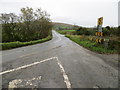
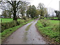
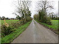
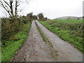
Nearby Images from Geograph Britain and Ireland:
©2017(licence)
©2017(licence)
©2017(licence)
©2017(licence)
The above images may not be of the site on this page, they are loaded from Geograph.
Please Submit an Image of this site or go out and take one for us!
Click here to see more info for this site
Nearby sites
Click here to view sites on an interactive map of the areaKey: Red: member's photo, Blue: 3rd party photo, Yellow: other image, Green: no photo - please go there and take one, Grey: site destroyed
Download sites to:
KML (Google Earth)
GPX (GPS waypoints)
CSV (Garmin/Navman)
CSV (Excel)
To unlock full downloads you need to sign up as a Contributory Member. Otherwise downloads are limited to 50 sites.
Turn off the page maps and other distractions
Nearby sites listing. In the following links * = Image available
8.1km NNW 336° Slievereagh Destroyed Stone Circle Stone Circle
10.3km SSE 149° Knockeenadara Cairn (R816087)
10.9km N 9° Duntryleague* Passage Grave
13.6km S 177° Cuppoge Stone Circle (R770040)
13.7km NNE 27° Corderry wedge tomb* Wedge Tomb
14.9km S 186° Moneen ring barrow* Barrow Cemetery
15.1km S 189° Moneen (Glanworth) cist* Cist
15.1km S 177° Labbacallee* Wedge Tomb
15.2km NNE 31° Shrough passage tomb* Passage Grave
17.1km NE 44° Gortavoher* Rock Art (R883299)
19.2km NNW 336° Gorteennacreeagh* Standing Stone (Menhir)
21.9km NNW 342° Ballynamona Stone Circle
25.5km NNW 332° Lough Gur Wedge tomb* Wedge Tomb (R6452940210)
25.6km NNW 334° Carraig Aille* Stone Fort or Dun (R6530740681)
26.0km NNW 335° Lough Gur O* Stone Circle
26.1km NNW 332° Lough Gur Neolithic settlement* Ancient Village or Settlement (R6419240658)
26.2km NNW 330° The Stone of the Tree - Lough Gur* Standing Stone (Menhir) (R6331540323)
26.3km NNW 330° Grange (Co. Limerick)* Stone Circle (R6326540417)
26.4km NNW 330° Lough Gur C* Stone Circle (R6327840536)
26.4km NNW 333° Bolin Island Crannog* Crannog
26.4km NNW 330° Lough Gur LI032-009 Standing Stone (Menhir) (R6332840616)
26.5km NNW 334° Lough Gur cairn circle* Cairn (R650415)
26.5km NNW 331° The Pillar Stone - Lough Gur* Standing Stone (Menhir) (R6341740725)
26.6km NNW 332° Lough Gur E* Multiple Stone Rows / Avenue (R638411)
27.3km WSW 244° Kilmaclenine* Burial Chamber or Dolmen
View more nearby sites and additional images


 We would like to know more about this location. Please feel free to add a brief description and any relevant information in your own language.
 Wir möchten mehr über diese Stätte erfahren. Bitte zögern Sie nicht, eine kurze Beschreibung und relevante Informationen in Deutsch hinzuzufügen.
 Nous aimerions en savoir encore un peu sur les lieux. S'il vous plaît n'hesitez pas à ajouter une courte description et tous les renseignements pertinents dans votre propre langue.
 Quisieramos informarnos un poco más de las lugares. No dude en añadir una breve descripción y otros datos relevantes en su propio idioma.