


<< Our Photo Pages >> Bircher Common - Misc. Earthwork in England in Herefordshire
Submitted by jfarrar on Monday, 21 September 2009 Page Views: 7761
Multi-periodSite Name: Bircher CommonCountry: England
NOTE: This site is 3.1 km away from the location you searched for.
County: Herefordshire Type: Misc. Earthwork
Nearest Town: Leominster Nearest Village: Bircher
Map Ref: SO454661
Latitude: 52.290307N Longitude: 2.801925W
Condition:
| 5 | Perfect |
| 4 | Almost Perfect |
| 3 | Reasonable but with some damage |
| 2 | Ruined but still recognisable as an ancient site |
| 1 | Pretty much destroyed, possibly visible as crop marks |
| 0 | No data. |
| -1 | Completely destroyed |
| 5 | Superb |
| 4 | Good |
| 3 | Ordinary |
| 2 | Not Good |
| 1 | Awful |
| 0 | No data. |
| 5 | Can be driven to, probably with disabled access |
| 4 | Short walk on a footpath |
| 3 | Requiring a bit more of a walk |
| 2 | A long walk |
| 1 | In the middle of nowhere, a nightmare to find |
| 0 | No data. |
| 5 | co-ordinates taken by GPS or official recorded co-ordinates |
| 4 | co-ordinates scaled from a detailed map |
| 3 | co-ordinates scaled from a bad map |
| 2 | co-ordinates of the nearest village |
| 1 | co-ordinates of the nearest town |
| 0 | no data |
Internal Links:
External Links:
I have visited· I would like to visit
Chrus visited on 1st Jan 2026 - their rating: Cond: 1 Amb: 4 Access: 3
")
You may be viewing yesterday's version of this page. To see the most up to date information please register for a free account.
")
Do not use the above information on other web sites or publications without permission of the contributor.
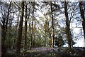
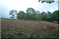
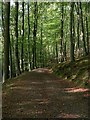
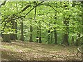
Nearby Images from Geograph Britain and Ireland:
©2014(licence)

©2025(licence)
©2021(licence)
©2008(licence)
©2009(licence)
The above images may not be of the site on this page, they are loaded from Geograph.
Please Submit an Image of this site or go out and take one for us!
Click here to see more info for this site
Nearby sites
Key: Red: member's photo, Blue: 3rd party photo, Yellow: other image, Green: no photo - please go there and take one, Grey: site destroyed
Download sites to:
KML (Google Earth)
GPX (GPS waypoints)
CSV (Garmin/Navman)
CSV (Excel)
To unlock full downloads you need to sign up as a Contributory Member. Otherwise downloads are limited to 50 sites.
Turn off the page maps and other distractions
Nearby sites listing. In the following links * = Image available
1.2km NW 304° Croft Ambrey* Hillfort (SO444668)
3.0km WSW 250° St John the Baptist and St Alkmund (Aymestrey)* Ancient Cross (SO4256065130)
3.0km W 275° Pyon Wood* Hillfort (SO424664)
4.2km SE 130° Luston Holy Well* Holy Well or Sacred Spring (SO4859563407)
4.9km S 188° St Michael's Church (Kingsland)* Ancient Cross (SO4468461269)
7.2km NNE 31° Haye Park Wood Enclosure* Ancient Village or Settlement (SO49167229)
8.2km NW 319° Brandon Camp* Hillfort (SO401724)
10.3km NNE 34° Ludlow Museum* Museum (SO512746)
10.6km NNE 30° Boiling Well (Ludlow)* Holy Well or Sacred Spring (SO508752)
10.9km ESE 122° Bach Camp* Hillfort (SO546602)
10.9km NNW 327° Leintwardine Cursus Cursus (SO39577534)
10.9km WNW 300° Brampton Bryan Lady Well* Holy Well or Sacred Spring (SO36007172)
11.0km NE 35° St Julian's Well (Ludlow)* Holy Well or Sacred Spring (SO5184275060)
11.4km WSW 251° Wapley Camp* Hillfort (SO3457162465)
11.4km NW 309° Coxall Knoll* Hillfort (SO366734)
11.8km SSE 165° Ivington Camp* Hillfort (SO484547)
11.8km NE 49° Caynham Camp* Hillfort (SO545737)
12.2km NNE 19° Bromfield Barrows* Barrow Cemetery (SO495776)
12.3km NNE 16° Robin Hoods Butt 1 (Shropshire) Round Barrow(s) (SO48977787)
12.5km WSW 258° Cat and Fiddle Enclosure Cropmark Ancient Village or Settlement (SO33146362)
12.6km SE 141° Blackwardine Crossroads* Modern Stone Circle etc (SO5318656161)
13.1km W 265° Stapleton Henge Henge (SO32356510)
13.1km SW 221° Tank Cottage Standing Stone (Menhir) (SO36615640)
13.8km SE 140° Risbury Camp* Hillfort (SO542554)
13.9km W 263° St Andrew's Church (Presteigne)* Ancient Cross (SO3156864528)
View more nearby sites and additional images


 We would like to know more about this location. Please feel free to add a brief description and any relevant information in your own language.
 Wir möchten mehr über diese Stätte erfahren. Bitte zögern Sie nicht, eine kurze Beschreibung und relevante Informationen in Deutsch hinzuzufügen.
 Nous aimerions en savoir encore un peu sur les lieux. S'il vous plaît n'hesitez pas à ajouter une courte description et tous les renseignements pertinents dans votre propre langue.
 Quisieramos informarnos un poco más de las lugares. No dude en añadir una breve descripción y otros datos relevantes en su propio idioma.