<< Text Pages >> Grodzisko Miszewo Murowane - Hillfort in Poland in Mazowieckie
Submitted by SolarMegalith on Wednesday, 17 November 2010 Page Views: 2838
Iron Age and Later PrehistorySite Name: Grodzisko Miszewo MurowaneCountry: Poland
NOTE: This site is 21.685 km away from the location you searched for.
Voivodeship: Mazowieckie Type: Hillfort
Nearest Town: Płock
Latitude: 52.485340N Longitude: 19.932300E
Condition:
| 5 | Perfect |
| 4 | Almost Perfect |
| 3 | Reasonable but with some damage |
| 2 | Ruined but still recognisable as an ancient site |
| 1 | Pretty much destroyed, possibly visible as crop marks |
| 0 | No data. |
| -1 | Completely destroyed |
| 5 | Superb |
| 4 | Good |
| 3 | Ordinary |
| 2 | Not Good |
| 1 | Awful |
| 0 | No data. |
| 5 | Can be driven to, probably with disabled access |
| 4 | Short walk on a footpath |
| 3 | Requiring a bit more of a walk |
| 2 | A long walk |
| 1 | In the middle of nowhere, a nightmare to find |
| 0 | No data. |
| 5 | co-ordinates taken by GPS or official recorded co-ordinates |
| 4 | co-ordinates scaled from a detailed map |
| 3 | co-ordinates scaled from a bad map |
| 2 | co-ordinates of the nearest village |
| 1 | co-ordinates of the nearest town |
| 0 | no data |
Internal Links:
External Links:
Hillfort in Mazowieckie
One of the most mysterious hillforts of Masovia (Mazowsze) is located 300m of the church in Miszewo Murowane. It was never excavated and its age remains uncertain. The earthwork is 10m high and the hillfort is surrounded with a 1m deep ditch.
You may be viewing yesterday's version of this page. To see the most up to date information please register for a free account.
Do not use the above information on other web sites or publications without permission of the contributor.
Nearby Images from Flickr
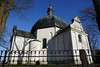
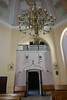
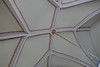
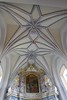
The above images may not be of the site on this page, but were taken nearby. They are loaded from Flickr so please click on them for image credits.
Click here to see more info for this site
Nearby sites
Click here to view sites on an interactive map of the areaKey: Red: member's photo, Blue: 3rd party photo, Yellow: other image, Green: no photo - please go there and take one, Grey: site destroyed
Download sites to:
KML (Google Earth)
GPX (GPS waypoints)
CSV (Garmin/Navman)
CSV (Excel)
To unlock full downloads you need to sign up as a Contributory Member. Otherwise downloads are limited to 50 sites.
Turn off the page maps and other distractions
Nearby sites listing. In the following links * = Image available
14.9km E 98° Grodzisko Wilkanowo Hillfort
15.7km E 101° Grodzisko Orszymowo Hillfort
23.0km N 349° Grodzisko Mokrzk* Hillfort
24.1km NW 321° Grodzisko Nowe Proboszczewice* Hillfort
37.5km SE 133° Kurhan Strzyżew Round Barrow(s)
40.1km SW 234° Mnich Stone Circle* Stone Circle
56.7km SW 225° Kurhan Ględzianówek Round Barrow(s)
57.8km NW 317° Grodzisko Skępe Hillfort
61.1km ENE 57° Grodzisko Sońsk* Hillfort
63.2km NE 46° Grodzisko Farska Góra Hillfort
63.8km N 8° Grodzisko Nidzgóra Hillfort
65.6km NNE 18° Grodzisko Bogurzyn Hillfort
67.9km SW 225° Grodzisko Tum* Hillfort
72.2km W 264° Wietrzychowice Long Barrows* Long Barrow
74.5km W 265° Obałki Long Barrows Long Barrow
78.7km W 262° Wólka Komorowska Long Barrows Long Barrow
79.1km NE 36° Grodzisko Grudusk* Hillfort
79.8km W 271° Sarnowo Long Barrows* Long Barrow
81.3km W 262° Gaj Long Barrow* Long Barrow
85.3km SSW 203° Muzeum Archeologiczne i Etnograficzne w Łodzi* Museum
89.3km NNE 29° Grodzisko Tańsk-Przedbory* Hillfort
89.3km NNE 29° Cmentarzysko Żale* Cist
89.5km NNE 32° Kurhany Dzierzgówek* Barrow Cemetery
95.8km NE 37° Grodzisko Krajewo Wielkie Hillfort
96.7km N 357° Grodzisko Stary Szaniec - Tarczyny Promontory Fort / Cliff Castle
View more nearby sites and additional images


 We would like to know more about this location. Please feel free to add a brief description and any relevant information in your own language.
 Wir möchten mehr über diese Stätte erfahren. Bitte zögern Sie nicht, eine kurze Beschreibung und relevante Informationen in Deutsch hinzuzufügen.
 Nous aimerions en savoir encore un peu sur les lieux. S'il vous plaît n'hesitez pas à ajouter une courte description et tous les renseignements pertinents dans votre propre langue.
 Quisieramos informarnos un poco más de las lugares. No dude en añadir una breve descripción y otros datos relevantes en su propio idioma.