


<< Other Photo Pages >> Lyonshall Bank - Misc. Earthwork in England in Herefordshire
Submitted by Anne T on Friday, 20 February 2026 Page Views: 397
Early MedievalSite Name: Lyonshall Bank Alternative Name: Row Ditch, Lyonshall Earthwork, Offa's Dyke (Lyonshall)Country: England County: Herefordshire Type: Misc. Earthwork
Nearest Town: Kington Nearest Village: Lyonshall
Map Ref: SO3349355016
Latitude: 52.189358N Longitude: 2.974287W
Condition:
| 5 | Perfect |
| 4 | Almost Perfect |
| 3 | Reasonable but with some damage |
| 2 | Ruined but still recognisable as an ancient site |
| 1 | Pretty much destroyed, possibly visible as crop marks |
| 0 | No data. |
| -1 | Completely destroyed |
| 5 | Superb |
| 4 | Good |
| 3 | Ordinary |
| 2 | Not Good |
| 1 | Awful |
| 0 | No data. |
| 5 | Can be driven to, probably with disabled access |
| 4 | Short walk on a footpath |
| 3 | Requiring a bit more of a walk |
| 2 | A long walk |
| 1 | In the middle of nowhere, a nightmare to find |
| 0 | No data. |
| 5 | co-ordinates taken by GPS or official recorded co-ordinates |
| 4 | co-ordinates scaled from a detailed map |
| 3 | co-ordinates scaled from a bad map |
| 2 | co-ordinates of the nearest village |
| 1 | co-ordinates of the nearest town |
| 0 | no data |
Internal Links:
External Links:
")
Just south west of Lyonshall, there are two sections of defensive ditch which appear to be linked to Offa's Dyke. These are scheduled as Historic England List ID 1001735, "Offa's Dyke: section NW of Holme Marsh extending 615yds (560m) to the railway", NGR SO 33493 55016, and Historic England List ID 1001733, "Offa's Dyke: the section 630yds (580m) long W of Lyonshall", NGR SO 32790 55995.
The Offa's Dyke Collaboratory Blog, "Design and Construction, Offa's Dyke, Lyonshall" treats both these sections as one continuous bank (which it used to be, now cut by a minor road).
The blog describes the feature as a substantial early medieval linear earthwork running northwest to southeast near the village of Lyonshall in Herefordshire. The bank is significant enough to "loom over the car as you drive through" the road cutting, distinguishing it from the less impressive Herefordshire sections that resemble "glorified hedgerows."
The earthwork's origins remain uncertain. Historical references include "Row Ditch" in tithe maps and a 14th-century meadow named Rowdiche, with the name probably deriving from "Rough ditch." Whether this represents a section of Offa's Dyke or a separate but related linear boundary is an open question. Disconnected earthwork sections across Herefordshire occupy an ambiguous scholarly status, sometimes attributed to Offa's Dyke, sometimes treated as independent structures. No excavation has been carried out to establish dating.
The road cutting provides a convenient cross-section view of the earthwork's construction, though it has also destroyed part of the monument. The feature lies in the landscape of ambiguous linear earthworks in Herefordshire that, as Erik Grigg notes, "give up their secrets with great reluctance."
Notes for visitors:
Condition: substantial bank survives, cut by minor road
Ambience: rural Herefordshire setting
Access: visible from minor road that cuts through it
You may be viewing yesterday's version of this page. To see the most up to date information please register for a free account.
Do not use the above information on other web sites or publications without permission of the contributor.
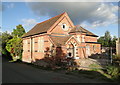
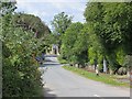
Nearby Images from Geograph Britain and Ireland:

©2026(licence)
©2011(licence)
©2010(licence)

©2026(licence)
©2015(licence)
The above images may not be of the site on this page, they are loaded from Geograph.
Please Submit an Image of this site or go out and take one for us!
Click here to see more info for this site
Nearby sites
Key: Red: member's photo, Blue: 3rd party photo, Yellow: other image, Green: no photo - please go there and take one, Grey: site destroyed
Download sites to:
KML (Google Earth)
GPX (GPS waypoints)
CSV (Garmin/Navman)
CSV (Excel)
To unlock full downloads you need to sign up as a Contributory Member. Otherwise downloads are limited to 50 sites.
Turn off the page maps and other distractions
Nearby sites listing. In the following links * = Image available
3.4km ENE 65° Tank Cottage Standing Stone (Menhir) (SO36615640)
6.6km WNW 302° Bradnor Hill 1 Stone Row / Alignment (SO27945860)
6.9km WNW 288° Yeld Wood Stone Row / Alignment (SO26995724)
7.0km NW 320° St Michael's Churchyard Cross (Knill)* Ancient Cross (SO2911860448)
7.5km N 7° Wapley Camp* Hillfort (SO3457162465)
7.6km WNW 283° The Whet Stone (Hergest Ridge)* Natural Stone / Erratic / Other Natural Feature (SO26055680)
7.8km NW 319° Burfa Camp* Hillfort (SO285610)
8.3km NW 306° Walton Cursus Cursus (SO26826001)
8.5km NW 304° Walton Green Cursus (SO26525989)
8.6km N 357° Cat and Fiddle Enclosure Cropmark Ancient Village or Settlement (SO33146362)
8.7km WNW 302° Walton Cursus Cursus (SO26195978)
9.3km NW 308° Hindwell Causewayed Enclosure* Causewayed Enclosure (SO26246092)
9.4km WNW 295° Old Radnor Church* Standing Stone (Menhir) (SO24995909)
9.6km NW 310° Knobley Stone* Standing Stone (Menhir) (SO26296132)
9.6km WNW 300° Walton Palisaded Enclosure* Timber Circle (SO25235996)
9.7km NNW 348° St Andrew's Church (Presteigne)* Ancient Cross (SO3156864528)
9.8km NW 305° Hindwell Enclosure* Timber Circle (SO2544560720)
9.9km NW 304° Hindwell Farm 1* Round Barrow(s) (SO25376064)
9.9km NW 307° Hindwell Ash* Round Barrow(s) (SO25706111)
10.0km SW 221° St Peter's Well, Whitney on Wye* Holy Well or Sacred Spring (SO268475)
10.1km NW 305° Hindwell Farm 2* Round Barrow(s) (SO25226091)
10.1km N 353° Stapleton Henge Henge (SO32356510)
10.2km WNW 298° Knapp Mount Barrow* Barrow Cemetery (SO2458659975)
10.3km WNW 303° Hindwell Cursus* Cursus (SO24926074)
10.4km S 185° The Knapp (Bredwardine)* Ancient Village or Settlement (SO32454467)
View more nearby sites and additional images


 We would like to know more about this location. Please feel free to add a brief description and any relevant information in your own language.
 Wir möchten mehr über diese Stätte erfahren. Bitte zögern Sie nicht, eine kurze Beschreibung und relevante Informationen in Deutsch hinzuzufügen.
 Nous aimerions en savoir encore un peu sur les lieux. S'il vous plaît n'hesitez pas à ajouter une courte description et tous les renseignements pertinents dans votre propre langue.
 Quisieramos informarnos un poco más de las lugares. No dude en añadir una breve descripción y otros datos relevantes en su propio idioma.