

<< Text Pages >> Wick A Cursus - Cursus in England in Worcestershire
Submitted by EssexMan on Wednesday, 07 April 2010 Page Views: 5434
Neolithic and Bronze AgeSite Name: Wick A CursusCountry: England
NOTE: This site is 5.041 km away from the location you searched for.
County: Worcestershire Type: Cursus
Nearest Town: Evesham Nearest Village: Wick
Map Ref: SO96704665 Landranger Map Number: 150
Latitude: 52.118158N Longitude: 2.04961W
Condition:
| 5 | Perfect |
| 4 | Almost Perfect |
| 3 | Reasonable but with some damage |
| 2 | Ruined but still recognisable as an ancient site |
| 1 | Pretty much destroyed, possibly visible as crop marks |
| 0 | No data. |
| -1 | Completely destroyed |
| 5 | Superb |
| 4 | Good |
| 3 | Ordinary |
| 2 | Not Good |
| 1 | Awful |
| 0 | No data. |
| 5 | Can be driven to, probably with disabled access |
| 4 | Short walk on a footpath |
| 3 | Requiring a bit more of a walk |
| 2 | A long walk |
| 1 | In the middle of nowhere, a nightmare to find |
| 0 | No data. |
| 5 | co-ordinates taken by GPS or official recorded co-ordinates |
| 4 | co-ordinates scaled from a detailed map |
| 3 | co-ordinates scaled from a bad map |
| 2 | co-ordinates of the nearest village |
| 1 | co-ordinates of the nearest town |
| 0 | no data |
Internal Links:
External Links:
Cursus in Worcestershire
Status: Possible
NMR No. SO 94 NE 9
You may be viewing yesterday's version of this page. To see the most up to date information please register for a free account.
Do not use the above information on other web sites or publications without permission of the contributor.
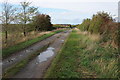
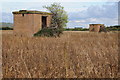
Nearby Images from Geograph Britain and Ireland:
©2008(licence)
©2005(licence)
©2012(licence)
©2012(licence)
©2012(licence)
The above images may not be of the site on this page, they are loaded from Geograph.
Please Submit an Image of this site or go out and take one for us!
Click here to see more info for this site
Nearby sites
Key: Red: member's photo, Blue: 3rd party photo, Yellow: other image, Green: no photo - please go there and take one, Grey: site destroyed
Download sites to:
KML (Google Earth)
GPX (GPS waypoints)
CSV (Garmin/Navman)
CSV (Excel)
To unlock full downloads you need to sign up as a Contributory Member. Otherwise downloads are limited to 50 sites.
Turn off the page maps and other distractions
Nearby sites listing. In the following links * = Image available
1.6km SSE 149° Wick B Cursus Cursus (SO975453)
3.6km ESE 115° St Michael (Cropthorne)* Ancient Cross (SP00014512)
6.5km SSW 192° St. Catherine's Well (Eckington)* Holy Well or Sacred Spring (SO95364030)
6.6km S 169° Elmley Castle* Hillfort (SO979402)
6.6km S 189° Kemerton Camp* Hillfort (SO957401)
8.3km S 177° Conderton Camp* Promontory Fort / Cliff Castle (SO972384)
8.3km SSW 195° The King and Queen Stones* Standing Stones (SO9456738632)
8.3km E 84° New Farm Roman Settlement* Ancient Village or Settlement (SP0499847546)
8.5km SSW 198° Norton Stones* Misc. Earthwork (SO940386)
8.7km E 83° Norton and Lenchwick Cursus* Cursus (SP054477)
10.9km WNW 301° Crookbarrow Hill* Artificial Mound (SO874523)
12.1km WNW 282° Kempsey Cross* Ancient Cross (SO8482149096)
12.2km SSW 211° Chad Well (Twyning)* Holy Well or Sacred Spring (SO90363617)
12.8km S 182° The Tibblestone* Standing Stone (Menhir) (SO96333384)
12.9km NW 322° Warndon Cross* Ancient Cross (SO8878256887)
13.0km SW 222° Towbury Camp* Hillfort (SO88003695)
13.3km NNW 331° Tibberton Cursus Cursus (SO90335831)
15.0km SSE 167° Alderton Cursus Cursus (SP00023199)
15.3km S 178° The Knolls* Ancient Village or Settlement (SO97253135)
15.9km SSE 159° The Warren Hillfort (SP024318)
16.0km SSW 208° Tewkesbury Abbey holy well* Holy Well or Sacred Spring (SO892325)
17.1km ESE 119° Willersey Hillfort Hillfort (SP11703840)
17.2km ESE 119° Willersey* Chambered Tomb (SP118383)
17.4km S 174° Odo and Dodo* Standing Stones (SO98402935)
17.4km SE 139° Shenberrow Hillfort* Hillfort (SP08043344)
View more nearby sites and additional images


 We would like to know more about this location. Please feel free to add a brief description and any relevant information in your own language.
 Wir möchten mehr über diese Stätte erfahren. Bitte zögern Sie nicht, eine kurze Beschreibung und relevante Informationen in Deutsch hinzuzufügen.
 Nous aimerions en savoir encore un peu sur les lieux. S'il vous plaît n'hesitez pas à ajouter une courte description et tous les renseignements pertinents dans votre propre langue.
 Quisieramos informarnos un poco más de las lugares. No dude en añadir una breve descripción y otros datos relevantes en su propio idioma.