


<< Text Pages >> Red Horse of Tysoe - Hill Figure or Geoglyph in England in Warwickshire
Submitted by SolarMegalith on Wednesday, 30 March 2011 Page Views: 9961
Multi-periodSite Name: Red Horse of TysoeCountry: England
NOTE: This site is 6.598 km away from the location you searched for.
County: Warwickshire Type: Hill Figure or Geoglyph
Nearest Village: Lower Tysoe
Map Ref: SP3539844833
Latitude: 52.100707N Longitude: 1.484641W
Condition:
| 5 | Perfect |
| 4 | Almost Perfect |
| 3 | Reasonable but with some damage |
| 2 | Ruined but still recognisable as an ancient site |
| 1 | Pretty much destroyed, possibly visible as crop marks |
| 0 | No data. |
| -1 | Completely destroyed |
| 5 | Superb |
| 4 | Good |
| 3 | Ordinary |
| 2 | Not Good |
| 1 | Awful |
| 0 | No data. |
| 5 | Can be driven to, probably with disabled access |
| 4 | Short walk on a footpath |
| 3 | Requiring a bit more of a walk |
| 2 | A long walk |
| 1 | In the middle of nowhere, a nightmare to find |
| 0 | No data. |
| 5 | co-ordinates taken by GPS or official recorded co-ordinates |
| 4 | co-ordinates scaled from a detailed map |
| 3 | co-ordinates scaled from a bad map |
| 2 | co-ordinates of the nearest village |
| 1 | co-ordinates of the nearest town |
| 0 | no data |
Internal Links:
External Links:
Hill Figure in Warwickshire
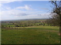
The hill figure of a horse located near Lower Tysoe was mentioned in 1656 and 1798. K.A. Carduss and W.G. Miller figured the location of the Red Horse on slope of the hill over Old Lodge Farm, in a place currently covered with a forest. The trenches opened near the head of the hill figure in 1969 have confirmed differencs in subsoil, while the geophysical survey in 1980 provided further evidence for existence of the Red Horse. The origin of the figure is unknown, possibly it was an Anglo-Saxon ritual feature. Possibly it was accompanied by another, smaller hill figure.
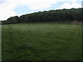
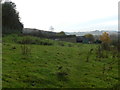
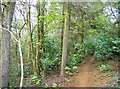
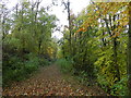
Currently remains of the Red Horse of Tysoe are buried under the forest.
Bibliography:
Newman P. 2009 Lost Gods of Albion: The Chalk Hill-Figures of Britain. Stroud: The History Press.
You may be viewing yesterday's version of this page. To see the most up to date information please register for a free account.
Do not use the above information on other web sites or publications without permission of the contributor.
Nearby Images from Geograph Britain and Ireland:
©2011(licence)
©2012(licence)
©2007(licence)
©2012(licence)
©2012(licence)
The above images may not be of the site on this page, they are loaded from Geograph.
Please Submit an Image of this site or go out and take one for us!
Click here to see more info for this site
Nearby sites
Key: Red: member's photo, Blue: 3rd party photo, Yellow: other image, Green: no photo - please go there and take one, Grey: site destroyed
Download sites to:
KML (Google Earth)
GPX (GPS waypoints)
CSV (Garmin/Navman)
CSV (Excel)
To unlock full downloads you need to sign up as a Contributory Member. Otherwise downloads are limited to 50 sites.
Turn off the page maps and other distractions
Nearby sites listing. In the following links * = Image available
4.9km NE 47° Nadbury Camp* Hillfort (SP3900048200)
6.8km SSE 152° Madmarston Hill* Hillfort (SP38653890)
8.0km NE 34° Holy Well (Burton Dassett)* Holy Well or Sacred Spring (SP398515)
8.2km NNE 19° Burton Dassett Tumuli Round Barrow(s) (SP380526)
8.6km SSE 156° Tadmarton Holy Well* Holy Well or Sacred Spring (SP3937)
9.4km NW 305° Ettington Cursus Cursus (SP277502)
9.5km NW 306° Ettington Cursus Cursus (SP277504)
9.8km SSE 160° Tadmarton Camp* Hillfort (SP38783568)
11.3km E 81° Cup and Saucer Stone* Ancient Cross (SP466466)
11.7km E 83° Ringstone (Cropredy) Stone Circle (SP470464)
13.8km ESE 122° Bodicote Cursus Cursus (SP472376)
14.3km NW 324° Charlecote B Cursus Cursus (SP268563)
14.5km ENE 75° Arbury Camp* Hillfort (SP494486)
14.5km NW 324° Charlecote B Cursus Cursus (SP268565)
15.0km SSW 203° King Stone Round Cairn* Cairn (SP2961430968)
15.0km SSW 202° Whispering Knights* Portal Tomb (SP29933084)
15.0km SSW 203° King Stone at the Rollrights* Standing Stone (Menhir) (SP2962030950)
15.1km SSW 203° Rollright Stones* Stone Circle (SP29583087)
15.1km SSW 203° Gough's Barrow (Long Compton) Cairn (SP29463090)
15.1km NNW 342° Oakley Wood Fort* Hillfort (SP306592)
15.6km NNW 328° Charlecote A Cursus Cursus (SP26895795)
15.6km NW 320° Hampton Lucy B Timber Circle (SP252567)
15.8km NW 320° Hampton Lucy A Timber Circle (SP251568)
15.9km SSW 203° Little Rollright Churchyard Cross* Ancient Cross (SP2935230116)
16.3km NNW 327° Wasperton Timber Circle (SP265585)
View more nearby sites and additional images


 We would like to know more about this location. Please feel free to add a brief description and any relevant information in your own language.
 Wir möchten mehr über diese Stätte erfahren. Bitte zögern Sie nicht, eine kurze Beschreibung und relevante Informationen in Deutsch hinzuzufügen.
 Nous aimerions en savoir encore un peu sur les lieux. S'il vous plaît n'hesitez pas à ajouter une courte description et tous les renseignements pertinents dans votre propre langue.
 Quisieramos informarnos un poco más de las lugares. No dude en añadir una breve descripción y otros datos relevantes en su propio idioma.