


<< Our Photo Pages >> Tadmarton Holy Well - Holy Well or Sacred Spring in England in Oxfordshire
Submitted by HOLYWELL on Friday, 29 February 2008 Page Views: 9301
Springs and Holy WellsSite Name: Tadmarton Holy WellCountry: England
NOTE: This site is 3.799 km away from the location you searched for.
County: Oxfordshire Type: Holy Well or Sacred Spring
Nearest Village: Tadmarton
Map Ref: SP3937
Latitude: 52.030046N Longitude: 1.432951W
Condition:
| 5 | Perfect |
| 4 | Almost Perfect |
| 3 | Reasonable but with some damage |
| 2 | Ruined but still recognisable as an ancient site |
| 1 | Pretty much destroyed, possibly visible as crop marks |
| 0 | No data. |
| -1 | Completely destroyed |
| 5 | Superb |
| 4 | Good |
| 3 | Ordinary |
| 2 | Not Good |
| 1 | Awful |
| 0 | No data. |
| 5 | Can be driven to, probably with disabled access |
| 4 | Short walk on a footpath |
| 3 | Requiring a bit more of a walk |
| 2 | A long walk |
| 1 | In the middle of nowhere, a nightmare to find |
| 0 | No data. |
| 5 | co-ordinates taken by GPS or official recorded co-ordinates |
| 4 | co-ordinates scaled from a detailed map |
| 3 | co-ordinates scaled from a bad map |
| 2 | co-ordinates of the nearest village |
| 1 | co-ordinates of the nearest town |
| 0 | no data |
Internal Links:
External Links:
")
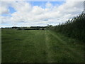
This ancient holy well arises high on a hill possible a hill fort site. It has rather been ruined by modern trappings of a pumping station but the reddy water is still visible. It lies in a copse in a golf course.
You may be viewing yesterday's version of this page. To see the most up to date information please register for a free account.
Do not use the above information on other web sites or publications without permission of the contributor.
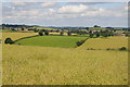
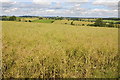
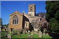
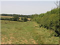
Nearby Images from Geograph Britain and Ireland:
©2012(licence)
©2012(licence)
©2006(licence)
©2006(licence)
©2021(licence)
The above images may not be of the site on this page, they are loaded from Geograph.
Please Submit an Image of this site or go out and take one for us!
Click here to see more info for this site
Nearby sites
Key: Red: member's photo, Blue: 3rd party photo, Yellow: other image, Green: no photo - please go there and take one, Grey: site destroyed
Download sites to:
KML (Google Earth)
GPX (GPS waypoints)
CSV (Garmin/Navman)
CSV (Excel)
To unlock full downloads you need to sign up as a Contributory Member. Otherwise downloads are limited to 50 sites.
Turn off the page maps and other distractions
Nearby sites listing. In the following links * = Image available
1.3km S 190° Tadmarton Camp* Hillfort (SP38783568)
1.9km N 350° Madmarston Hill* Hillfort (SP38653890)
8.1km SE 144° Ilbury Camp* Hillfort (SP438305)
8.2km E 86° Bodicote Cursus Cursus (SP472376)
8.6km NNW 336° Red Horse of Tysoe Hill Figure or Geoglyph (SP3539844833)
10.7km SW 217° Druids Barrow Round Barrow(s) (SP32612835)
10.9km SW 236° Whispering Knights* Portal Tomb (SP29933084)
11.1km WSW 238° King Stone Round Cairn* Cairn (SP2961430968)
11.1km WSW 238° King Stone at the Rollrights* Standing Stone (Menhir) (SP2962030950)
11.2km N 0° Nadbury Camp* Hillfort (SP3900048200)
11.2km WSW 237° Rollright Stones* Stone Circle (SP29583087)
11.3km WSW 238° Gough's Barrow (Long Compton) Cairn (SP29463090)
11.6km E 94° Astrop Well* Holy Well or Sacred Spring (SP50603624)
11.8km E 93° St Rumbald's Well* Holy Well or Sacred Spring (SP50783651)
11.8km SW 235° Little Rollright Churchyard Cross* Ancient Cross (SP2935230116)
12.2km NE 39° Cup and Saucer Stone* Ancient Cross (SP466466)
12.3km NE 41° Ringstone (Cropredy) Stone Circle (SP470464)
12.7km SW 218° New Street Stone* Holed Stone (SP312270)
12.8km SW 219° Serpent's Well (Chipping Norton) Holy Well or Sacred Spring (SP310270)
13.3km S 186° Hoar Stone at Enstone* Chambered Tomb (SP37792375)
13.7km SW 230° Salford Cross Cup Marks (Salford)* Ancient Cross (SP2864428058)
13.7km SW 229° Salford Wayside Cross* Ancient Cross (SP2872927960)
13.7km E 100° Rainsborough Camp* Hillfort (SP526348)
14.4km SSW 201° Hawk Stone* Standing Stone (Menhir) (SP3392023540)
14.5km N 4° Holy Well (Burton Dassett)* Holy Well or Sacred Spring (SP398515)
View more nearby sites and additional images


 We would like to know more about this location. Please feel free to add a brief description and any relevant information in your own language.
 Wir möchten mehr über diese Stätte erfahren. Bitte zögern Sie nicht, eine kurze Beschreibung und relevante Informationen in Deutsch hinzuzufügen.
 Nous aimerions en savoir encore un peu sur les lieux. S'il vous plaît n'hesitez pas à ajouter une courte description et tous les renseignements pertinents dans votre propre langue.
 Quisieramos informarnos un poco más de las lugares. No dude en añadir una breve descripción y otros datos relevantes en su propio idioma.