


<< Our Photo Pages >> Tadmarton Camp - Hillfort in England in Oxfordshire
Submitted by h_fenton on Tuesday, 08 March 2011 Page Views: 10976
Iron Age and Later PrehistorySite Name: Tadmarton Camp Alternative Name: Tadmarton HeathCountry: England
NOTE: This site is 5.287 km away from the location you searched for.
County: Oxfordshire Type: Hillfort
Nearest Town: Banbury Nearest Village: Tadmarton
Map Ref: SP38783568
Latitude: 52.018194N Longitude: 1.436307W
Condition:
| 5 | Perfect |
| 4 | Almost Perfect |
| 3 | Reasonable but with some damage |
| 2 | Ruined but still recognisable as an ancient site |
| 1 | Pretty much destroyed, possibly visible as crop marks |
| 0 | No data. |
| -1 | Completely destroyed |
| 5 | Superb |
| 4 | Good |
| 3 | Ordinary |
| 2 | Not Good |
| 1 | Awful |
| 0 | No data. |
| 5 | Can be driven to, probably with disabled access |
| 4 | Short walk on a footpath |
| 3 | Requiring a bit more of a walk |
| 2 | A long walk |
| 1 | In the middle of nowhere, a nightmare to find |
| 0 | No data. |
| 5 | co-ordinates taken by GPS or official recorded co-ordinates |
| 4 | co-ordinates scaled from a detailed map |
| 3 | co-ordinates scaled from a bad map |
| 2 | co-ordinates of the nearest village |
| 1 | co-ordinates of the nearest town |
| 0 | no data |
Internal Links:
External Links:
I have visited· I would like to visit
h_fenton has visited here
")
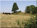
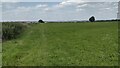
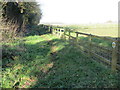
Tadmarton Camp is a bivallate fort which is roughly circular in shape, the interior had a diameter of about 165 metres. The internal bank survives at a height of upto four feet above the interior (and upto around 6 feet from the outside).The internal bank is visible almost all the way around the fort.
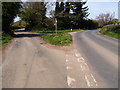
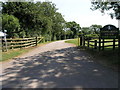
The fort is cut through, north-east to south-west by a modern road, to the south-east of the road the fort now forms part of a golf course; to the north-west the fort is on farmland which looks like it is sometimes ploughed.
Tadmarton Camp is assumed to date from the Iron Age, English Heritage (on PastScape) in a badly worded site description suggest it might date to the nineteenth century, but on further reading it turns out that the nineteenth century reference is not the hillfort/camp but a nearby "squarish ditched earthwork".
http://www.pastscape.org.uk/hob.aspx?hob_id=335064
You may be viewing yesterday's version of this page. To see the most up to date information please register for a free account.
")
Do not use the above information on other web sites or publications without permission of the contributor.
Nearby Images from Geograph Britain and Ireland:
©2006(licence)
©2021(licence)
©2017(licence)
©2017(licence)
©2006(licence)
The above images may not be of the site on this page, they are loaded from Geograph.
Please Submit an Image of this site or go out and take one for us!
Click here to see more info for this site
Nearby sites
Key: Red: member's photo, Blue: 3rd party photo, Yellow: other image, Green: no photo - please go there and take one, Grey: site destroyed
Download sites to:
KML (Google Earth)
GPX (GPS waypoints)
CSV (Garmin/Navman)
CSV (Excel)
To unlock full downloads you need to sign up as a Contributory Member. Otherwise downloads are limited to 50 sites.
Turn off the page maps and other distractions
Nearby sites listing. In the following links * = Image available
1.3km N 10° Tadmarton Holy Well* Holy Well or Sacred Spring (SP3937)
3.2km N 358° Madmarston Hill* Hillfort (SP38653890)
7.2km SE 136° Ilbury Camp* Hillfort (SP438305)
8.6km ENE 78° Bodicote Cursus Cursus (SP472376)
9.6km SW 220° Druids Barrow Round Barrow(s) (SP32612835)
9.8km NNW 340° Red Horse of Tysoe Hill Figure or Geoglyph (SP3539844833)
10.1km WSW 242° Whispering Knights* Portal Tomb (SP29933084)
10.3km WSW 243° King Stone Round Cairn* Cairn (SP2961430968)
10.3km WSW 243° King Stone at the Rollrights* Standing Stone (Menhir) (SP2962030950)
10.4km WSW 243° Rollright Stones* Stone Circle (SP29583087)
10.5km WSW 243° Gough's Barrow (Long Compton) Cairn (SP29463090)
10.9km WSW 240° Little Rollright Churchyard Cross* Ancient Cross (SP2935230116)
11.5km SW 222° New Street Stone* Holed Stone (SP312270)
11.6km SW 222° Serpent's Well (Chipping Norton) Holy Well or Sacred Spring (SP310270)
11.8km E 88° Astrop Well* Holy Well or Sacred Spring (SP50603624)
12.0km S 185° Hoar Stone at Enstone* Chambered Tomb (SP37792375)
12.0km E 86° St Rumbald's Well* Holy Well or Sacred Spring (SP50783651)
12.5km N 1° Nadbury Camp* Hillfort (SP3900048200)
12.6km SW 233° Salford Wayside Cross* Ancient Cross (SP2872927960)
12.7km SW 233° Salford Cross Cup Marks (Salford)* Ancient Cross (SP2864428058)
13.1km SSW 202° Hawk Stone* Standing Stone (Menhir) (SP3392023540)
13.4km NE 36° Cup and Saucer Stone* Ancient Cross (SP466466)
13.5km NE 38° Ringstone (Cropredy) Stone Circle (SP470464)
13.5km SSE 149° Hoar Stone at Barton* Long Barrow (SP458241)
13.7km SW 224° Churchill Standing Stone* Standing Stone (Menhir) (SP29372568)
View more nearby sites and additional images


 We would like to know more about this location. Please feel free to add a brief description and any relevant information in your own language.
 Wir möchten mehr über diese Stätte erfahren. Bitte zögern Sie nicht, eine kurze Beschreibung und relevante Informationen in Deutsch hinzuzufügen.
 Nous aimerions en savoir encore un peu sur les lieux. S'il vous plaît n'hesitez pas à ajouter une courte description et tous les renseignements pertinents dans votre propre langue.
 Quisieramos informarnos un poco más de las lugares. No dude en añadir una breve descripción y otros datos relevantes en su propio idioma.