


<< Our Photo Pages >> Minns Close Tump Wood - Causewayed Enclosure in England in Herefordshire
Submitted by yewtreeguy on Wednesday, 15 August 2018 Page Views: 2190
Neolithic and Bronze AgeSite Name: Minns Close Tump WoodCountry: England
NOTE: This site is 1.723 km away from the location you searched for.
County: Herefordshire Type: Causewayed Enclosure
Nearest Village: Abbey Dore
Map Ref: SO38693162
Latitude: 51.979644N Longitude: 2.894061W
Condition:
| 5 | Perfect |
| 4 | Almost Perfect |
| 3 | Reasonable but with some damage |
| 2 | Ruined but still recognisable as an ancient site |
| 1 | Pretty much destroyed, possibly visible as crop marks |
| 0 | No data. |
| -1 | Completely destroyed |
| 5 | Superb |
| 4 | Good |
| 3 | Ordinary |
| 2 | Not Good |
| 1 | Awful |
| 0 | No data. |
| 5 | Can be driven to, probably with disabled access |
| 4 | Short walk on a footpath |
| 3 | Requiring a bit more of a walk |
| 2 | A long walk |
| 1 | In the middle of nowhere, a nightmare to find |
| 0 | No data. |
| 5 | co-ordinates taken by GPS or official recorded co-ordinates |
| 4 | co-ordinates scaled from a detailed map |
| 3 | co-ordinates scaled from a bad map |
| 2 | co-ordinates of the nearest village |
| 1 | co-ordinates of the nearest town |
| 0 | no data |
Be the first person to rate this site - see the 'Contribute!' box in the right hand menu.
Internal Links:
External Links:
I have visited· I would like to visit
SumDoood would like to visit
")
Given I only discovered it two weeks ago it has obviously not had any work done on assessing the photographs but it does look pretty convincing.
You may be viewing yesterday's version of this page. To see the most up to date information please register for a free account.
Do not use the above information on other web sites or publications without permission of the contributor.
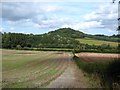
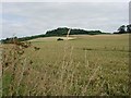
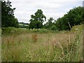
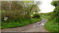
Nearby Images from Geograph Britain and Ireland:
©2020(licence)
©2006(licence)
©2006(licence)
©2019(licence)
©2022(licence)
The above images may not be of the site on this page, they are loaded from Geograph.
Please Submit an Image of this site or go out and take one for us!
Click here to see more info for this site
Nearby sites
Key: Red: member's photo, Blue: 3rd party photo, Yellow: other image, Green: no photo - please go there and take one, Grey: site destroyed
Download sites to:
KML (Google Earth)
GPX (GPS waypoints)
CSV (Garmin/Navman)
CSV (Excel)
To unlock full downloads you need to sign up as a Contributory Member. Otherwise downloads are limited to 50 sites.
Turn off the page maps and other distractions
Nearby sites listing. In the following links * = Image available
2.2km N 10° Dunseal* Round Barrow(s) (SO391338)
5.1km N 359° Timberline Camp Hillfort (SO387367)
5.9km E 100° Kilpeck church* Early Christian Sculptured Stone (SO44513051)
6.6km NNW 335° Poston Camp Hillfort (SO3598937647)
7.3km SW 235° Clodock Inscribed Stone* Carving (SO32642751)
7.3km SW 234° St. Clodock's Well* Holy Well or Sacred Spring (SO32692738)
7.5km SSE 166° Grosmont Churchyard Cross* Ancient Cross (SO40462432)
7.9km NNW 334° Peterchurch St Peter's Well* Holy Well or Sacred Spring (SO35333880)
8.4km W 268° Llanveyno Crosses* Ancient Cross (SO3031131361)
8.7km SE 140° Garway Hill* Long Barrow (SO44232492)
9.3km WSW 251° Wiral Cairn* Cairn (SO2985028710)
9.6km WSW 256° Crucorney Fawr 2 Round Cairn (SO293294)
9.8km N 351° Holy Well (Blakemere)* Holy Well or Sacred Spring (SO37254128)
9.8km NNW 345° Blakemere Church Stone* Marker Stone (SO362411)
9.8km WSW 259° Crucorney Fawr 1 Round Cairn (SO290298)
10.0km WNW 303° Wern Derys* Standing Stone (Menhir) (SO30363726)
10.2km NE 40° Eaton Camp* Promontory Fort / Cliff Castle (SO454393)
10.2km W 271° St. Thomas' Well* Holy Well or Sacred Spring (SO28433201)
10.6km S 178° Grosmont Fawr Hillfort (SO389210)
10.8km SW 217° Pen-Twyn* Hillfort (SO3210023000)
11.3km NNE 26° Holy Well (Swainshill)* Holy Well or Sacred Spring (SO43724177)
11.4km SE 143° Holy Well (Garway)* Holy Well or Sacred Spring (SO4547122500)
11.4km NNW 331° Great Llanavon Farm* Long Barrow (SO3322441689)
11.8km E 82° Aconbury Hill* Hillfort (SO504331)
12.0km SW 226° St Martin's Church (Cwmyoy)* Ancient Cross (SO29902340)
View more nearby sites and additional images


 We would like to know more about this location. Please feel free to add a brief description and any relevant information in your own language.
 Wir möchten mehr über diese Stätte erfahren. Bitte zögern Sie nicht, eine kurze Beschreibung und relevante Informationen in Deutsch hinzuzufügen.
 Nous aimerions en savoir encore un peu sur les lieux. S'il vous plaît n'hesitez pas à ajouter une courte description et tous les renseignements pertinents dans votre propre langue.
 Quisieramos informarnos un poco más de las lugares. No dude en añadir una breve descripción y otros datos relevantes en su propio idioma.