 with our Megalithic Portal iPhone app")


<< Text Pages >> Whitchurch Holy Well - Holy Well or Sacred Spring in England in Buckinghamshire
Submitted by HOLYWELL on Thursday, 03 April 2008 Page Views: 4191
Springs and Holy WellsSite Name: Whitchurch Holy WellCountry: England
NOTE: This site is 3.058 km away from the location you searched for.
County: Buckinghamshire Type: Holy Well or Sacred Spring
Nearest Village: Whitchurch
Map Ref: SP806208
Latitude: 51.879950N Longitude: 0.830489W
Condition:
| 5 | Perfect |
| 4 | Almost Perfect |
| 3 | Reasonable but with some damage |
| 2 | Ruined but still recognisable as an ancient site |
| 1 | Pretty much destroyed, possibly visible as crop marks |
| 0 | No data. |
| -1 | Completely destroyed |
| 5 | Superb |
| 4 | Good |
| 3 | Ordinary |
| 2 | Not Good |
| 1 | Awful |
| 0 | No data. |
| 5 | Can be driven to, probably with disabled access |
| 4 | Short walk on a footpath |
| 3 | Requiring a bit more of a walk |
| 2 | A long walk |
| 1 | In the middle of nowhere, a nightmare to find |
| 0 | No data. |
| 5 | co-ordinates taken by GPS or official recorded co-ordinates |
| 4 | co-ordinates scaled from a detailed map |
| 3 | co-ordinates scaled from a bad map |
| 2 | co-ordinates of the nearest village |
| 1 | co-ordinates of the nearest town |
| 0 | no data |
Internal Links:
External Links:
Holy Well or Sacred Spring in Buckinghamshire
This is found in a small wood although the water is culverted into an animal trough. Little is known of it other than the fact that it was petrifying.
You may be viewing yesterday's version of this page. To see the most up to date information please register for a free account.
Do not use the above information on other web sites or publications without permission of the contributor.
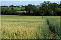
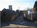
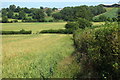
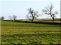
Nearby Images from Geograph Britain and Ireland:
©2013(licence)
©2016(licence)
©2013(licence)
©2015(licence)

©2025(licence)
The above images may not be of the site on this page, they are loaded from Geograph.
Please Submit an Image of this site or go out and take one for us!
Click here to see more info for this site
Nearby sites
Key: Red: member's photo, Blue: 3rd party photo, Yellow: other image, Green: no photo - please go there and take one, Grey: site destroyed
Download sites to:
KML (Google Earth)
GPX (GPS waypoints)
CSV (Garmin/Navman)
CSV (Excel)
To unlock full downloads you need to sign up as a Contributory Member. Otherwise downloads are limited to 50 sites.
Turn off the page maps and other distractions
Nearby sites listing. In the following links * = Image available
141m SW 226° Holy Well (Whitchurch)* Holy Well or Sacred Spring (SP805207)
508m W 260° Whittle Hole* Holy Well or Sacred Spring (SP801207)
607m W 261° Fair Alice well Holy Well or Sacred Spring (SP800207)
3.4km WNW 301° Scorne Well* Holy Well or Sacred Spring (SP777225)
6.3km SSE 153° St. Osyth's Well (Bierton)* Holy Well or Sacred Spring (SP836152)
7.1km S 171° Discover Bucks Museum Museum (SP8180113835)
7.2km NW 311° Sionhill Farm Henge (SP75012541)
8.3km WNW 298° Botyl Well* Holy Well or Sacred Spring (SP732245)
8.3km S 189° Hartwell Springs* Holy Well or Sacred Spring (SP7939412589)
9.9km NE 52° Soulbury Stone* Natural Stone / Erratic / Other Natural Feature (SP88292709)
11.5km NNE 22° St. John's Well (Buckinghamshire)* Holy Well or Sacred Spring (SP847316)
11.9km ENE 60° Linslade Holy Well Holy Well or Sacred Spring (SP908270)
12.3km SW 214° Cuddington Spring Holy Well or Sacred Spring (SP739105)
12.9km ENE 62° Shepherd's Race (Heath)* Maze or Labyrinth (SP9227)
13.0km N 0° Whaddon Barrow* Round Barrow(s)
13.3km SSE 161° Wellwick Farm (Buckinghamshire)* Ancient Village or Settlement (SP8514008240)
13.7km SW 221° Stock Well (Chearsley)* Holy Well or Sacred Spring (SP718103)
14.5km NNW 330° Thornborough (Bucks)* Barrow Cemetery (SP732333)
14.8km SSE 159° Bacombe Hill Barrow Cemetery (SP86160712)
14.8km SSE 159° Bacombe Hill Bowl Barrow Round Barrow(s) (SP86130709)
14.9km SSE 150° Boddington Camp* Hillfort (SP882080)
14.9km S 173° Ragpit Hill Cross Dyke Misc. Earthwork (SP82750601)
15.0km S 173° Ragpit Cross Dykes Misc. Earthwork (SP82750600)
15.0km S 172° Ragpit Cross Dyke Misc. Earthwork (SP83020598)
15.2km ESE 116° Northfield Settlement Ancient Village or Settlement (SP944143)
View more nearby sites and additional images


 We would like to know more about this location. Please feel free to add a brief description and any relevant information in your own language.
 Wir möchten mehr über diese Stätte erfahren. Bitte zögern Sie nicht, eine kurze Beschreibung und relevante Informationen in Deutsch hinzuzufügen.
 Nous aimerions en savoir encore un peu sur les lieux. S'il vous plaît n'hesitez pas à ajouter une courte description et tous les renseignements pertinents dans votre propre langue.
 Quisieramos informarnos un poco más de las lugares. No dude en añadir una breve descripción y otros datos relevantes en su propio idioma.