


<< Text Pages >> Crowmarsh Cursus - Cursus in England in Oxfordshire
Submitted by EssexMan on Wednesday, 07 April 2010 Page Views: 3785
Neolithic and Bronze AgeSite Name: Crowmarsh CursusCountry: England
NOTE: This site is 2.579 km away from the location you searched for.
County: Oxfordshire Type: Cursus
Nearest Town: Wallingford Nearest Village: Crowmarsh
Map Ref: SU61158585 Landranger Map Number: 175
Latitude: 51.568216N Longitude: 1.119133W
Condition:
| 5 | Perfect |
| 4 | Almost Perfect |
| 3 | Reasonable but with some damage |
| 2 | Ruined but still recognisable as an ancient site |
| 1 | Pretty much destroyed, possibly visible as crop marks |
| 0 | No data. |
| -1 | Completely destroyed |
| 5 | Superb |
| 4 | Good |
| 3 | Ordinary |
| 2 | Not Good |
| 1 | Awful |
| 0 | No data. |
| 5 | Can be driven to, probably with disabled access |
| 4 | Short walk on a footpath |
| 3 | Requiring a bit more of a walk |
| 2 | A long walk |
| 1 | In the middle of nowhere, a nightmare to find |
| 0 | No data. |
| 5 | co-ordinates taken by GPS or official recorded co-ordinates |
| 4 | co-ordinates scaled from a detailed map |
| 3 | co-ordinates scaled from a bad map |
| 2 | co-ordinates of the nearest village |
| 1 | co-ordinates of the nearest town |
| 0 | no data |
Internal Links:
External Links:
Cruciform Long Enclosure in Oxfordshire
Status: Certain
NMR No. SU 68 NW 40
Extent: 240mx20m
Terminal type: Bank barow
Date: 3540-3340 cal BC 83% confidence (BM-1405) for antler from primary ditch fill
Note: This location marks one terminal (end) of a cursus monument. The location of the other terminal can be found in the Nearby Site list below.
You may be viewing yesterday's version of this page. To see the most up to date information please register for a free account.
Do not use the above information on other web sites or publications without permission of the contributor.
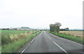
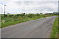
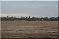
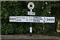
Nearby Images from Geograph Britain and Ireland:

©2009(licence)
©2011(licence)
©2014(licence)
©2009(licence)
©2022(licence)
The above images may not be of the site on this page, they are loaded from Geograph.
Please Submit an Image of this site or go out and take one for us!
Click here to see more info for this site
Nearby sites
Key: Red: member's photo, Blue: 3rd party photo, Yellow: other image, Green: no photo - please go there and take one, Grey: site destroyed
Download sites to:
KML (Google Earth)
GPX (GPS waypoints)
CSV (Garmin/Navman)
CSV (Excel)
To unlock full downloads you need to sign up as a Contributory Member. Otherwise downloads are limited to 50 sites.
Turn off the page maps and other distractions
Nearby sites listing. In the following links * = Image available
302m SW 215° Crowmarsh Cursus Cursus (SU60988560)
314m SSW 211° Crowmarsh Complex Barrow Cemetery (SU60998558)
3.2km SSW 212° Moulsford Cursus Cursus (SU59498312)
4.3km WNW 299° Cholsey Hill Camp* Hillfort (SU5735387927)
4.4km SW 226° Lingley Knoll Misc. Earthwork (SU58048274)
4.4km ENE 71° Grim's Ditch (Ridgeway, Bachelor's Hill)* Misc. Earthwork (SU6530787336)
4.4km SW 226° Lingley Knob Round Barrow(s) (SU57978276)
5.3km NNE 14° Benson Cursus Cursus (SU624910)
6.1km S 186° Goring Cursus Cursus (SU606798)
6.2km S 188° Goring Enclosure Causewayed Enclosure (SU604797)
6.3km NNE 17° Benson Cursus Cursus (SU629919)
6.4km W 274° Blewburton Hill* Hillfort (SU547862)
6.7km N 353° Shillingford Cursus Cursus (SU602925)
6.8km N 352° Warborough Cursus Cursus (SU60119260)
7.0km NNW 330° Brightwell Barrow* Round Barrow(s) (SU576919)
7.1km N 350° Shillingford Cursus Cursus (SU598928)
7.8km NNW 328° Sinodun Camp* Hillfort (SU5694592434)
8.0km WSW 244° Lowbury Hill Camp Ancient Temple (SU5400082250)
8.0km SSE 159° Bozedown Camp* Hillfort (SU6419578403)
8.0km NE 46° Swyncombe Downs Earthwork Misc. Earthwork (SU66889152)
8.1km ESE 103° Stoke Row Puddingstone* Natural Stone / Erratic / Other Natural Feature (SU6910684123)
8.3km NNW 348° Dorchester; Overy Cursus (SU593939)
8.3km NE 47° Swyncombe Earthworks* Misc. Earthwork (SU6722091570)
8.6km NNW 335° Dyke Hills* Hillfort (SU57389358)
8.6km SE 125° Wyfold Castle* Hillfort (SU68328099)
View more nearby sites and additional images


 We would like to know more about this location. Please feel free to add a brief description and any relevant information in your own language.
 Wir möchten mehr über diese Stätte erfahren. Bitte zögern Sie nicht, eine kurze Beschreibung und relevante Informationen in Deutsch hinzuzufügen.
 Nous aimerions en savoir encore un peu sur les lieux. S'il vous plaît n'hesitez pas à ajouter une courte description et tous les renseignements pertinents dans votre propre langue.
 Quisieramos informarnos un poco más de las lugares. No dude en añadir una breve descripción y otros datos relevantes en su propio idioma.