<< Our Photo Pages >> Kosilenzien Burgwall - Hillfort in Germany in Brandenburg, Berlin
Submitted by KaiHofmann on Thursday, 16 December 2010 Page Views: 2657
Iron Age and Later PrehistorySite Name: Kosilenzien BurgwallCountry: Germany
NOTE: This site is 6.239 km away from the location you searched for.
Land: Brandenburg, Berlin Type: Hillfort
Nearest Town: Bad Liebenwerda Nearest Village: Kosilenzien
Latitude: 51.456761N Longitude: 13.353710E
Condition:
| 5 | Perfect |
| 4 | Almost Perfect |
| 3 | Reasonable but with some damage |
| 2 | Ruined but still recognisable as an ancient site |
| 1 | Pretty much destroyed, possibly visible as crop marks |
| 0 | No data. |
| -1 | Completely destroyed |
| 5 | Superb |
| 4 | Good |
| 3 | Ordinary |
| 2 | Not Good |
| 1 | Awful |
| 0 | No data. |
| 5 | Can be driven to, probably with disabled access |
| 4 | Short walk on a footpath |
| 3 | Requiring a bit more of a walk |
| 2 | A long walk |
| 1 | In the middle of nowhere, a nightmare to find |
| 0 | No data. |
| 5 | co-ordinates taken by GPS or official recorded co-ordinates |
| 4 | co-ordinates scaled from a detailed map |
| 3 | co-ordinates scaled from a bad map |
| 2 | co-ordinates of the nearest village |
| 1 | co-ordinates of the nearest town |
| 0 | no data |
Internal Links:
External Links:
I have visited· I would like to visit
Janek visited on 10th Jul 2022 - their rating: Cond: 3 Amb: 4 Access: 4
")
A Bronze Age fort (oval with 400m diameter), which was also used in the Iron Age and later by Slavic settlers in the 10th century.
You may be viewing yesterday's version of this page. To see the most up to date information please register for a free account.
")
")
Do not use the above information on other web sites or publications without permission of the contributor.
Nearby Images from Flickr
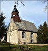
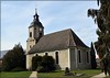
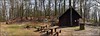
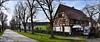
The above images may not be of the site on this page, but were taken nearby. They are loaded from Flickr so please click on them for image credits.
Click here to see more info for this site
Nearby sites
Click here to view sites on an interactive map of the areaKey: Red: member's photo, Blue: 3rd party photo, Yellow: other image, Green: no photo - please go there and take one, Grey: site destroyed
Download sites to:
KML (Google Earth)
GPX (GPS waypoints)
CSV (Garmin/Navman)
CSV (Excel)
To unlock full downloads you need to sign up as a Contributory Member. Otherwise downloads are limited to 50 sites.
Turn off the page maps and other distractions
Nearby sites listing. In the following links * = Image available
7.3km WSW 237° Boragk Steinkreuz Early Christian Sculptured Stone
11.3km E 98° Gotenkreuz Elsterwerda Holed Stone
11.7km NNE 18° Rothsteiner Felsen Rock Outcrop
20.3km NNW 343° Huegelgraeberfeld Schweinert* Barrow Cemetery
21.2km WSW 249° Spitzer Stein Bucha* Standing Stone (Menhir)
23.1km NNE 14° Priessen Kreuzsteinstumpf* Early Christian Sculptured Stone
23.1km WSW 255° Lattenberg Hügelgräbergruppe Barrow Cemetery
23.3km ESE 110° Grossthiemig Kreuz Ancient Cross
24.9km SSE 168° Goldkuppe* Hillfort
25.9km SSE 168° Burgberg Löbsal* Hillfort
25.9km S 170° Wallburg Göhrisch* Hillfort
26.1km W 266° Spitzenroda* Rock Art
26.5km N 10° Hügelgräberfeld Frankenhain* Barrow Cemetery
27.9km N 359° Schlieben Wallanlage* Ancient Village or Settlement
28.6km S 173° Burgberg Zeren* Hillfort
29.4km W 260° Ramsches Holz Barrow Cemetery
29.6km SSW 200° Steudten* Standing Stone (Menhir)
29.7km W 263° Ochsensaal Hügelgräber Barrow Cemetery
29.7km NE 36° Schlomigsberg Hillfort
30.4km W 261° Teufelsstein Höllenpfort Standing Stone (Menhir)
30.7km WSW 259° Museum Frauwalde Museum
30.9km NNE 29° Steinkreuz Friedersdorf* Ancient Cross
31.9km W 259° Kranich Barrow Cemetery
32.7km NE 38° Sonnewalde Kreuzstein* Early Christian Sculptured Stone
35.4km WSW 245° Gräberfeld am Doktorteich* Barrow Cemetery
View more nearby sites and additional images


 We would like to know more about this location. Please feel free to add a brief description and any relevant information in your own language.
 Wir möchten mehr über diese Stätte erfahren. Bitte zögern Sie nicht, eine kurze Beschreibung und relevante Informationen in Deutsch hinzuzufügen.
 Nous aimerions en savoir encore un peu sur les lieux. S'il vous plaît n'hesitez pas à ajouter une courte description et tous les renseignements pertinents dans votre propre langue.
 Quisieramos informarnos un poco más de las lugares. No dude en añadir una breve descripción y otros datos relevantes en su propio idioma.