<< Text Pages >> Lublin-Sławinek Long Barrow - Long Barrow in Poland in Lubelskie
Submitted by SolarMegalith on Sunday, 17 August 2008 Page Views: 3793
Neolithic and Bronze AgeSite Name: Lublin-Sławinek Long BarrowCountry: Poland
NOTE: This site is 34.011 km away from the location you searched for.
Voivodeship: Lubelskie Type: Long Barrow
Nearest Town: Lublin
Latitude: 51.266670N Longitude: 22.516670E
Condition:
| 5 | Perfect |
| 4 | Almost Perfect |
| 3 | Reasonable but with some damage |
| 2 | Ruined but still recognisable as an ancient site |
| 1 | Pretty much destroyed, possibly visible as crop marks |
| 0 | No data. |
| -1 | Completely destroyed |
| 5 | Superb |
| 4 | Good |
| 3 | Ordinary |
| 2 | Not Good |
| 1 | Awful |
| 0 | No data. |
| 5 | Can be driven to, probably with disabled access |
| 4 | Short walk on a footpath |
| 3 | Requiring a bit more of a walk |
| 2 | A long walk |
| 1 | In the middle of nowhere, a nightmare to find |
| 0 | No data. |
| 5 | co-ordinates taken by GPS or official recorded co-ordinates |
| 4 | co-ordinates scaled from a detailed map |
| 3 | co-ordinates scaled from a bad map |
| 2 | co-ordinates of the nearest village |
| 1 | co-ordinates of the nearest town |
| 0 | no data |
Be the first person to rate this site - see the 'Contribute!' box in the right hand menu.
Internal Links:
External Links:
Long Barrow in Lubelskie
The megalithic tomb of the Funnelbeaker Culture (neolithic period) was discovered in this district of city Lublin. Big parts of the tomb were build out of timber.
You may be viewing yesterday's version of this page. To see the most up to date information please register for a free account.
Do not use the above information on other web sites or publications without permission of the contributor.
Nearby Images from Flickr
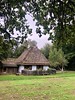
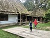
The above images may not be of the site on this page, but were taken nearby. They are loaded from Flickr so please click on them for image credits.
Click here to see more info for this site
Nearby sites
Click here to view sites on an interactive map of the areaKey: Red: member's photo, Blue: 3rd party photo, Yellow: other image, Green: no photo - please go there and take one, Grey: site destroyed
Download sites to:
KML (Google Earth)
GPX (GPS waypoints)
CSV (Garmin/Navman)
CSV (Excel)
To unlock full downloads you need to sign up as a Contributory Member. Otherwise downloads are limited to 50 sites.
Turn off the page maps and other distractions
Nearby sites listing. In the following links * = Image available
16.7km S 184° Grodzisko Osmolice Hillfort
22.0km ESE 112° Kurhany Podzamcze* Barrow Cemetery
35.2km E 95° Grodzisko Sajczyce Hillfort
38.0km ESE 112° Grodzisko Ewopole Hillfort
46.2km ESE 106° Grodzisko Kanie* Hillfort
65.9km ESE 110° Kurhan Stare Depułtycze* Round Barrow(s)
67.1km SE 126° Kurhan Wiszenki Round Barrow(s)
68.3km ESE 109° Kurhan Depułtycze Królewskie* Round Barrow(s)
70.4km ESE 104° Kurhany Chełm-Borek Barrow Cemetery
72.4km ESE 104° Kurhan Strupin Mały Round Barrow(s)
73.7km ESE 118° Grodzisko Horodysko* Hillfort
79.2km SE 145° Kurhany Hubale Barrow Cemetery
79.5km WSW 245° Krzemionki Opatowskie Flint Mine* Ancient Mine, Quarry or other Industry
83.2km SW 231° Kurhan Łopata Round Barrow(s)
83.6km ESE 120° Kurhany Majdan Nowy Barrow Cemetery
86.2km E 100° Kurhan Barbarówka Round Barrow(s)
89.3km SW 232° Malice Kościelne Megalithic Tomb Long Barrow
89.9km ESE 112° Kurhany Putnowice Wielkie Barrow Cemetery
90.8km ESE 120° Grodzisko Skibice Hillfort
92.1km SW 231° Kurhan Leszczków Round Barrow(s)
106.6km NW 305° Grodzisko Stara Warka Promontory Fort / Cliff Castle
107.3km SSE 154° Grodzisko Susiec Hillfort
109.7km WNW 288° Grodzisko Kiełbów Stary Ancient Village or Settlement
110.1km WSW 246° Pielgrzym Sculpture* Sculptured Stone
111.5km WSW 247° Łysa Góra Sacred Mountain* Misc. Earthwork
View more nearby sites and additional images


 We would like to know more about this location. Please feel free to add a brief description and any relevant information in your own language.
 Wir möchten mehr über diese Stätte erfahren. Bitte zögern Sie nicht, eine kurze Beschreibung und relevante Informationen in Deutsch hinzuzufügen.
 Nous aimerions en savoir encore un peu sur les lieux. S'il vous plaît n'hesitez pas à ajouter une courte description et tous les renseignements pertinents dans votre propre langue.
 Quisieramos informarnos un poco más de las lugares. No dude en añadir una breve descripción y otros datos relevantes en su propio idioma.