


<< Our Photo Pages >> St. Eustace's Well - Holy Well or Sacred Spring in England in Kent
Submitted by DavidCWoods on Saturday, 08 October 2005 Page Views: 10569
Springs and Holy WellsSite Name: St. Eustace's WellCountry: England County: Kent Type: Holy Well or Sacred Spring
Nearest Town: Ashford Nearest Village: Wye
Map Ref: TR0617045889
Latitude: 51.175057N Longitude: 0.948089E
Condition:
| 5 | Perfect |
| 4 | Almost Perfect |
| 3 | Reasonable but with some damage |
| 2 | Ruined but still recognisable as an ancient site |
| 1 | Pretty much destroyed, possibly visible as crop marks |
| 0 | No data. |
| -1 | Completely destroyed |
| 5 | Superb |
| 4 | Good |
| 3 | Ordinary |
| 2 | Not Good |
| 1 | Awful |
| 0 | No data. |
| 5 | Can be driven to, probably with disabled access |
| 4 | Short walk on a footpath |
| 3 | Requiring a bit more of a walk |
| 2 | A long walk |
| 1 | In the middle of nowhere, a nightmare to find |
| 0 | No data. |
| 5 | co-ordinates taken by GPS or official recorded co-ordinates |
| 4 | co-ordinates scaled from a detailed map |
| 3 | co-ordinates scaled from a bad map |
| 2 | co-ordinates of the nearest village |
| 1 | co-ordinates of the nearest town |
| 0 | no data |
Internal Links:
External Links:
")
Hope says that this well was named for Eustachius, Abbot of Flai. He apparently blessed the water here (in about 1200), which then gained miraculous powers, curing all diseases.
Withersdane is not listed on my map - it is the actual location of the well, but is simply one or two farms and a few cottages - the nearest village is Wye. Having asked at the church I followed the road out of the village to the west, taking the turning to the right just before the college Hall of Residence. I followed the single track round a left turn, then a right and then took a road turning off to the left. A quarter of a mile or so further on the road veered to the right, with a smaller drive going straight ahead to Rose and Withersdane Cottages. It is in the garden of the latter that the well is to be seen.
You may be viewing yesterday's version of this page. To see the most up to date information please register for a free account.
Do not use the above information on other web sites or publications without permission of the contributor.
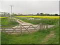
Nearby Images from Geograph Britain and Ireland:
©2013(licence)
©2013(licence)
©2013(licence)
©2014(licence)
©2010(licence)
The above images may not be of the site on this page, they are loaded from Geograph.
Please Submit an Image of this site or go out and take one for us!
Click here to see more info for this site
Nearby sites
Key: Red: member's photo, Blue: 3rd party photo, Yellow: other image, Green: no photo - please go there and take one, Grey: site destroyed
Download sites to:
KML (Google Earth)
GPX (GPS waypoints)
CSV (Garmin/Navman)
CSV (Excel)
To unlock full downloads you need to sign up as a Contributory Member. Otherwise downloads are limited to 50 sites.
Turn off the page maps and other distractions
Nearby sites listing. In the following links * = Image available
1.3km NE 36° The Junipers Tumulus* Round Barrow(s) (TR069470)
1.8km WNW 295° Pilgrims Way 8 Ancient Trackway (TR045466)
1.9km ESE 113° Broad Downs Bowl Barrow* Round Barrow(s) (TR08004520)
2.9km NNE 28° Warren Wood Saucer Barrow Round Barrow(s) (TR07444852)
3.7km E 93° Shrub's Wood Long Barrow* Long Barrow (TR09914587)
4.5km WNW 291° Plantagenet's Well* Holy Well or Sacred Spring (TR019473)
4.7km NW 325° Jackets Field Long Barrow* Long Barrow (TR03304961)
4.7km W 281° Duke's Spring* Holy Well or Sacred Spring (TR015466)
5.1km WNW 291° Pilgrims Way 7 Ancient Trackway (TR013475)
5.1km NNW 330° Kings Wood Mound* Misc. Earthwork (TR034502)
5.2km NNW 338° Kings Wood Barrow* Round Barrow(s) (TR04005060)
5.2km NE 44° Eggringe Wood Bowl Barrow Round Barrow(s) (TR09664979)
5.5km NE 48° Buckholt Farm Barrows Round Barrow(s) (TR10114972)
5.7km NE 40° Pennypot Lane Bowl Barrow* Round Barrow(s) (TR09675035)
5.7km NE 40° Eggringe Wood Western Bowl Barrow* Round Barrow(s) (TR09655041)
5.8km WNW 288° Lady Well ( East well ) Holy Well or Sacred Spring (TR006474)
6.0km NE 38° Eggringe Wood Barrow Cemetery* Barrow Cemetery (TR097507)
6.3km NE 41° Eggringe Wood Round Barrow* Round Barrow(s) (TR10155079)
6.3km NE 41° Eggringe Wood East Bowl Barrow* Round Barrow(s) (TR10115083)
6.3km NE 47° Mounts Wood Barrow Round Barrow(s) (TR10615043)
6.9km WNW 288° Pilgrims Way 6 Ancient Trackway (TQ995478)
6.9km NNE 29° Denge Wood Tumulus Round Barrow(s) (TR0933852069)
7.1km SE 129° Stowting Court Barrow Round Barrow(s) (TR11904161)
7.3km NW 309° The Lees Denehole Ancient Mine, Quarry or other Industry (TR003502)
7.4km ESE 119° Swinyard's Hill Tumulus Round Barrow(s) (TR12784255)
View more nearby sites and additional images


 We would like to know more about this location. Please feel free to add a brief description and any relevant information in your own language.
 Wir möchten mehr über diese Stätte erfahren. Bitte zögern Sie nicht, eine kurze Beschreibung und relevante Informationen in Deutsch hinzuzufügen.
 Nous aimerions en savoir encore un peu sur les lieux. S'il vous plaît n'hesitez pas à ajouter une courte description et tous les renseignements pertinents dans votre propre langue.
 Quisieramos informarnos un poco más de las lugares. No dude en añadir una breve descripción y otros datos relevantes en su propio idioma.