


<< Our Photo Pages >> Holy Well (Tawstock) - Holy Well or Sacred Spring in England in Devon
Submitted by HOLYWELL on Wednesday, 26 March 2008 Page Views: 9462
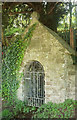
Springs and Holy WellsSite Name: Holy Well (Tawstock) Alternative Name: St. Peter's wellCountry: England
NOTE: This site is 0.36 km away from the location you searched for.
County: Devon Type: Holy Well or Sacred Spring
Nearest Village: Tawstock
Map Ref: SS553298
Latitude: 51.049270N Longitude: 4.065743W
Condition:
| 5 | Perfect |
| 4 | Almost Perfect |
| 3 | Reasonable but with some damage |
| 2 | Ruined but still recognisable as an ancient site |
| 1 | Pretty much destroyed, possibly visible as crop marks |
| 0 | No data. |
| -1 | Completely destroyed |
| 5 | Superb |
| 4 | Good |
| 3 | Ordinary |
| 2 | Not Good |
| 1 | Awful |
| 0 | No data. |
| 5 | Can be driven to, probably with disabled access |
| 4 | Short walk on a footpath |
| 3 | Requiring a bit more of a walk |
| 2 | A long walk |
| 1 | In the middle of nowhere, a nightmare to find |
| 0 | No data. |
| 5 | co-ordinates taken by GPS or official recorded co-ordinates |
| 4 | co-ordinates scaled from a detailed map |
| 3 | co-ordinates scaled from a bad map |
| 2 | co-ordinates of the nearest village |
| 1 | co-ordinates of the nearest town |
| 0 | no data |
Internal Links:
External Links:
 (PID:37654)")
First recorded in the 14th century but with hints of saxon origins. It is found by the local school and near St. Peter's church which once used its waters. It is a grade 2 listed building and was restored in 1938. Access to the water is prevented by the locked metal door and the water appears to arise in a cave like structure.
You may be viewing yesterday's version of this page. To see the most up to date information please register for a free account.
Do not use the above information on other web sites or publications without permission of the contributor.
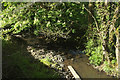
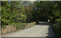
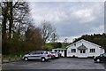
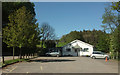
Nearby Images from Geograph Britain and Ireland:
©2019(licence)
©2019(licence)
©2016(licence)
©2019(licence)
©2019(licence)
The above images may not be of the site on this page, they are loaded from Geograph.
Please Submit an Image of this site or go out and take one for us!
Click here to see more info for this site
Nearby sites
Key: Red: member's photo, Blue: 3rd party photo, Yellow: other image, Green: no photo - please go there and take one, Grey: site destroyed
Download sites to:
KML (Google Earth)
GPX (GPS waypoints)
CSV (Garmin/Navman)
CSV (Excel)
To unlock full downloads you need to sign up as a Contributory Member. Otherwise downloads are limited to 50 sites.
Turn off the page maps and other distractions
Nearby sites listing. In the following links * = Image available
3.0km NNW 345° Dripping Well (Barnstaple)* Holy Well or Sacred Spring (SS546327)
3.2km N 8° Museum of Barnstaple and North Devon* Museum (SS5586732983)
4.4km N 359° Pilton Long Stone* Standing Stone (Menhir) (SS55313421)
4.4km N 2° Ladywell (Pilton)* Holy Well or Sacred Spring (SS556342)
5.6km NNE 15° Burridge Camp* Ancient Village or Settlement (SS569352)
6.9km WNW 295° Yelland* Multiple Stone Rows / Avenue (SS4912532889)
8.9km NNE 15° Plaistow Enclosure* Ancient Village or Settlement (SS5793038350)
9.1km SE 138° Brightley Barton Camp Hillfort (SS6124822911)
9.2km NE 39° Cunnilear Hillfort Hillfort (SS61283680)
9.5km SW 216° Berry Castle (Huntshaw Wood)* Hillfort (SS49502228)
9.5km ESE 115° St. Urith's well* Holy Well or Sacred Spring (SS638255)
9.9km NE 50° Smay's Wood Enclosure Ancient Village or Settlement (SS63033595)
10.0km NW 317° St. Brannoc's Holy Well (Braunton)* Holy Well or Sacred Spring (SS487374)
10.7km NW 321° Knowle Castle* Hillfort (SS488383)
11.2km ENE 57° Stoke Rivers fort* Ancient Village or Settlement (SS649356)
11.9km NE 43° Smythapark Hillfort Hillfort (SS63653837)
12.3km SSW 212° Coverney Well* Holy Well or Sacred Spring (SS484196)
12.4km W 267° Shell Middens at Westward Ho!* Ancient Village or Settlement (SS429294)
12.8km ENE 60° Mockham Down Camp* Hillfort (SS66683582)
12.9km S 175° Combe Wood Hillfort (SS561169)
12.9km N 354° Centery Farm Tumuli* Barrow Cemetery (SS543427)
13.3km SSW 192° Castle Hill (Woolleigh Bridge) Ancient Village or Settlement (SS5225916849)
13.3km E 93° Bremridge Wood Fort Promontory Fort / Cliff Castle (SS68602880)
13.6km ENE 58° Down Castle Enclosure Ancient Village or Settlement (SS67053664)
13.7km NNW 328° Spreacombe Fort Hillfort (SS4823641585)
View more nearby sites and additional images


 We would like to know more about this location. Please feel free to add a brief description and any relevant information in your own language.
 Wir möchten mehr über diese Stätte erfahren. Bitte zögern Sie nicht, eine kurze Beschreibung und relevante Informationen in Deutsch hinzuzufügen.
 Nous aimerions en savoir encore un peu sur les lieux. S'il vous plaît n'hesitez pas à ajouter une courte description et tous les renseignements pertinents dans votre propre langue.
 Quisieramos informarnos un poco más de las lugares. No dude en añadir una breve descripción y otros datos relevantes en su propio idioma.