<< Text Pages >> Tatchbury Mount - Hillfort in England in Hampshire
Submitted by JimChampion on Wednesday, 01 June 2005 Page Views: 12042
Iron Age and Later PrehistorySite Name: Tatchbury MountCountry: England
NOTE: This site is 1.535 km away from the location you searched for.
County: Hampshire Type: Hillfort
Nearest Town: Totton Nearest Village: Netley Marsh
Map Ref: SU330144
Latitude: 50.928114N Longitude: 1.53182W
Condition:
| 5 | Perfect |
| 4 | Almost Perfect |
| 3 | Reasonable but with some damage |
| 2 | Ruined but still recognisable as an ancient site |
| 1 | Pretty much destroyed, possibly visible as crop marks |
| 0 | No data. |
| -1 | Completely destroyed |
| 5 | Superb |
| 4 | Good |
| 3 | Ordinary |
| 2 | Not Good |
| 1 | Awful |
| 0 | No data. |
| 5 | Can be driven to, probably with disabled access |
| 4 | Short walk on a footpath |
| 3 | Requiring a bit more of a walk |
| 2 | A long walk |
| 1 | In the middle of nowhere, a nightmare to find |
| 0 | No data. |
| 5 | co-ordinates taken by GPS or official recorded co-ordinates |
| 4 | co-ordinates scaled from a detailed map |
| 3 | co-ordinates scaled from a bad map |
| 2 | co-ordinates of the nearest village |
| 1 | co-ordinates of the nearest town |
| 0 | no data |
Be the first person to rate this site - see the 'Contribute!' box in the right hand menu.
Internal Links:
External Links:
I have visited· I would like to visit
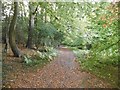
PeterParslow visited on 2nd Aug 2011 - their rating: Amb: 4 Access: 4 Most of the old psychiatric hospital is being dismantled, so there are lots of caution signs, but the footpath is still open. You can enter from the road to the north, and walk round the western side. Or enter through the subway under the Totton bypass, follow the path across a couple of fields.
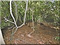
Hillfort enclosing 5 acres. The two banks are about 4m high and on the west side there is a smaller bank between the main ones. The hillfort was landscaped as part of an ornamental garden in the 19th century and it is now home to (and gives its name to) the Tatchbury Mount psychiatric hospital.
You may be viewing yesterday's version of this page. To see the most up to date information please register for a free account.
Do not use the above information on other web sites or publications without permission of the contributor.
Nearby Images from Geograph Britain and Ireland:

©2015(licence)

©2010(licence)
©2015(licence)

©2015(licence)
©2015(licence)
The above images may not be of the site on this page, they are loaded from Geograph.
Please Submit an Image of this site or go out and take one for us!
Click here to see more info for this site
Nearby sites
Key: Red: member's photo, Blue: 3rd party photo, Yellow: other image, Green: no photo - please go there and take one, Grey: site destroyed
Download sites to:
KML (Google Earth)
GPX (GPS waypoints)
CSV (Garmin/Navman)
CSV (Excel)
To unlock full downloads you need to sign up as a Contributory Member. Otherwise downloads are limited to 50 sites.
Turn off the page maps and other distractions
Nearby sites listing. In the following links * = Image available
1.4km WNW 298° Money Hills Barrow Cemetery (SU31771505)
1.8km NE 52° Testwood Lakes* Museum (SU344155)
4.8km WNW 290° Stagbury Hill* Barrow Cemetery (SU285160)
5.7km WSW 246° Malwood Castle Hillfort (SU278121)
5.9km S 175° Ashurst Lodge Earthworks* Misc. Earthwork (SU336085)
6.2km S 175° Matley Heath* Round Barrow(s) (SU336082)
6.5km NW 309° Plaitford Barrow* Round Barrow(s) (SU27901852)
6.7km NE 51° Toothill Camp* Hillfort (SU38151865)
6.9km SSE 152° Longdown (New Forest) tumuli* Round Barrow(s) (SU363083)
6.9km SSW 206° New Forest Museum* Museum (SU30020813)
7.9km ENE 72° Castle Hill (Southampton)* Misc. Earthwork (SU40571688)
8.2km WNW 302° Landford Common Tumulus* Round Barrow(s) (SU260187)
8.3km W 279° Black Bush Plain* Barrow Cemetery (SU248157)
8.4km SSE 160° Yew Tree Heath* Round Barrow(s) (SU3589506556)
8.6km W 266° Fritham Butt* Round Barrow(s) (SU244138)
8.7km ENE 73° Chilworth Ring* Hillfort (SU413170)
8.8km N 349° Dunwood Camp Hillfort (SU313230)
9.0km WNW 295° Hamptworth Common Tumulus* Round Barrow(s) (SU248182)
9.0km SE 142° Ipley Cross* Round Barrow(s) (SU38670735)
9.6km SE 142° The Dibden-Lynch Bottom Ring Henge
9.9km SE 138° Tricia's Tor* Barrow Cemetery (SU3960807074)
9.9km SSE 166° Deny Lodge Cattle Pen* Artificial Mound (SU3548404771)
9.9km SSE 147° Dibden Bottom* Barrow Cemetery (SU385061)
10.0km W 272° Irons Well (Eyeworth)* Holy Well or Sacred Spring (SU22931476)
10.2km SE 141° Darcy Island* Round Barrow(s) (SU39520654)
View more nearby sites and additional images


 We would like to know more about this location. Please feel free to add a brief description and any relevant information in your own language.
 Wir möchten mehr über diese Stätte erfahren. Bitte zögern Sie nicht, eine kurze Beschreibung und relevante Informationen in Deutsch hinzuzufügen.
 Nous aimerions en savoir encore un peu sur les lieux. S'il vous plaît n'hesitez pas à ajouter une courte description et tous les renseignements pertinents dans votre propre langue.
 Quisieramos informarnos un poco más de las lugares. No dude en añadir una breve descripción y otros datos relevantes en su propio idioma.