

<< Text Pages >> Arundel Park Enclosure - Ancient Village or Settlement in England in West Sussex
Submitted by coldrum on Thursday, 26 November 2020 Page Views: 1067
Multi-periodSite Name: Arundel Park EnclosureCountry: England
NOTE: This site is 1.628 km away from the location you searched for.
County: West Sussex Type: Ancient Village or Settlement
Nearest Town: Arundel
Map Ref: TQ01400855
Latitude: 50.867572N Longitude: 0.560409W
Condition:
| 5 | Perfect |
| 4 | Almost Perfect |
| 3 | Reasonable but with some damage |
| 2 | Ruined but still recognisable as an ancient site |
| 1 | Pretty much destroyed, possibly visible as crop marks |
| 0 | No data. |
| -1 | Completely destroyed |
| 5 | Superb |
| 4 | Good |
| 3 | Ordinary |
| 2 | Not Good |
| 1 | Awful |
| 0 | No data. |
| 5 | Can be driven to, probably with disabled access |
| 4 | Short walk on a footpath |
| 3 | Requiring a bit more of a walk |
| 2 | A long walk |
| 1 | In the middle of nowhere, a nightmare to find |
| 0 | No data. |
| 5 | co-ordinates taken by GPS or official recorded co-ordinates |
| 4 | co-ordinates scaled from a detailed map |
| 3 | co-ordinates scaled from a bad map |
| 2 | co-ordinates of the nearest village |
| 1 | co-ordinates of the nearest town |
| 0 | no data |
Be the first person to rate this site - see the 'Contribute!' box in the right hand menu.
Internal Links:
External Links:
Ancient Village or Settlement in West Sussex. From Heritage Gateway:
"Iron Age - Romano-British Enclosure within Arundel Park."
https://www.heritagegateway.org.uk/Gateway/Results_Single.aspx?uid=MWS2696&resourceID=1032
You may be viewing yesterday's version of this page. To see the most up to date information please register for a free account.
Do not use the above information on other web sites or publications without permission of the contributor.
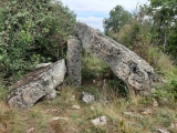
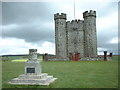
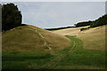
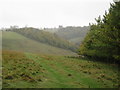
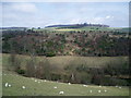
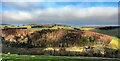
Nearby Images from Geograph Britain and Ireland:
©2005(licence)
©2016(licence)
©2009(licence)
©2009(licence)
©2020(licence)
The above images may not be of the site on this page, they are loaded from Geograph.
Please Submit an Image of this site or go out and take one for us!
Click here to see more info for this site
Nearby sites
Key: Red: member's photo, Blue: 3rd party photo, Yellow: other image, Green: no photo - please go there and take one, Grey: site destroyed
Download sites to:
KML (Google Earth)
GPX (GPS waypoints)
CSV (Garmin/Navman)
CSV (Excel)
To unlock full downloads you need to sign up as a Contributory Member. Otherwise downloads are limited to 50 sites.
Turn off the page maps and other distractions
Nearby sites listing. In the following links * = Image available
56m NW 316° Arundel Barrow MWS2707 Round Barrow(s) (TQ01360859)
141m W 263° Arundel Park Ditched Bowl Barrow Round Barrow(s) (TQ01260853)
488m NNW 338° Prehistoric and Roman Field System and Earthworks Misc. Earthwork (TQ01210900)
524m NNW 338° Arundel Park Barrow MWS6559 Round Barrow(s) (TQ01190903)
576m NNW 341° Arundel Barrow MWS14523 Round Barrow(s) (TQ01200909)
708m NNW 348° Arundel Park Barrow MWS14520 Round Barrow(s) (TQ01240924)
725m N 354° Arundel Park Barrow MWS14778 Round Barrow(s) (TQ01310927)
730m N 0° Arundel Park Settlements Ancient Village or Settlement (TQ01390928)
733m N 350° Arundel Park Barrow MWS14521 Round Barrow(s) (TQ01260927)
1.0km N 359° Arundel Park Barrow MWS14784 Round Barrow(s) (TQ01360957)
1.8km WNW 282° Late Prehistoric and Roman Field systems Misc. Earthwork (SU99640888)
2.0km NNW 326° War Dyke and Prehistoric Enclosure Misc. Earthwork (TQ00251020)
2.0km NNW 336° South Wood Cross Dyke Misc. Earthwork (TQ00541040)
2.5km E 91° Burpham Camp Hillfort (TQ03920854)
2.5km E 91° Burpham Camp Hillfort (TQ03920854)
2.7km NNW 335° Cross Dyke, Whiteways Misc. Earthwork (TQ00201101)
3.2km WSW 254° Goblestubbs Copse earthworks Ancient Village or Settlement (SU983076)
3.7km NNW 342° Bury Hill (West Sussex) Causewayed Enclosure (TQ002120)
4.3km WNW 292° Prehistoric to Roman Field System Misc. Earthwork (SU97391005)
4.3km E 80° Norfolk Clump Tumulus Round Barrow(s) (TQ056094)
4.6km NNE 32° Highdown Tumulus Round Barrow(s) (TQ038125)
4.8km NE 41° Amberley Mount Field System Misc. Earthwork (TQ045122)
4.8km NE 38° Amberley Mount Tumuli Barrow Cemetery (TQ043124)
4.9km ENE 74° Wepham Down Earthwork* Misc. Earthwork (TQ06141001)
5.1km NW 320° Barkhale Tumulus* Round Barrow(s) (SU980124)
View more nearby sites and additional images


 We would like to know more about this location. Please feel free to add a brief description and any relevant information in your own language.
 Wir möchten mehr über diese Stätte erfahren. Bitte zögern Sie nicht, eine kurze Beschreibung und relevante Informationen in Deutsch hinzuzufügen.
 Nous aimerions en savoir encore un peu sur les lieux. S'il vous plaît n'hesitez pas à ajouter une courte description et tous les renseignements pertinents dans votre propre langue.
 Quisieramos informarnos un poco más de las lugares. No dude en añadir una breve descripción y otros datos relevantes en su propio idioma.