 with our Megalithic Portal iPhone app")


<< Text Pages >> Telscombe Cross Dyke - Misc. Earthwork in England in East Sussex
Submitted by jfarrar on Wednesday, 21 May 2014 Page Views: 3075
Multi-periodSite Name: Telscombe Cross DykeCountry: England
NOTE: This site is 1.644 km away from the location you searched for.
County: East Sussex Type: Misc. Earthwork
Nearest Town: Brighton Nearest Village: Telscombe
Map Ref: TQ402029
Latitude: 50.808696N Longitude: 0.011501W
Condition:
| 5 | Perfect |
| 4 | Almost Perfect |
| 3 | Reasonable but with some damage |
| 2 | Ruined but still recognisable as an ancient site |
| 1 | Pretty much destroyed, possibly visible as crop marks |
| 0 | No data. |
| -1 | Completely destroyed |
| 5 | Superb |
| 4 | Good |
| 3 | Ordinary |
| 2 | Not Good |
| 1 | Awful |
| 0 | No data. |
| 5 | Can be driven to, probably with disabled access |
| 4 | Short walk on a footpath |
| 3 | Requiring a bit more of a walk |
| 2 | A long walk |
| 1 | In the middle of nowhere, a nightmare to find |
| 0 | No data. |
| 5 | co-ordinates taken by GPS or official recorded co-ordinates |
| 4 | co-ordinates scaled from a detailed map |
| 3 | co-ordinates scaled from a bad map |
| 2 | co-ordinates of the nearest village |
| 1 | co-ordinates of the nearest town |
| 0 | no data |
Internal Links:
External Links:
Misc. Earthwork in East Sussex
The monument includes the surviving earthworks of a cross dyke which runs
across a ridge of the Sussex Downs, around 2km north of the present coastline.
The cross dyke, which falls into two areas, is a north east-south west aligned
ditch, measuring up to 6m wide and 0.75m deep, with a total length of c.290m.
This is flanked on its south eastern side by a large bank 6.5m wide, surviving
to a height of c.2m. Around 80m from its north eastern end, a small section of
the earthworks, and an associated Bronze Age bowl barrow, were levelled by
the construction of a covered water reservoir in 1909, and this area is
therefore excluded from the scheduling. The monument has also been partially
disturbed by the insertion of an associated water main along the length of the
ditch. A gap of 14m in the earthworks around 185m from the north eastern end
is interpreted as an original feature, with the continuation of the earthworks
to the south west showing a slight change of alignment. Aerial photographs
show that the cross dyke continues towards the south west from the south
western end of the monument as a below ground feature. This section has,
however, been levelled by modern ploughing and bulldozing, and is
therefore not included in the scheduling.
The modern fences which cross the monument are excluded from the scheduling,
as are the water main markers situated on the bank of the cross dyke although
the ground beneath these features is included.
(Text by English Heritage)
You may be viewing yesterday's version of this page. To see the most up to date information please register for a free account.
Do not use the above information on other web sites or publications without permission of the contributor.
Nearby Images from Geograph Britain and Ireland:

©2012(licence)

©2012(licence)

©2021(licence)

©2012(licence)
©2011(licence)
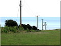
The above images may not be of the site on this page, they are loaded from Geograph.
Please Submit an Image of this site or go out and take one for us!
Click here to see more info for this site
Nearby sites
Key: Red: member's photo, Blue: 3rd party photo, Yellow: other image, Green: no photo - please go there and take one, Grey: site destroyed
Download sites to:
KML (Google Earth)
GPX (GPS waypoints)
CSV (Garmin/Navman)
CSV (Excel)
To unlock full downloads you need to sign up as a Contributory Member. Otherwise downloads are limited to 50 sites.
Turn off the page maps and other distractions
Nearby sites listing. In the following links * = Image available
669m WSW 245° Pedlersburgh* Round Barrow(s) (TQ396026)
3.1km WSW 257° Hangman's Stone (Rottingdean ) Marker Stone (TQ372021)
3.8km W 269° Beacon Hill Tumuli Barrow Cemetery (TQ364027)
4.0km SE 135° Peacehaven Heights* Round Barrow(s) (TQ431002)
4.6km ENE 63° Pook's Dyke Misc. Earthwork (TQ44270507)
5.1km ENE 63° Itford Hill Ancient Village or Settlement (TQ447053)
5.2km N 354° The Gurdy Stone* Modern Stone Circle etc (TQ3948408002)
5.3km SE 125° Castle Hill (East Sussex) Hillfort (TQ446000)
7.2km NNE 32° Ranscombe Camp* Ancient Village or Settlement (TQ438091)
7.4km NE 37° The Caburn* Hillfort (TQ445089)
7.4km WNW 286° Whitehawk* Causewayed Enclosure (TQ33030477)
7.5km ENE 75° Lord’s Burghs Tumuli Barrow Cemetery (TQ474051)
7.5km NW 322° Stones around Falmer Village Pump Natural Stone / Erratic / Other Natural Feature (TQ354087)
7.8km ENE 68° Firle Plantation Tumuli* Barrow Cemetery (TQ474060)
7.8km NNE 30° Oxteddle Bottom Field System. Misc. Earthwork (TQ439098)
8.0km NNE 27° The Bible Earthwork Misc. Earthwork (TQ437101)
8.2km E 87° Five Lord's Burgh Tumulus Round Barrow(s) (TQ484035)
8.5km NNE 19° Malling Hill Field System Misc. Earthwork (TQ427110)
8.5km NNE 23° Cliffe Hill Tumuli Round Barrow(s) (TQ433108)
8.6km E 93° Blackstone Bottom Tumuli Barrow Cemetery (TQ488027)
8.6km NNE 31° Oxteddle Bottom Barrow Cemetery (TQ444104)
8.6km NNE 21° Malling Hill Long Barrow* Long Barrow (TQ4311810996)
8.7km ENE 72° Firle Beacon Long Barrow* Long Barrow (TQ484058)
8.7km E 82° Bostal Bottom Tumuli Barrow Cemetery (TQ488043)
8.8km N 360° Offham Hill* Causewayed Enclosure (TQ399117)
View more nearby sites and additional images


 We would like to know more about this location. Please feel free to add a brief description and any relevant information in your own language.
 Wir möchten mehr über diese Stätte erfahren. Bitte zögern Sie nicht, eine kurze Beschreibung und relevante Informationen in Deutsch hinzuzufügen.
 Nous aimerions en savoir encore un peu sur les lieux. S'il vous plaît n'hesitez pas à ajouter une courte description et tous les renseignements pertinents dans votre propre langue.
 Quisieramos informarnos un poco más de las lugares. No dude en añadir una breve descripción y otros datos relevantes en su propio idioma.