


<< Our Photo Pages >> Longstone Farm - Stone Row / Alignment in England in Cornwall
Submitted by SandyG on Tuesday, 01 October 2002 Page Views: 4664
Neolithic and Bronze AgeSite Name: Longstone FarmCountry: England
NOTE: This site is 2.219 km away from the location you searched for.
County: Cornwall Type: Stone Row / Alignment
Nearest Town: Launceston Nearest Village: Tregada / Dunterton
Map Ref: SX36218033 Landranger Map Number: 201
Latitude: 50.599649N Longitude: 4.315757W
Condition:
| 5 | Perfect |
| 4 | Almost Perfect |
| 3 | Reasonable but with some damage |
| 2 | Ruined but still recognisable as an ancient site |
| 1 | Pretty much destroyed, possibly visible as crop marks |
| 0 | No data. |
| -1 | Completely destroyed |
| 5 | Superb |
| 4 | Good |
| 3 | Ordinary |
| 2 | Not Good |
| 1 | Awful |
| 0 | No data. |
| 5 | Can be driven to, probably with disabled access |
| 4 | Short walk on a footpath |
| 3 | Requiring a bit more of a walk |
| 2 | A long walk |
| 1 | In the middle of nowhere, a nightmare to find |
| 0 | No data. |
| 5 | co-ordinates taken by GPS or official recorded co-ordinates |
| 4 | co-ordinates scaled from a detailed map |
| 3 | co-ordinates scaled from a bad map |
| 2 | co-ordinates of the nearest village |
| 1 | co-ordinates of the nearest town |
| 0 | no data |
Internal Links:
External Links:
")
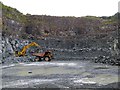
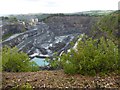
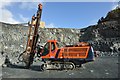
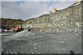
Update November 2019: This now destroyed row is featured on the Stone Rows of Great Britain website - see their entry for Longstone Farm. The SRoGB describes the row as having measured 70m, and included three large orthostats. The stones were "recorded immediately before their removal in 1981". The SRoGB includes a plan of the row, provided by the National Mapping Programme (Cornwall Council) and gives a link to HER 37154 (LONGSTONE - Bronze Age stone alignment). The area was bulldozed in 1981 to make way for a quarry.
You may be viewing yesterday's version of this page. To see the most up to date information please register for a free account.
")
")
Do not use the above information on other web sites or publications without permission of the contributor.
Nearby Images from Geograph Britain and Ireland:
©2015(licence)

©2015(licence)
©2015(licence)
©2013(licence)
©2013(licence)
The above images may not be of the site on this page, they are loaded from Geograph.
Please Submit an Image of this site or go out and take one for us!
Click here to see more info for this site
Nearby sites
Key: Red: member's photo, Blue: 3rd party photo, Yellow: other image, Green: no photo - please go there and take one, Grey: site destroyed
Download sites to:
KML (Google Earth)
GPX (GPS waypoints)
CSV (Garmin/Navman)
CSV (Excel)
To unlock full downloads you need to sign up as a Contributory Member. Otherwise downloads are limited to 50 sites.
![]()
Turn off the page maps and other distractions
Nearby sites listing. In the following links * = Image available
821m S 175° Castle Park Hill Camp* Ancient Village or Settlement (SX36257951)
1.4km WSW 237° St Brigid's Well Holy Well or Sacred Spring (SX350796)
1.9km SSE 159° Woodtown Camp Ancient Village or Settlement (SX36827857)
2.3km SE 143° Carthamartha Cist Cist (SX37577844)
2.5km SE 131° Castle Head Promontory Fort Promontory Fort / Cliff Castle (SX38087863)
2.6km SE 142° Carthamartha Fort Hillfort (SX37747824)
2.6km WSW 242° St Michael's Well (Lezant)* Holy Well or Sacred Spring
2.7km S 181° Rezare Holy Well* Holy Well or Sacred Spring (SX3607977615)
3.0km SE 137° Dunterue wood Enclosure Ancient Village or Settlement (SX38217805)
5.2km NNE 29° Lifton Holy Well Holy Well or Sacred Spring (SX389848)
5.6km NW 321° Maiden's Well (Launceston) Holy Well or Sacred Spring (SX32858477)
6.1km E 93° Ramsdown Camp Ancient Village or Settlement (SX42327982)
6.6km NNW 335° Smallacoombe Wood Round Ancient Village or Settlement (SX33628636)
6.6km NE 37° Lifton Camp Ancient Village or Settlement (SX40378547)
6.8km NW 320° St Stephen's Well* Holy Well or Sacred Spring (SX320857)
7.2km NNW 329° Werrington Park Round Ancient Village or Settlement (SX32668665)
7.7km WSW 249° Rings Camp Hillfort (SX28957780)
7.8km SSW 211° Linkinhorne Round* Ancient Village or Settlement (SX31927376)
8.3km SSW 209° St Melor's Well* Holy Well or Sacred Spring (SX319732)
8.4km SSW 201° South Hill Inscribed Stone* Standing Stone (Menhir) (SX3289072618)
8.4km WNW 299° Kestle Rings Hillfort (SX28958463)
8.6km SSW 195° Lower Manaton Holy Well or Sacred Spring (SX3377072033)
8.7km W 271° Lewannick* Sculptured Stone (SX275807)
8.8km W 271° Blaunder's Well* Holy Well or Sacred Spring (SX274807)
8.9km W 273° Swearing Cross Ancient Cross (SX27368113)
View more nearby sites and additional images


 We would like to know more about this location. Please feel free to add a brief description and any relevant information in your own language.
 Wir möchten mehr über diese Stätte erfahren. Bitte zögern Sie nicht, eine kurze Beschreibung und relevante Informationen in Deutsch hinzuzufügen.
 Nous aimerions en savoir encore un peu sur les lieux. S'il vous plaît n'hesitez pas à ajouter une courte description et tous les renseignements pertinents dans votre propre langue.
 Quisieramos informarnos un poco más de las lugares. No dude en añadir una breve descripción y otros datos relevantes en su propio idioma.