<< Our Photo Pages >> Marterstein Sonneberg - Standing Stone (Menhir) in Germany in Thuringia
Submitted by KaiHofmann on Friday, 20 September 2013 Page Views: 2064
Neolithic and Bronze AgeSite Name: Marterstein SonnebergCountry: Germany
NOTE: This site is 8.734 km away from the location you searched for.
Land: Thuringia Type: Standing Stone (Menhir)
Nearest Town: Sonneberg
Latitude: 50.355670N Longitude: 11.185068E
Condition:
| 5 | Perfect |
| 4 | Almost Perfect |
| 3 | Reasonable but with some damage |
| 2 | Ruined but still recognisable as an ancient site |
| 1 | Pretty much destroyed, possibly visible as crop marks |
| 0 | No data. |
| -1 | Completely destroyed |
| 5 | Superb |
| 4 | Good |
| 3 | Ordinary |
| 2 | Not Good |
| 1 | Awful |
| 0 | No data. |
| 5 | Can be driven to, probably with disabled access |
| 4 | Short walk on a footpath |
| 3 | Requiring a bit more of a walk |
| 2 | A long walk |
| 1 | In the middle of nowhere, a nightmare to find |
| 0 | No data. |
| 5 | co-ordinates taken by GPS or official recorded co-ordinates |
| 4 | co-ordinates scaled from a detailed map |
| 3 | co-ordinates scaled from a bad map |
| 2 | co-ordinates of the nearest village |
| 1 | co-ordinates of the nearest town |
| 0 | no data |
Internal Links:
External Links:
I have visited· I would like to visit
Klingon visited on 20th Oct 2020 - their rating: Cond: 4 Amb: 3 Access: 5
")
A small standing stone with 3 cup marks on it.
You may be viewing yesterday's version of this page. To see the most up to date information please register for a free account.
")
Do not use the above information on other web sites or publications without permission of the contributor.
Nearby Images from Flickr
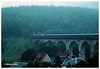
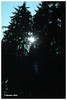

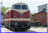
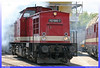
The above images may not be of the site on this page, but were taken nearby. They are loaded from Flickr so please click on them for image credits.
Click here to see more info for this site
Nearby sites
Click here to view sites on an interactive map of the areaKey: Red: member's photo, Blue: 3rd party photo, Yellow: other image, Green: no photo - please go there and take one, Grey: site destroyed
Download sites to:
KML (Google Earth)
GPX (GPS waypoints)
CSV (Garmin/Navman)
CSV (Excel)
To unlock full downloads you need to sign up as a Contributory Member. Otherwise downloads are limited to 50 sites.
Turn off the page maps and other distractions
Nearby sites listing. In the following links * = Image available
14.7km NW 306° Herrenberg Wallanlage Causewayed Enclosure
16.4km NW 308° Bleß Wallanlage* Causewayed Enclosure
24.6km SSE 149° Schamelstein Sculptured Stone
26.9km W 266° Poststein Rock Art
28.8km E 87° Zwölf Apostel* Stone Row / Alignment
28.8km SW 218° Püchitz Neolithic Village Ancient Village or Settlement
30.1km W 260° Saarbach Hünengrab Not Known (by us)
31.4km SSW 201° Staffelberg* Hillfort
33.0km NNE 26° Teufelsbruecke Obernitz Cave or Rock Shelter
33.6km NNW 346° Bärenkeller Garsitz Cave or Rock Shelter
38.0km SSE 162° Turmberg Hillfort Hillfort
39.4km NNE 16° Weinberg Oberpreilipp Ancient Village or Settlement
40.0km NE 35° Clythenhöhle Cave or Rock Shelter
42.4km W 277° Steinsburgmuseum* Museum
42.4km W 280° Steinsburg Grabhügel (4) Round Barrow(s)
42.5km W 278° Steinsburg* Hillfort
42.5km W 281° Steinsburg Grabhügel (3) Round Barrow(s)
42.6km W 280° Grabhügel am Schwarzen Stock (2)* Round Barrow(s)
42.8km W 280° Grabhügel am Schwarzen Stock (1)* Round Barrow(s)
42.8km W 277° Steinsburg Grabhügel (2) Round Barrow(s)
43.3km NE 37° Herthahöhle Cave or Rock Shelter
43.4km NE 37° Herdloch Ranis Cave or Rock Shelter
43.4km NE 38° Ilsenhöhle* Cave or Rock Shelter
43.5km W 277° Steinsburg Grabhügel (1) Round Barrow(s)
43.9km NE 36° Binsenberg Ancient Village or Settlement
View more nearby sites and additional images


 We would like to know more about this location. Please feel free to add a brief description and any relevant information in your own language.
 Wir möchten mehr über diese Stätte erfahren. Bitte zögern Sie nicht, eine kurze Beschreibung und relevante Informationen in Deutsch hinzuzufügen.
 Nous aimerions en savoir encore un peu sur les lieux. S'il vous plaît n'hesitez pas à ajouter une courte description et tous les renseignements pertinents dans votre propre langue.
 Quisieramos informarnos un poco más de las lugares. No dude en añadir una breve descripción y otros datos relevantes en su propio idioma.