<< Our Photo Pages >> High Hill hillfort - Hillfort in Czech Republic in Bohemia
Submitted by ladrin on Saturday, 13 November 2021 Page Views: 462
Iron Age and Later PrehistorySite Name: High Hill hillfort Alternative Name: Hradiště na Vysokém VrchuCountry: Czech Republic
NOTE: This site is 5.954 km away from the location you searched for.
Region: Bohemia Type: Hillfort
Nearest Town: Kladno Nearest Village: Malé Kyšice
Latitude: 50.058811N Longitude: 14.064900E
Condition:
| 5 | Perfect |
| 4 | Almost Perfect |
| 3 | Reasonable but with some damage |
| 2 | Ruined but still recognisable as an ancient site |
| 1 | Pretty much destroyed, possibly visible as crop marks |
| 0 | No data. |
| -1 | Completely destroyed |
| 5 | Superb |
| 4 | Good |
| 3 | Ordinary |
| 2 | Not Good |
| 1 | Awful |
| 0 | No data. |
| 5 | Can be driven to, probably with disabled access |
| 4 | Short walk on a footpath |
| 3 | Requiring a bit more of a walk |
| 2 | A long walk |
| 1 | In the middle of nowhere, a nightmare to find |
| 0 | No data. |
| 5 | co-ordinates taken by GPS or official recorded co-ordinates |
| 4 | co-ordinates scaled from a detailed map |
| 3 | co-ordinates scaled from a bad map |
| 2 | co-ordinates of the nearest village |
| 1 | co-ordinates of the nearest town |
| 0 | no data |
Internal Links:
External Links:

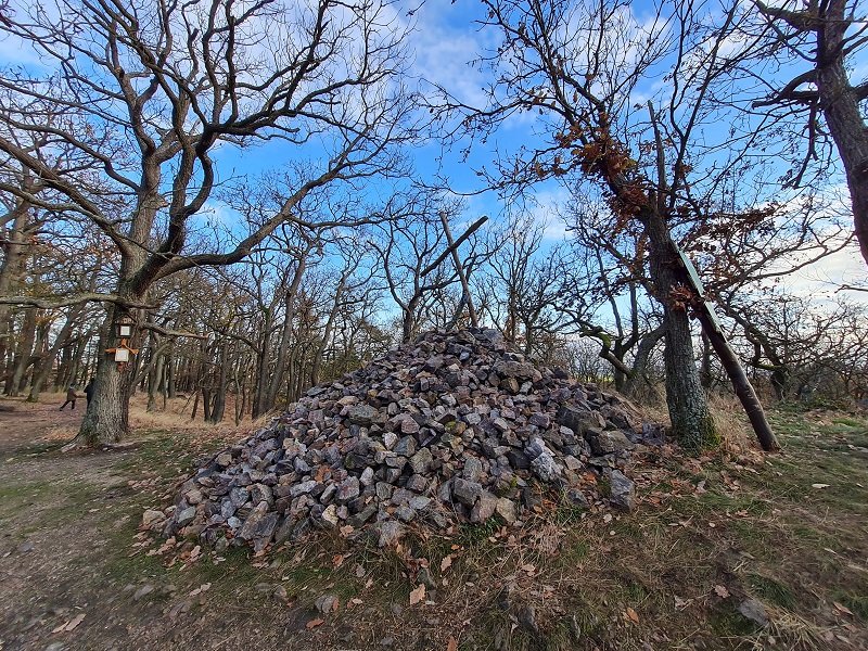
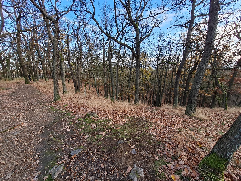
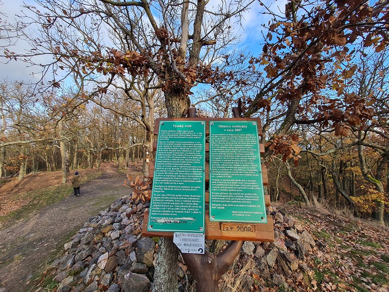
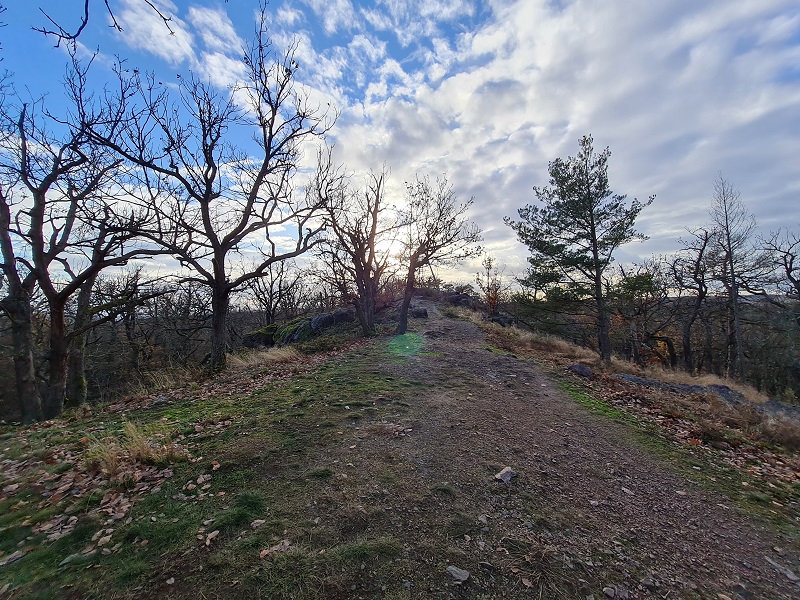
Remains of the Bronze Age hillfort can be still recognized on a rocky top of the distinctive hill west of Prague city. So called Vysoký vrch (simply High Hill) has altitude of 486m and is a nice place to visit, mainly because of amazing views. Eespecially from the newly built wooden lookout.
An intensive archeological survey started in 1961 and confirmed the presence of the Celtic element dated from the Younger Bronze Age till the Early La Tène period. Sporadic traces the later Slavic settlement was also confirmed.
The hillfort itself was more likely small in size, covering 1,5ha and because of rather modest archeological findings is assumed mainly guard purpose of the place. Fortress had roughly square shape and ist stony ramparts were 275 cm heigh. Apart from pottery shreds a good amount of river pebbles was found here, which sould served as the slinger ammunition perhaps.
You may be viewing yesterday's version of this page. To see the most up to date information please register for a free account.


Do not use the above information on other web sites or publications without permission of the contributor.
Nearby Images from Flickr


The above images may not be of the site on this page, but were taken nearby. They are loaded from Flickr so please click on them for image credits.
Click here to see more info for this site
Nearby sites
Click here to view sites on an interactive map of the areaKey: Red: member's photo, Blue: 3rd party photo, Yellow: other image, Green: no photo - please go there and take one, Grey: site destroyed
Download sites to:
KML (Google Earth)
GPX (GPS waypoints)
CSV (Garmin/Navman)
CSV (Excel)
To unlock full downloads you need to sign up as a Contributory Member. Otherwise downloads are limited to 50 sites.
Turn off the page maps and other distractions
Nearby sites listing. In the following links * = Image available
1.1km W 281° Žlábek holy well (Hollow)* Holy Well or Sacred Spring
4.1km W 281° Bratronice Menhir* Standing Stone (Menhir)
5.0km NW 310° Lhota Stone* Standing Stone (Menhir)
5.1km W 266° Belec* Standing Stone (Menhir)
5.3km NNW 346° Družec Menhir* Standing Stone (Menhir)
6.0km N 9° Velká Dobrá Stone* Standing Stone (Menhir)
6.3km WNW 298° Spanilá hůrka (Graceful height)* Round Barrow(s)
6.5km N 3° Barrow Cemetery Hora (The Hill)* Barrow Cemetery
8.2km NNW 337° Saint Roch Stone* Rock Outcrop
8.5km SSW 212° Oppidum Stradonice* Hillfort
8.6km SSW 213° Stradonice Menhir* Standing Stone (Menhir)
10.3km NNW 330° Tuchlovice Cross Stone* Ancient Cross
10.3km NNW 328° Tuchlovice Menhir* Standing Stone (Menhir)
10.5km WSW 256° Rosalia Well* Holy Well or Sacred Spring
11.0km W 267° Zbečno standing stone* Standing Stone (Menhir)
11.1km SSE 152° St. John Rock* Cave or Rock Shelter
11.1km SSE 154° Svatý Jan pod Skalou* Holy Well or Sacred Spring
11.2km SSE 154° St. Ivan Stone* Sculptured Stone
12.5km SSE 166° Turské Maštale Caves* Cave or Rock Shelter
12.5km SSE 167° Tetín cross and old slavic burial stones* Ancient Cross
12.5km SSE 167° St. Ludmila Stone* Standing Stone (Menhir)
12.6km SSE 166° Hillfort Tetín* Hillfort
13.2km N 8° Vinařice Menhir* Standing Stone (Menhir)
13.7km NNW 343° Smečno Menhir* Standing Stone (Menhir)
14.7km SSE 165° Koda.* Cave or Rock Shelter
View more nearby sites and additional images


 We would like to know more about this location. Please feel free to add a brief description and any relevant information in your own language.
 Wir möchten mehr über diese Stätte erfahren. Bitte zögern Sie nicht, eine kurze Beschreibung und relevante Informationen in Deutsch hinzuzufügen.
 Nous aimerions en savoir encore un peu sur les lieux. S'il vous plaît n'hesitez pas à ajouter une courte description et tous les renseignements pertinents dans votre propre langue.
 Quisieramos informarnos un poco más de las lugares. No dude en añadir una breve descripción y otros datos relevantes en su propio idioma.