<< Our Photo Pages >> Neubürg - Ancient Village or Settlement in Germany in Bavaria
Submitted by Klingon on Sunday, 09 June 2019 Page Views: 532
Multi-periodSite Name: NeubürgCountry: Germany
NOTE: This site is 16.082 km away from the location you searched for.
Land: Bavaria Type: Ancient Village or Settlement
Nearest Town: Bayreuth Nearest Village: Wohnsgehaig
Latitude: 49.891184N Longitude: 11.401572E
Condition:
| 5 | Perfect |
| 4 | Almost Perfect |
| 3 | Reasonable but with some damage |
| 2 | Ruined but still recognisable as an ancient site |
| 1 | Pretty much destroyed, possibly visible as crop marks |
| 0 | No data. |
| -1 | Completely destroyed |
| 5 | Superb |
| 4 | Good |
| 3 | Ordinary |
| 2 | Not Good |
| 1 | Awful |
| 0 | No data. |
| 5 | Can be driven to, probably with disabled access |
| 4 | Short walk on a footpath |
| 3 | Requiring a bit more of a walk |
| 2 | A long walk |
| 1 | In the middle of nowhere, a nightmare to find |
| 0 | No data. |
| 5 | co-ordinates taken by GPS or official recorded co-ordinates |
| 4 | co-ordinates scaled from a detailed map |
| 3 | co-ordinates scaled from a bad map |
| 2 | co-ordinates of the nearest village |
| 1 | co-ordinates of the nearest town |
| 0 | no data |
Internal Links:
External Links:
I have visited· I would like to visit
Klingon visited on 1st Jun 2019 - their rating: Cond: -1 Amb: 5 Access: 4
")
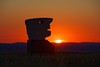
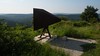
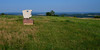
The Neubürg, a flat-topped mount in the Franconian Jura, was settled for the first time 12.000 years ago. Today, modern works of art by various artists are exhibited in the area.
You may be viewing yesterday's version of this page. To see the most up to date information please register for a free account.
")
")
")
Do not use the above information on other web sites or publications without permission of the contributor.
Nearby Images from Flickr
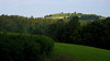

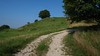
The above images may not be of the site on this page, but were taken nearby. They are loaded from Flickr so please click on them for image credits.
Click here to see more info for this site
Nearby sites
Click here to view sites on an interactive map of the areaKey: Red: member's photo, Blue: 3rd party photo, Yellow: other image, Green: no photo - please go there and take one, Grey: site destroyed
Download sites to:
KML (Google Earth)
GPX (GPS waypoints)
CSV (Garmin/Navman)
CSV (Excel)
To unlock full downloads you need to sign up as a Contributory Member. Otherwise downloads are limited to 50 sites.
Turn off the page maps and other distractions
Nearby sites listing. In the following links * = Image available
15.3km SSW 209° Esperhöhle Leutzdorf Cave or Rock Shelter
15.8km WSW 237° Langenstein Streitberg Natural Stone / Erratic / Other Natural Feature
16.0km NNW 347° Turmberg Hillfort Hillfort
22.7km W 278° Jungfernhoehle (Virgin's cave)* Cave or Rock Shelter
26.1km SW 223° Walberla* Hillfort
28.0km SSE 166° Felsenloch Plech Cave or Rock Shelter
28.1km W 272° Lietzendorf Grabhügel Barrow Cemetery
30.6km N 355° Schamelstein Sculptured Stone
31.3km SSE 153° Rabenfels Natural Stone / Erratic / Other Natural Feature
31.6km SSE 155° Maximilianshoehle* Cave or Rock Shelter
35.0km NW 310° Staffelberg* Hillfort
36.2km SW 225° Mark-forst Grabhügel Artificial Mound
37.2km W 270° Historisches Museum Bamberg* Museum
39.9km SSE 164° Dürrnberghöhlen* Cave or Rock Shelter
40.5km SSE 164° Starenfelshöhle* Cave or Rock Shelter
40.9km SSE 165° Neutrasfelsen Natural Stone / Erratic / Other Natural Feature
41.7km W 281° Bamberg Cave Rock Art
41.9km S 170° Wallanlage Windburg Hillfort
43.5km ENE 73° Großer Haberstein* Rock Outcrop
43.9km NW 311° Püchitz Neolithic Village Ancient Village or Settlement
44.6km SSW 206° Kraftshofer Forst* Round Barrow(s)
44.7km S 173° Houbirg* Causewayed Enclosure
45.4km NE 50° Hoher Stein Fichtelgebirge Natural Stone / Erratic / Other Natural Feature
45.4km SE 141° Hahnbacher Teufelstein Natural Stone / Erratic / Other Natural Feature
45.7km S 172° Hohler Fels Houbirg* Cave or Rock Shelter
View more nearby sites and additional images


 We would like to know more about this location. Please feel free to add a brief description and any relevant information in your own language.
 Wir möchten mehr über diese Stätte erfahren. Bitte zögern Sie nicht, eine kurze Beschreibung und relevante Informationen in Deutsch hinzuzufügen.
 Nous aimerions en savoir encore un peu sur les lieux. S'il vous plaît n'hesitez pas à ajouter une courte description et tous les renseignements pertinents dans votre propre langue.
 Quisieramos informarnos un poco más de las lugares. No dude en añadir una breve descripción y otros datos relevantes en su propio idioma.