<< Our Photo Pages >> Skalná päsť - Rock Outcrop in Slovakia
Submitted by ladrin on Wednesday, 06 November 2024 Page Views: 1479
Natural PlacesSite Name: Skalná päsť Alternative Name: Jánošíkova päsťCountry: Slovakia
NOTE: This site is 24.911 km away from the location you searched for.
Type: Rock Outcrop
Nearest Town: Ružomberok Nearest Village: Lisková
Latitude: 49.086368N Longitude: 19.335090E
Condition:
| 5 | Perfect |
| 4 | Almost Perfect |
| 3 | Reasonable but with some damage |
| 2 | Ruined but still recognisable as an ancient site |
| 1 | Pretty much destroyed, possibly visible as crop marks |
| 0 | No data. |
| -1 | Completely destroyed |
| 5 | Superb |
| 4 | Good |
| 3 | Ordinary |
| 2 | Not Good |
| 1 | Awful |
| 0 | No data. |
| 5 | Can be driven to, probably with disabled access |
| 4 | Short walk on a footpath |
| 3 | Requiring a bit more of a walk |
| 2 | A long walk |
| 1 | In the middle of nowhere, a nightmare to find |
| 0 | No data. |
| 5 | co-ordinates taken by GPS or official recorded co-ordinates |
| 4 | co-ordinates scaled from a detailed map |
| 3 | co-ordinates scaled from a bad map |
| 2 | co-ordinates of the nearest village |
| 1 | co-ordinates of the nearest town |
| 0 | no data |
Internal Links:
External Links:

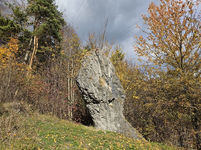
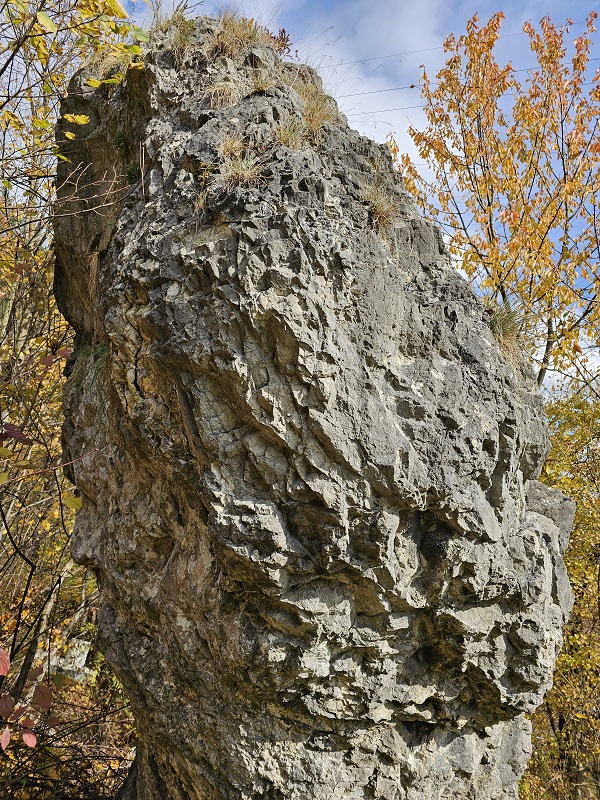
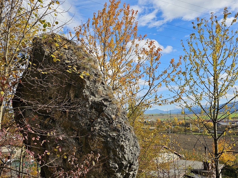
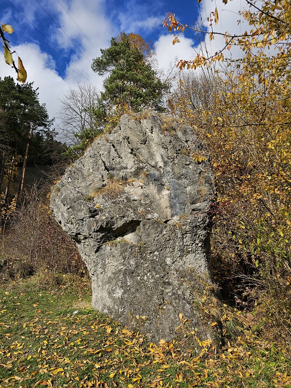
Distinctive natural monument on the right bank of Váh river. Typical limestone "mushroom rock" is six meters high and has a strong resemblance to a human fist.
Being located just below the archaeological location of Lipá it is no wonder that number of folk legends are connected to the place. One of them is about Juraj Jánošík, famous Slovak highwayman, who gave the rock its alternate name. But my favourite rumour is that the Fist shows the way to lost treasure of Templars.
The site is National Protected monument since 1971 and is well signposted.
You may be viewing yesterday's version of this page. To see the most up to date information please register for a free account.


Do not use the above information on other web sites or publications without permission of the contributor.
Click here to see more info for this site
Nearby sites
Click here to view sites on an interactive map of the areaKey: Red: member's photo, Blue: 3rd party photo, Yellow: other image, Green: no photo - please go there and take one, Grey: site destroyed
Download sites to:
KML (Google Earth)
GPX (GPS waypoints)
CSV (Garmin/Navman)
CSV (Excel)
To unlock full downloads you need to sign up as a Contributory Member. Otherwise downloads are limited to 50 sites.
Turn off the page maps and other distractions
Nearby sites listing. In the following links * = Image available
10.8km E 80° Archeoskanzen Havránok* Museum
53.1km E 85° Prehistoric Greeting* Burial Chamber or Dolmen
61.2km SSW 196° Pusty Hrad* Ancient Village or Settlement
68.0km N 1° Grodzisko Gilowice* Hillfort
70.2km E 93° Podtatranské múzeum v Poprade* Museum
72.1km E 95° Gánovce 1* Ancient Village or Settlement
75.9km NNE 15° Muzeum Miejskie Suchej Beskidzkiej* Museum
77.2km NW 319° Tyra Stone* Rock Art
77.4km SSW 206° Štiavnické Menhiry* Standing Stone (Menhir)
78.1km NNW 327° Góra Ostry Settlement* Ancient Village or Settlement
78.3km NNE 14° Grodzisko Zembrzyce* Promontory Fort / Cliff Castle
80.5km NNW 328° Góra Tuł Settlement* Ancient Village or Settlement
80.6km NNW 329° Góra Grodzisko Settlement* Ancient Village or Settlement
81.6km NNW 341° Palenica Earthwork* Misc. Earthwork
82.0km NNW 329° Machulowa Settlement* Ancient Village or Settlement
83.0km NNW 341° Grodzisko Zómczysko* Ancient Village or Settlement
83.9km NW 325° Puńców Settlement* Ancient Village or Settlement
84.6km NNW 340° Młyńska Kępa Settlement* Ancient Village or Settlement
85.2km NNW 345° Grodzisko Stare Bielsko* Hillfort
86.0km N 8° Grodzisko Gorzeń Górny* Hillfort
88.0km NNW 333° Grodzisko Międzyświeć* Hillfort
88.5km NNE 15° Grodzisko Bugaj* Hillfort
90.0km NW 326° Grodzisko Góra Zamkowa - Cieszyn* Hillfort
96.5km WSW 258° Roman inscription in Trenčín* Carving
97.2km ENE 57° Grodzisko Góra Zyndrama Hillfort
View more nearby sites and additional images


 We would like to know more about this location. Please feel free to add a brief description and any relevant information in your own language.
 Wir möchten mehr über diese Stätte erfahren. Bitte zögern Sie nicht, eine kurze Beschreibung und relevante Informationen in Deutsch hinzuzufügen.
 Nous aimerions en savoir encore un peu sur les lieux. S'il vous plaît n'hesitez pas à ajouter une courte description et tous les renseignements pertinents dans votre propre langue.
 Quisieramos informarnos un poco más de las lugares. No dude en añadir una breve descripción y otros datos relevantes en su propio idioma.