<< Our Photo Pages >> Štiavnické Menhiry - Standing Stone (Menhir) in Slovakia
Submitted by Izozo on Saturday, 16 March 2024 Page Views: 225
Neolithic and Bronze AgeSite Name: Štiavnické Menhiry Alternative Name: Menhir nad ŠtiavnicouCountry: Slovakia
NOTE: This site is 40.401 km away from the location you searched for.
Type: Standing Stone (Menhir)
Nearest Town: Banská Štiavnica Nearest Village: Banská Štiavnica
Latitude: 48.459277N Longitude: 18.876289E
Condition:
| 5 | Perfect |
| 4 | Almost Perfect |
| 3 | Reasonable but with some damage |
| 2 | Ruined but still recognisable as an ancient site |
| 1 | Pretty much destroyed, possibly visible as crop marks |
| 0 | No data. |
| -1 | Completely destroyed |
| 5 | Superb |
| 4 | Good |
| 3 | Ordinary |
| 2 | Not Good |
| 1 | Awful |
| 0 | No data. |
| 5 | Can be driven to, probably with disabled access |
| 4 | Short walk on a footpath |
| 3 | Requiring a bit more of a walk |
| 2 | A long walk |
| 1 | In the middle of nowhere, a nightmare to find |
| 0 | No data. |
| 5 | co-ordinates taken by GPS or official recorded co-ordinates |
| 4 | co-ordinates scaled from a detailed map |
| 3 | co-ordinates scaled from a bad map |
| 2 | co-ordinates of the nearest village |
| 1 | co-ordinates of the nearest town |
| 0 | no data |
Internal Links:
External Links:
")
The one and only menhir in situ in Slovakia. Absolutely nothing available about these stones, no information at all.
There is a parking place at Cervená Studná, you should park there and continue by foot. It’s a 1,8 km walk, only a 100 m is difficult uphill at the end.
You may be viewing yesterday's version of this page. To see the most up to date information please register for a free account.
")
")
")
Do not use the above information on other web sites or publications without permission of the contributor.
Nearby Images from Flickr

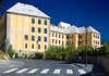
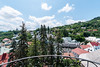

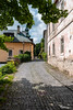
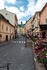
The above images may not be of the site on this page, but were taken nearby. They are loaded from Flickr so please click on them for image credits.
Click here to see more info for this site
Nearby sites
Click here to view sites on an interactive map of the areaKey: Red: member's photo, Blue: 3rd party photo, Yellow: other image, Green: no photo - please go there and take one, Grey: site destroyed
Download sites to:
KML (Google Earth)
GPX (GPS waypoints)
CSV (Garmin/Navman)
CSV (Excel)
To unlock full downloads you need to sign up as a Contributory Member. Otherwise downloads are limited to 50 sites.
Turn off the page maps and other distractions
Nearby sites listing. In the following links * = Image available
20.3km ENE 58° Pusty Hrad* Ancient Village or Settlement
65.8km SW 229° Nitriansky Hrádok Ancient Village or Settlement
78.0km NW 309° Roman inscription in Trenčín* Carving
84.3km NNE 31° Archeoskanzen Havránok* Museum
98.9km SSW 205° Tatai Kő* Modern Stone Circle etc
99.9km SSW 202° Vértesszőlősi Kő* Modern Stone Circle etc
100.2km S 173° Aquincumi Museum Museum
108.3km WNW 295° Javorníky Menhir Standing Stone (Menhir)
114.1km NE 49° Prehistoric Greeting* Burial Chamber or Dolmen
117.5km E 88° Domica* Cave or Rock Shelter
123.1km NNW 333° Vidče Stone Spheres* Natural Stone / Erratic / Other Natural Feature
123.4km ENE 57° Podtatranské múzeum v Poprade* Museum
123.5km ENE 59° Gánovce 1* Ancient Village or Settlement
124.9km S 178° Százhalombatta Tell* Ancient Village or Settlement
125.0km S 178° Százhalombatta Barrow Barrow Cemetery
127.0km SE 139° Jaszdozsa-Kapolnahalom Tell Ancient Village or Settlement
129.3km NW 304° Archeological Outdoor Museum Modrá* Museum
131.9km WNW 288° Menhiry Holic* Standing Stones
132.7km NW 305° The King's Table* Sculptured Stone
134.2km W 262° Stupavsky hrad* Hillfort
135.2km WNW 287° Church of Saint Margaret of Antioch, Kopčany* Misc. Earthwork
135.5km WSW 251° Gerulata Ancient Village or Settlement
135.7km N 356° Góra Ostry Settlement* Ancient Village or Settlement
137.0km WNW 287° Slavic fortified settlement in Mikulčice* Ancient Village or Settlement
138.1km N 356° Góra Tuł Settlement* Ancient Village or Settlement
View more nearby sites and additional images


 We would like to know more about this location. Please feel free to add a brief description and any relevant information in your own language.
 Wir möchten mehr über diese Stätte erfahren. Bitte zögern Sie nicht, eine kurze Beschreibung und relevante Informationen in Deutsch hinzuzufügen.
 Nous aimerions en savoir encore un peu sur les lieux. S'il vous plaît n'hesitez pas à ajouter une courte description et tous les renseignements pertinents dans votre propre langue.
 Quisieramos informarnos un poco más de las lugares. No dude en añadir una breve descripción y otros datos relevantes en su propio idioma.