<< Text Pages >> Bad Griesbach Teufelsstein - Rock Art in Germany in Bavaria
Submitted by holger_rix on Saturday, 26 December 2015 Page Views: 1523
Rock ArtSite Name: Bad Griesbach Teufelsstein Alternative Name: Teufelsfelsen, HabererkircheCountry: Germany
NOTE: This site is 1.053 km away from the location you searched for.
Land: Bavaria Type: Rock Art
Nearest Town: Bad Griesbach
Latitude: 48.456806N Longitude: 13.209918E
Condition:
| 5 | Perfect |
| 4 | Almost Perfect |
| 3 | Reasonable but with some damage |
| 2 | Ruined but still recognisable as an ancient site |
| 1 | Pretty much destroyed, possibly visible as crop marks |
| 0 | No data. |
| -1 | Completely destroyed |
| 5 | Superb |
| 4 | Good |
| 3 | Ordinary |
| 2 | Not Good |
| 1 | Awful |
| 0 | No data. |
| 5 | Can be driven to, probably with disabled access |
| 4 | Short walk on a footpath |
| 3 | Requiring a bit more of a walk |
| 2 | A long walk |
| 1 | In the middle of nowhere, a nightmare to find |
| 0 | No data. |
| 5 | co-ordinates taken by GPS or official recorded co-ordinates |
| 4 | co-ordinates scaled from a detailed map |
| 3 | co-ordinates scaled from a bad map |
| 2 | co-ordinates of the nearest village |
| 1 | co-ordinates of the nearest town |
| 0 | no data |
Be the first person to rate this site - see the 'Contribute!' box in the right hand menu.
Internal Links:
External Links:
Rock Art in Bavaria
Teufelsfelsen oder Habererkirche. Im Inneren eine Höhlenmalerei eine "Habergoaß" erkennbar.
You may be viewing yesterday's version of this page. To see the most up to date information please register for a free account.
Do not use the above information on other web sites or publications without permission of the contributor.
Nearby Images from Flickr
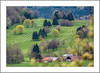


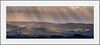
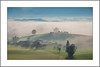
The above images may not be of the site on this page, but were taken nearby. They are loaded from Flickr so please click on them for image credits.
Click here to see more info for this site
Nearby sites
Click here to view sites on an interactive map of the areaKey: Red: member's photo, Blue: 3rd party photo, Yellow: other image, Green: no photo - please go there and take one, Grey: site destroyed
Download sites to:
KML (Google Earth)
GPX (GPS waypoints)
CSV (Garmin/Navman)
CSV (Excel)
To unlock full downloads you need to sign up as a Contributory Member. Otherwise downloads are limited to 50 sites.
Turn off the page maps and other distractions
Nearby sites listing. In the following links * = Image available
22.2km NE 55° Summstein Klostergarten* Modern Stone Circle etc
22.6km NW 318° Galgweis Siedlung Ancient Village or Settlement
25.5km NNW 338° Museum Quintana* Museum
25.7km NNW 337° Künzing-Bruck Siedlung Ancient Village or Settlement
27.2km NNW 334° Künzing-Unternberg Kultanlage Henge
29.4km NNW 330° Osterhofen Siedlung Ancient Village or Settlement
30.8km NNW 327° Linzing Siedlung Ancient Village or Settlement
35.2km NW 326° Ottmaring-Nindorf Siedlung Ancient Village or Settlement
36.0km NNW 329° Langenisarhofen Ancient Village or Settlement
37.0km NW 312° Gneiding Ringheiligtum Henge
37.0km NNE 16° Opferstein Saldenburg Natural Stone / Erratic / Other Natural Feature
42.3km NW 307° Kothingeichendorf Settlement 2 Ancient Village or Settlement
42.5km NW 307° Kothingeichendorf Settlement 1 Ancient Village or Settlement
42.6km NW 307° Kothingeichendorf Ringheiligtum Henge
43.4km NW 305° Oberframmering Siedlung Ancient Village or Settlement
44.4km NNE 26° Ringelai Stone Circle Stone Circle
45.8km NNE 22° Neudorf Monolith Standing Stone (Menhir)
46.1km NNW 331° Natternberg Siedlung Ancient Village or Settlement
46.4km WSW 237° Bronzezeitliche Siedlung Altötting Ancient Village or Settlement
46.5km WSW 237° Brandgräber der Urnenfelderzeit Altötting Barrow Cemetery
47.6km WSW 239° Siedlung der Römischen Kaiserzeit Ancient Village or Settlement
48.2km SW 235° Station des Mesolithikums und vorgeschichtliche Siedlung Kastl Ancient Village or Settlement
49.2km WSW 239° Vorgeschichtliches Grabenwerk Raitenhart Misc. Earthwork
49.2km WSW 238° Brandgräber der Bronzezeit Unterburgkirchen Barrow Cemetery
49.3km SW 236° Vorgeschichtlicher Siedlungsplatz Kastl Ancient Village or Settlement
View more nearby sites and additional images


 We would like to know more about this location. Please feel free to add a brief description and any relevant information in your own language.
 Wir möchten mehr über diese Stätte erfahren. Bitte zögern Sie nicht, eine kurze Beschreibung und relevante Informationen in Deutsch hinzuzufügen.
 Nous aimerions en savoir encore un peu sur les lieux. S'il vous plaît n'hesitez pas à ajouter une courte description et tous les renseignements pertinents dans votre propre langue.
 Quisieramos informarnos un poco más de las lugares. No dude en añadir una breve descripción y otros datos relevantes en su propio idioma.