<< Text Pages >> Gerulata - Ancient Village or Settlement in Slovakia
Submitted by holger_rix on Saturday, 26 December 2015 Page Views: 1571
Multi-periodSite Name: GerulataCountry: Slovakia
NOTE: This site is 2.724 km away from the location you searched for.
Type: Ancient Village or Settlement
Nearest Town: Bratislava
Latitude: 48.055918N Longitude: 17.149604E
Condition:
| 5 | Perfect |
| 4 | Almost Perfect |
| 3 | Reasonable but with some damage |
| 2 | Ruined but still recognisable as an ancient site |
| 1 | Pretty much destroyed, possibly visible as crop marks |
| 0 | No data. |
| -1 | Completely destroyed |
| 5 | Superb |
| 4 | Good |
| 3 | Ordinary |
| 2 | Not Good |
| 1 | Awful |
| 0 | No data. |
| 5 | Can be driven to, probably with disabled access |
| 4 | Short walk on a footpath |
| 3 | Requiring a bit more of a walk |
| 2 | A long walk |
| 1 | In the middle of nowhere, a nightmare to find |
| 0 | No data. |
| 5 | co-ordinates taken by GPS or official recorded co-ordinates |
| 4 | co-ordinates scaled from a detailed map |
| 3 | co-ordinates scaled from a bad map |
| 2 | co-ordinates of the nearest village |
| 1 | co-ordinates of the nearest town |
| 0 | no data |
Be the first person to rate this site - see the 'Contribute!' box in the right hand menu.
Internal Links:
External Links:
Ancient Village or Settlement in Slovakia
You may be viewing yesterday's version of this page. To see the most up to date information please register for a free account.
Do not use the above information on other web sites or publications without permission of the contributor.
Nearby Images from Flickr
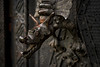
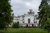


The above images may not be of the site on this page, but were taken nearby. They are loaded from Flickr so please click on them for image credits.
Click here to see more info for this site
Nearby sites
Click here to view sites on an interactive map of the areaKey: Red: member's photo, Blue: 3rd party photo, Yellow: other image, Green: no photo - please go there and take one, Grey: site destroyed
Download sites to:
KML (Google Earth)
GPX (GPS waypoints)
CSV (Garmin/Navman)
CSV (Excel)
To unlock full downloads you need to sign up as a Contributory Member. Otherwise downloads are limited to 50 sites.
Turn off the page maps and other distractions
Nearby sites listing. In the following links * = Image available
18.4km NNW 327° Villa Rustica Bratislava Dubravka Ancient Village or Settlement
25.0km NNW 348° Stupavsky hrad* Hillfort
42.1km WSW 245° Donnerskirchen Tumulus* Round Barrow(s)
45.8km NNW 330° Stillfried Zentrum der Urzeit* Museum
57.0km NW 306° Pillichsdorf Kalvarienberg Tumulus Round Barrow(s)
60.0km WNW 292° Summstein Wasserpark* Modern Stone Circle etc
61.0km WNW 286° Naturhistorisches Museum Wien* Museum
61.9km NW 309° Keltenstein Ulrichskirchen* Holed Stone
70.2km NNW 344° Rabensburg Tumuli (1) Round Barrow(s)
71.9km NW 324° MAMUZ Museum Mistelbach* Museum
72.0km NNW 345° Rabensburg Tumulus (2) Round Barrow(s)
74.9km SW 232° Keltenwall Schwarzenbach Hillfort
75.1km SW 232° Keltendorf Schwarzenbach Museum
76.7km NW 321° MAMUZ Schloss Asparn-Zaya* Museum
77.6km NW 305° Niederhollabrunn Leeberg Round Barrow(s)
77.6km NW 307° Niederfellabrunn Leeberg Round Barrow(s)
78.8km E 89° Nitriansky Hrádok Ancient Village or Settlement
81.4km WNW 297° Hügelgrab Löwenberg* Round Barrow(s)
81.9km W 267° Peilstein Berg Natural Stone / Erratic / Other Natural Feature
82.4km N 358° Church of Saint Margaret of Antioch, Kopčany* Misc. Earthwork
83.3km N 357° Slavic fortified settlement in Mikulčice* Ancient Village or Settlement
83.6km W 269° Hafnerberg Steinkreise Stone Circle
83.7km N 1° Menhiry Holic* Standing Stones
83.7km NW 305° Leeberg* Artificial Mound
84.0km NW 304° Geitzendorf* Barrow Cemetery
View more nearby sites and additional images


 We would like to know more about this location. Please feel free to add a brief description and any relevant information in your own language.
 Wir möchten mehr über diese Stätte erfahren. Bitte zögern Sie nicht, eine kurze Beschreibung und relevante Informationen in Deutsch hinzuzufügen.
 Nous aimerions en savoir encore un peu sur les lieux. S'il vous plaît n'hesitez pas à ajouter une courte description et tous les renseignements pertinents dans votre propre langue.
 Quisieramos informarnos un poco más de las lugares. No dude en añadir una breve descripción y otros datos relevantes en su propio idioma.